Railbed
Appalachian Trail/Three Lakes Trail Loop from Route 301
This figure-eight loop hike traverses an old mine railbed and passes several scenic lakes.
From the east end of the Bear Mountain Bridge, proceed north on N.Y. Route 9D for 8.0 miles to Peekskill Road at the southern end of Cold Spring (just beyond the Boscobel Restoration). Turn right and follow Peekskill Road for 0.5 mile to its terminus at a junction with N.Y. Route 301, then turn right and follow Route 301 for 7.0 miles to a parking area on the left side of the road on a small peninsula that juts into Canopus Lake.
From the parking area, walk back (southwest) along Route 301 for about 500 feet. When the guardrail on the left side of the road ends, turn left and follow a footpath, marked with the white blazes of the Appalachian Trail (A.T.), that leads downhill. The trail bears right and continues on a path built into the side of a hill. This was the route of a narrow-gauge railroad, built in 1873 to transport iron ore from mines in the area to Dump Hill, at the intersection of Philipstown Turnpike and Dennytown Road (from where it was transported to the foundry in Cold Spring by horse-drawn wagons).
Nassau-Suffolk Greenbelt Trail (Woodbury to Cold Spring Harbor)
This hike traverses the northern end of the Nassau-Suffolk Greenbelt Trail, with undulating terrain and steep grades, and reaches a panoramic view over the waters of Cold Spring Harbor.
This one-way hike requires two cars. Take the Long Island Expressway east to Exit 40E and proceed east on Jericho Turnpike (NY 25). In 1.0 mile, take the exit for NY 106 & 107 North, then bear right in 0.3 mile to stay on NY 106. In 3.5 miles, turn right onto NY 25A. In 4.1 miles, stay on NY 25A as it bears left and becomes Harbor Road. Continue for another 0.6 mile, and turn right into a parking area for Cold Spring Harbor State Park, just past the entrance to the Cold Spring Harbor Library.
With the second car, head south on Harbor Road for 0.6 mile, then turn left onto NY 108. In 1.6 miles, NY 108 ends, and you bear right to continue on Woodbury Road. In another 1.8 miles, turn right onto Jericho Turnpike (NY 25) and proceed for about 750 feet to the entrance to Trail View State Park, on the right.
See directions for bus, below.
Each end of the hike can also be reached by public transportation, but only limited weekday service is available. To reach the start of the hike, take the NICE (Nassau Inter-County Express) N79 bus from the Hicksville station on the Port Jefferson Branch of the Long Island Rail Road (www.nicebus.com). From the northern end of the hike at Cold Spring Harbor State Park, you can take the HART (Huntington Area Rapid Transit) H10 bus to the Huntington station (take the bus to Pulaski Avenue and New York Avenue in Huntington and walk north on New York Avenue for about 0.3 mile to the station) (www.sct-bus.org).
When thinking about hiking on Long Island, most people envision flat, relatively monotonous terrain. Indeed, most hiking trails on Long Island are flat, or nearly so. But this hike is a notable exception. It is situated on the Harbor Hill glacial moraine, which features undulating terrain and some steep climbs and descents. In fact, this may be the most challenging hike (from the point of view of terrain) on Long Island.
Koegel Park
A tiny network of trails wanders through mature upland forest with large deciduous trees. Koegel Park is at the top of a hill that slopes 140 feet down to the North County Trailway.
Henry Hudson Trail
Henry Hudson Trail
Several paths or segments make up the Henry Hudson Trail network, and getting from one to another can be challenging. Hikers may be less affected than bikers.
Use the Web Map link on this site for a trail map and brochure for the path segments north and south of the Garden State Parkway.
Parking locations are identified on the trail map and brochure (Web Map link), which include:
Henry Hudson Trail Activity Center -- GPS Coordinates: 40.413341, -74.050544
Trailhead near Garden State Parkway Exit 117 -- GPS Coordinates: 40.422785, -74.212541
- Parkway South to Exit 117A. (Aberdeen) After toll, turn left onto Lloyd Rd. Cross overpass. At first light, turn left onto Gerard Ave., lot is on the right.
- Parkway North to Exit 117. Bear right onto Hwy 35 South, then U-Turn left onto “35 North Matawan/Amboys.” Head back toward the Parkway, turn right at Clark St. Go straight through the first light, to lot on right.
Public transportation: NJ Transit's North Jersey Coast Line to the Matawan-Aberdeen station is about one mile from the western end of the Atlantic Path. NJ Transit bus #834, which connects Red Bank railroad station with Highlands, stops at the intersection of NJ 36 and Leonard Avenue in Leonardo, 0.5 mile west of the Atlantic Path's eastern terminus. The Academy Line provides bus service to Atlantic Highlands from the Port Authority Bus Terminal in New York City.
High Line-Elevated NYC Park-Rail Trail
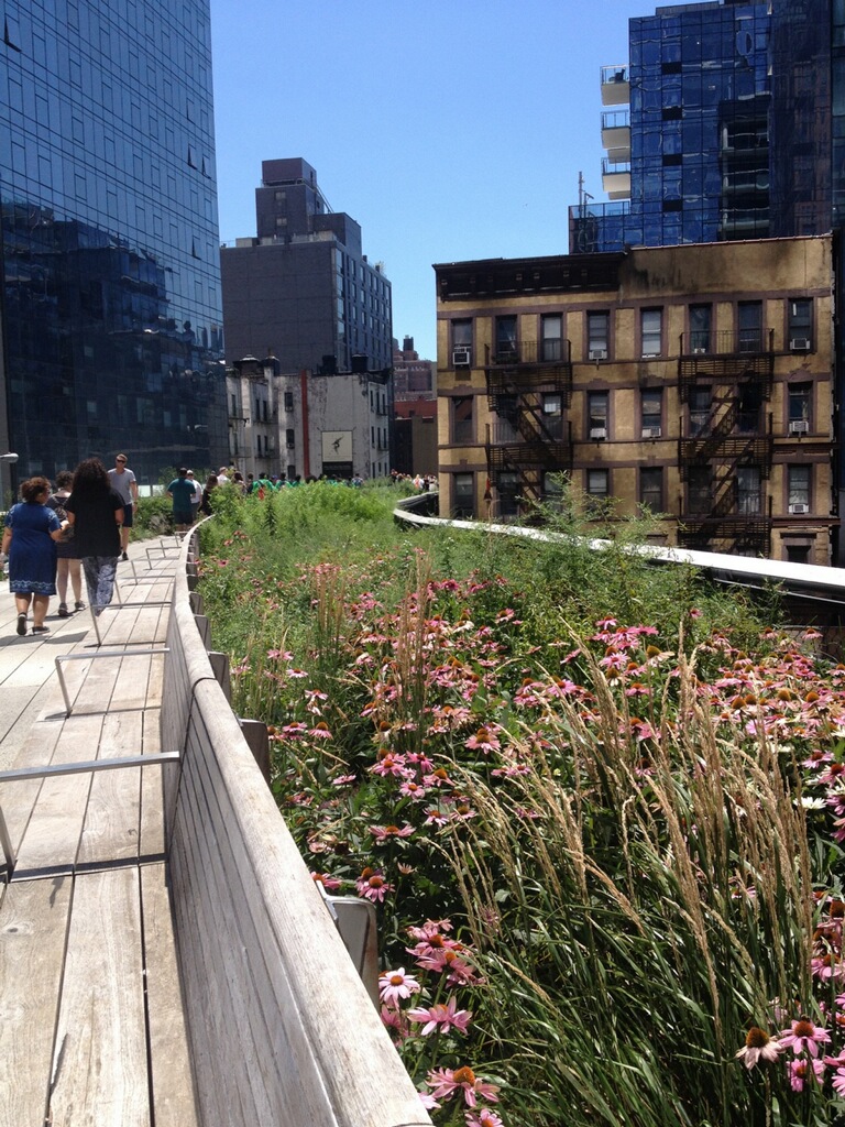
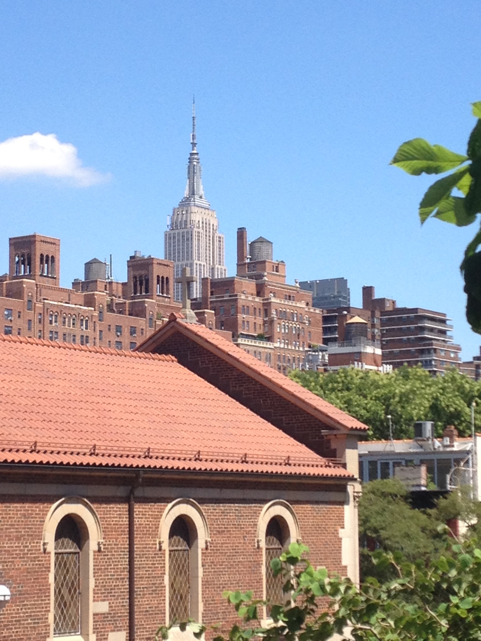
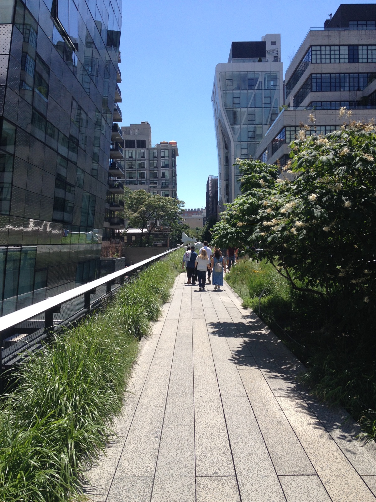
High Line - Elevated NYC Park-Rail Trail
From 1934 to 1980 an elevated rail line, now called the High Line, connected the rail yards of mid-town Manhattan to an industrial district along the lower West Side of Manhattan. Constructed 30 feet above the ground, it avoided dangerous street crossings, and routed between 10th and 11th streets in its more northern sections the railway avoided association with the unpopular elevated sections of New York's subway system.
The view of the High Line looking upward at its southern terminus from the street at Gansevoort and Washington appears like a cut of meat chopped with a cleaver. A sheer glass wall looms thirty feet overhead; the design seems intended to remind the viewer this is the historic Meatpacking District. Fittingly, according to park docents the very last train to travel the High Line delivered a shipment of frozen turkeys. Much has changed, May 2015 the Whitney Museum of American Art opened a massive new extension (designed by Renzo Piano) snuggled up next to the High Line at this location.
There is much to see along the initial one mile walkway – from striking views of the distant Hudson River and iconic Manhattan buildings poking skyward, to gorgeous landscapes at your feet. Before heading north from the Gansevoort Street entrance it is worth turning back towards the “meat chop” terminus to experience the view. The High Line passes north through a series of beautiful gardens and unique features, including Gansevoort Woodland, the Sundeck and Water Feature (a shallow linear wading pool), Chelsea Market Passage, Chelsea Grasslands, Seating Steps, Wildflower Field and the Radical Bench.
- 10th Avenue Square (between West 17th and West 18th streets) features bleachers that descend through original girders ending with a framed view looking up 10th Avenue. The installation is wheelchair accessible by zigzagging down the rows of bleachers.
- This place in particular reveals original art-deco steel side railings; but they are present throughout the park especially when a section is viewable from the street level. Commonplace round railing were used where the public could not see the original viaduct from the street.
- At 26th Street a viewing spur includes seating facing the street with a large frame that recalls the billboards that blocked the views to the west before the elevated rail viaduct was transformed into a park. The frame is empty, allowing park visitors to view people on the street, and allowing park goers to be seen from the street.
- The park currently ends, or starts, at West 34th Street between 11th Avenue and Westside Highway at the Hudson Yards.
The landscape design itself includes much of the original wild self-seeded plant life and flora that used to naturally inhabit the abandoned corridor – some 300 species of perennials, grasses, shrubs, and trees. The Friends of the Highline web site contains a Bloom List updated by the season. For a printable walkway map use the Web Map link on this (or the Friends web site).
- The deck along the High Line corridor was created from a series of smooth, tapered concrete planks laid in a linear fashion, suggestive of railroad tracks. The walkway flows variously from side to side or into the center or can cover the full deck; it can be narrow, or divided into parallel paths, or become as wide as 60 feet (at 10th Avenue Square). At the Falcone Flyover (between West 25th and West 26th streets) the narrow walkway is elevated above the rail bed which carries visitors through a canopy of sumac and magnolia trees.
- Throughout the park original rail tracks can be seen; more than a third of them have been re-installed. In some places the tracks are embedded in the pathway, in others hidden among various plantings and vegetation.
- After sunset sections of the pathway glow from LED light bars installed low to the ground (and under benches), making possible stellar views of the Manhattan skyline from 30 feet above ground with no overhead lights. Perhaps it needs to be said, the crime rate on the High Line is very low.
Joshua David and Robert Hammond, Co-Founders of Friends of the High Line, were interviewed on NPR's "All Things Considered" on September 3, 2011. The audio tour begins at the corner of Gansevoort and Washington streets. The link includes two versions -- 80 minutes and 12 minutes -- you will need to scan the page to locate them.
Driving not recommended.
Access points are at: Gansevoort Street, West 14th Street (elevator access), West 16th Street (elevator access), West 18th Street, West 20th Street, West 23rd Street (elevator access), West 26th Street, West 28th Street, and West 30th Street (elevator access), 11th Avenue (at 30th Street), 34th Street.
Harlem Valley Rail Trail
Harlem Valley Rail Trail
The portion of the Harlem Line that forms the Harlem Valley Rail Trail was completed in 1852 and later became part of the New York Central Railroad system (which became Penn Central in 1968). Until 1972, passenger service was operated by the New York Central Railroad (1968-1972 by Penn Central) as far as Chatham (where it connected with the Boston-Albany line). Freight service on the line was abandoned in 1981.
Use the Contact Information link for an expanded history as well as updates about progress towards completing the entire trail.
The trail is planned to be 46.1 miles long. In 2009 two sections were completed, a 10.8 mile section in Dutchess County from Wassaic to Millerton, and a 3.7 mile segment in Columbia County from Under Mountain Rd. to Copake Falls Station.
Use the Web Map link on this site to view a trail map link that displays finished and undeveloped sections.
The south trailhead is at the Wassaic Metro-North Station, Route 22, Amenia, NY 12501 – GPS Coordinates: 41.814838, -73.562328
The north trailhead for the contiguous 10.8 mile section is in Millerton on US 44 near the intersection with NY 22. There are several alternative access points with parking along the trail (use Web Map link on this site).
Appalachian National Scenic Trail
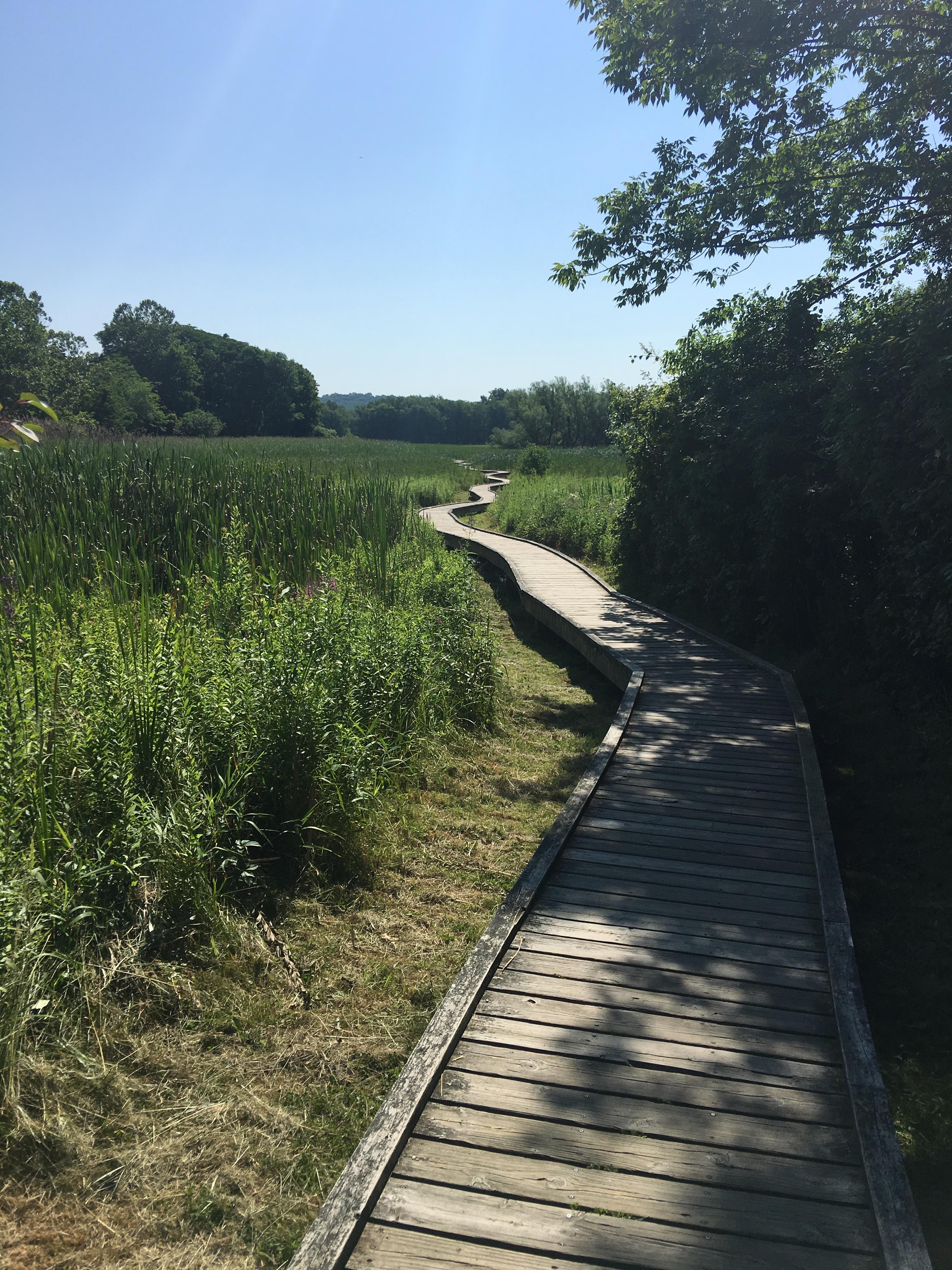
The Appalachian Trail is one of the longest continuously marked footpath in the world, measuring roughly 2,180 miles in length. The Trail goes through fourteen states along the crests and valleys of the Appalachian mountain range from the southern terminus at Springer Mountain, Georgia, to the Trail’s northern terminus at Katahdin, Maine.
An overview map of the trail along its entire length is available from the National Park “Appalachian National Scenic Trail” web page.
The AT is uniformly marked with a 2" x 6" white-painted, vertical blaze.
For detailed descriptions of hikes along the AT in NY and NJ click the "Choose another experience" button on this web site. In the search field enter "Appalachian Trail." The majority of these are loop hikes in conjunction with other trails. For AT-only hikes click here. The database includes a few AT hikes in nearby sections of Pennsylvania and Connecticut.
Two of the few wheelchair accessible sections from Georgia to Maine are in this region:
- A 0.40-mile segment at Bear Mountain State Park (news release). This trail segment is included as part of a summit loop hike.
- A 0.67-mile segment on the Pochuck Boardwalk in Vernon, NJ (trail map with parking information)
Driving:
Parking is available in all the parks listed on this site that host a segment of the AT. One spot identified on this web page is where the AT crosses NY-17A near Warwick, NY. GPS Coordinates: 41.244185, -74.287035.
On the Appalachian Trail Region page look for the link “Parking along the AT.” It features parking areas organized by state.
Public Transportation:
Hike descriptions that include the AT will indicate if public transportation (train or bus) is available to a particular trailhead.
Walkway Over the Hudson State Historic Park
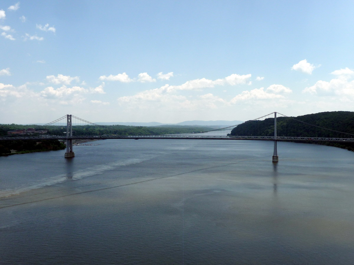
This renovated 19th-century railroad bridge is now a pedestrian and bike path over the Hudson River. The bridge deck stands 212 feet above the river's surface and is 6,768 feet (1.28 miles) long, making it the longest elevated pedestrian bridge in the world.
In 1992 Walkway Over the Hudson, Inc., a not-for-profit corporation, started the effort to renovate the bridge that had deteriorated after a 1974 fire suspended rail service. It became a state park when finally opened in October 2009.
Besides breathtaking views of the Hudson River and its landscape, the bridge connects to 27 miles of rail trails and riverfront parks already built or planned in Ulster and Dutchess Counties. A nearly 4-mile loop hike that includes the Mid-Hudson Bridge is possible. A connector trail also leads to Franny Reese State Park on the west side of the river. Click to view hike descriptions that start from either the east shore or west shore of the Hudson River.
- The park is open from 7:00a.m. to sunset with no access 30 minutes prior to sunset.
Alert: Walkway may be closed during inclement weather
If inclement weather makes the Park unsafe for visitors, the Walkway Over the Hudson State Historic Park (and the Elevator leading to the Park) will be closed until conditions improve. For current information, go to www.walkway.org.
By train: Walkway Over the Hudson State Historic Park is located just 4 blocks north of the Metro-North and Amtrak station in Poughkeepsie.
Driving Directions:
From the South/East: Take the Taconic State Parkway north to the Route 55/Poughkeepsie exit. Take Route 55 west towards Poughkeepsie. Stay on Route 55/44 through the City of Poughkeepsie, and take a right onto Columbus Drive (just past Poughkeepsie Grand Hotel and City Hall). Columbus Drive becomes Washington Street. Continue on Washington Street to right on Parker Avenue. Park entrance is on the left. Free parking is available in a large dirt field; a fee is charged at the paved parking area.
-
Poughkeepsie Entrance: 61 Parker Avenue, Poughkeepsie, NY 12601, GPS Coordinates 41.711799, -73.926435
From the South/West: Take Route 9W North. Just past the exit for the Mid-Hudson Bridge, take a right onto Haviland Road. Park entrance is on the left just beyond the Hudson Valley Rail Trail parking area. A small paid parking area is at the trail head (for about a dozen cars); parking on the north side of Haviland Road is free. There is also a large, free parking area at the Hudson Valley Rail Trail entrance.
-
Highland Entrance: 87 Haviland Road, Highland, NY 12528, GPS Coordinates 41.710477, -73.955038
From the North: Take the New York State Thruway (I-87) south to Exit 18, Poughkeepsie/New Paltz. Take right onto Route 299. Follow Route 299 east to Route 9W south. Make a left onto Haviland Road. Park entrance is on the left.
Wallkill National Wildlife Refuge
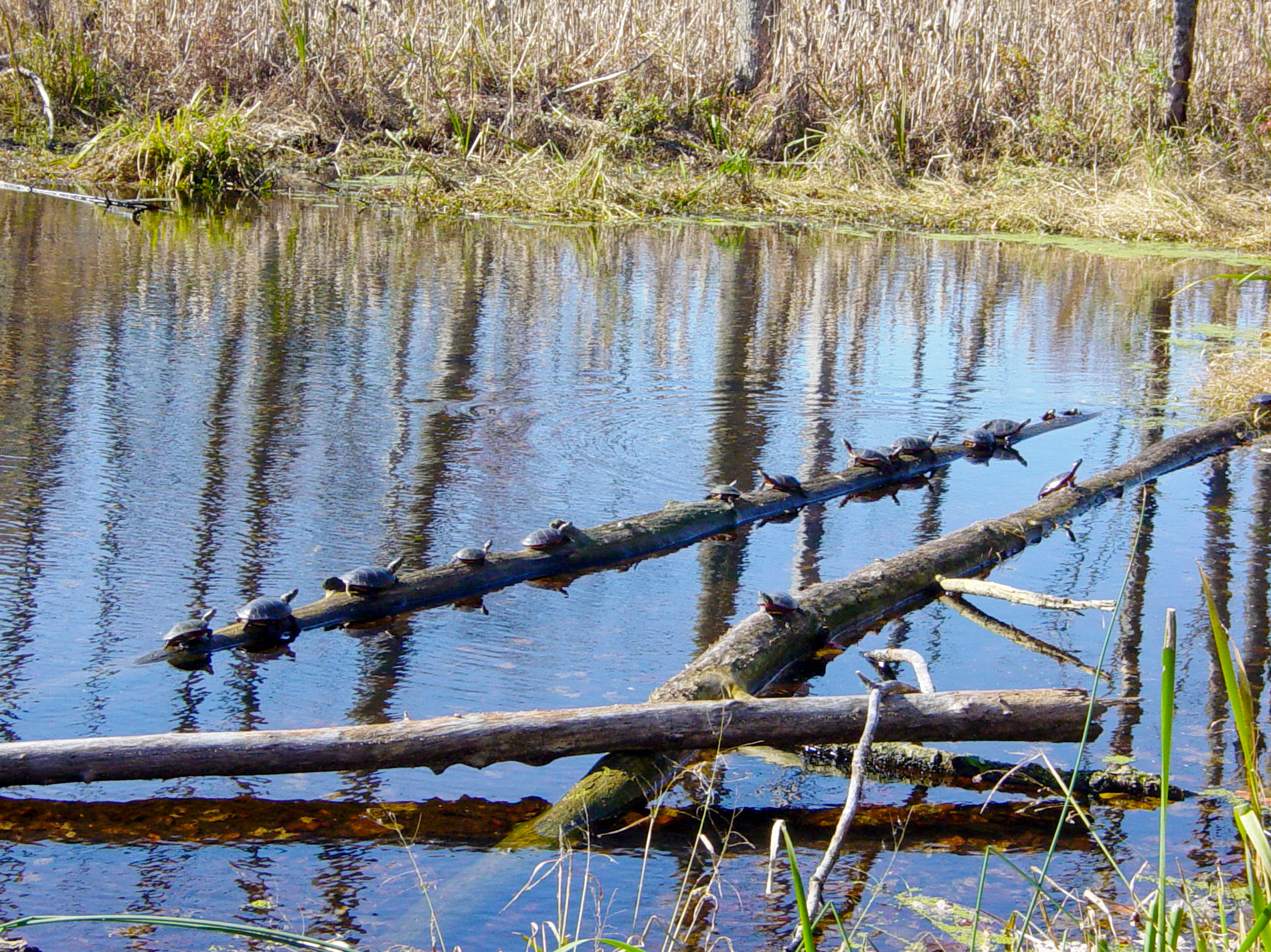
The Wallkill River Wildlife Refuge, established in 1990, protects and manages land to conserve the biological diversity of the Wallkill Valley. Its special emphasis is on forest-dwelling and grassland birds, migrating waterfowl, wintering raptors, and endangered species.
There are five nature trails on the refuge. Use the Web Map link on this site to view trails and trailhead parking areas.
- The level 2.5-mile Liberty Loop Trail, which traverses the refuge’s northern portion, crossing into its New York section, follows the dikes of an abandoned sod farm around a wetland and grassland management area. It is co-aligned with the Appalachian Trail (white) for 1.5 miles. A portion of the trail utilizes the right-of-way of the abandoned Lehigh and New England Railroad.
- This is the only trail in the refuge where hunting is always prohibited (more information on hunting below).
- It is also the only trail where dogs are permitted.
- The Winding Waters Trail, located 0.5 mile west of the Liberty Loop Trail, is at the northern tip of the refuge, further into Orange County, N.Y. It offers another 2.1 miles of trail along the river and through restored fields and a canoe/kayak launch at the trailhead.
- The Timberdoodle Trail follows another segment of the Lehigh and New England Railroad right-of-way through forested bottomlands and wetlands, extending 2.3 miles south of Bassett’s Bridge Road.
- Beginning at refuge headquarters, the Dagmar-Dale Nature Trail traverses hilly terrain, passing through grasslands and hardwood forests on its way down to the Wallkill River. It consists of two loop trails, which may be combined to create a longer loop hike. The North Loop (blue) is 1.7 miles long, while the South Loop (yellow) is 1.0 mile long.
- The 1.5-mile Wood Duck Nature Trail, a self-guided interpretative trail, follows the right-of-way of the Hanford Branch of the New York, Susquehanna and Western Railroad, abandoned in 1958, passing extensive wetlands along the way.
- The first 0.6 mile is wheelchair accessible.
On the Refuge’s web page, click on a “Maps” link for close-up satellite views of several of these trails.
Hunting is allowed on and near these trails at various times in the spring, fall and winter, with the exception already noted of the Liberty Loop Trail, where hunting is always prohibited. Of its 6,000 acres, 5,000 are available for seasonal hunting.
Visitors are urged to wear safety orange when the trails are open to both hunters and non-hunters. It is noteworthy that hunters, according to the refuge’s web site, “must wear in a conspicuous manner on head, chest, and back a minimum of 400 square inches of solid fluorescent orange clothing.”
- New Jersey hunting regulations, which the U.S. Fish & Wildlife Service generally follows in the refuge, can be confusing. It may be prudent to call the Refuge office (phone number under Contact Information) before visiting to ascertain if one or more of its many hunting seasons is in progress.
- For more information: On the Refuge’s web site follow the links: “visit/visitor activities/hunting.” See also the current-year hunting schedule for New Jersey state parks here.
There is no hunting on Sundays on the refuge.
From I-287N take Exit 52B to NJ23-North (it is Exit 52A from I-287S). Follow NJ23-N 15 miles to beyond Hamburg but before Sussex, turn right onto Glenwood Road. In 1.5 miles the refuge headquarters is on the left.
Headquarters street address: 1547 Glenwood Road, Sussex, NJ 07461. GPS Coordinates: GPS: 41.20115, -74.56320
