The production of the Shawangunk Trails map set, much like our other trail maps, was a great collaborative effort involving many volunteers, parks partners, and Trail Conference staff. The following individuals were the primary contributors to this map set:
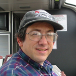 Daniel Chazin, Publications Chair and Project Manager
An active volunteer for the NY-NJ Trail Conference since 1982, Dan currently serves as board secretary as well as chair of the publications committee. For the past eight years, Dan has written a hiking column for The Record of Bergen County, NJ. It currently appears on Thursdays in the newspaper's Sports section.
In addition to serving as the project manager for this project, Daniel also worked on editing materials for the map backs.
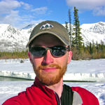 Jeremy Apgar, Cartographer
Jeremy has been the cartographer and GIS specialist for the NY-NJ Trail Conference since 2007. He has produced a variety of maps for the organization, including published hiking maps of the NY-NJ area as well as maps to aid trail-building efforts and open-space acquisition.
Jeremy did the cartography for this map set, building upon the original work of Eric Yadlovski, who created the first digitally-produced version of this map set in 2005.
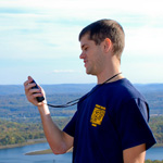
Lou Leonardis, Brand Manager
An active Trail Conference member since 1997, Lou has utilized trails in this area to help train for various excursions including a one-day hike of Devil's Path, a winter traverse of the Presidential Range and climbing Mount Rainier and other peaks in the Cascades. Lou and his Summit, NJ-based graphic design studio Enzo Creative help to streamline the production of the Trail Conference's maps and developed a dynamic identity system that yields a consistent look and feel from one map set to another. For this map set specifically, he helped design and put together the many graphic and textual components of the map backs and covers.
Volunteer GPSers, Field-Checkers and Reviewers
Many other individuals helped with this map set, and without their assistance, we would not have been able to produce such a high-quality map set of the northern Shawangunks region.
So a big thanks to everyone involved!
The Publications Committee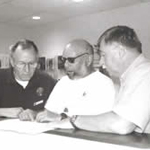
Our Publications Committee is responsible for producing and marketing all Trail Conference map sets. Volunteer members of the committee provided essential input for these maps.
We welcome volunteers who are interesting in contributing to our efforts, thereby ensuring that the public is provided with the most accurate, up-to-date and useful information about the trails in the NY-NJ region! If you are interested in volunteering with the Publications Committee, please visit our Volunteer page. There are so many ways to contribute, so you, too, can be a mapmaker!
Back to Shawangunk Trails main page