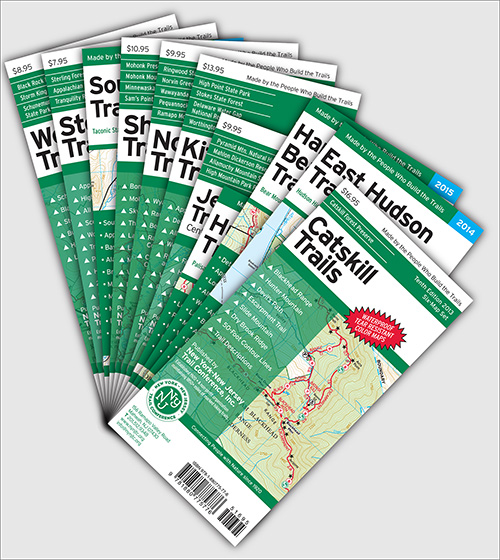
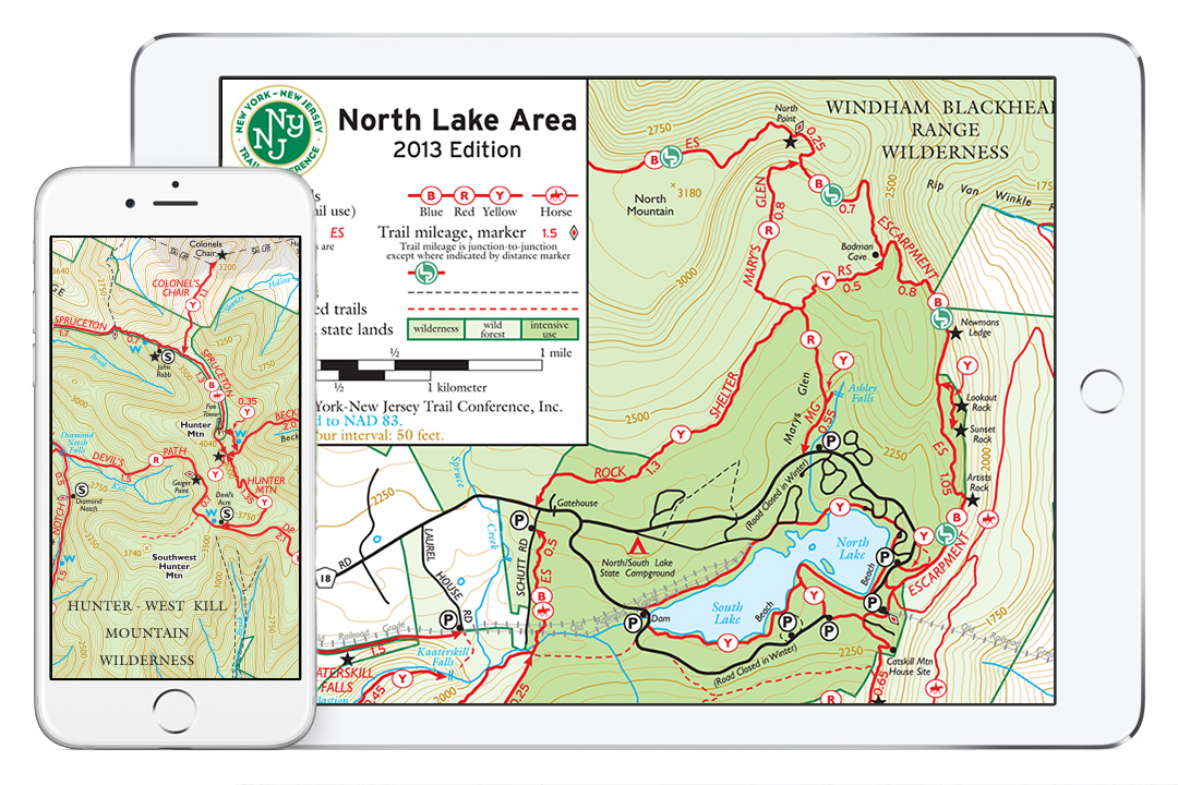
The New York-New Jersey Trail Conference has made more than 60 enhanced trail maps available on Apple and Android mobile devices, including several maps for the Catskills. Using the PDF Maps app from Avenza, you can pinpoint your location on a map using GPS, track your route, mark waypoints and geotag photos, measure distances, and much more.
For Apple devices, click to download the PDF Maps app for free!
(see below for detailed steps)
For Android devices, click to download the PDF Maps app for free!
(see below for detailed steps)
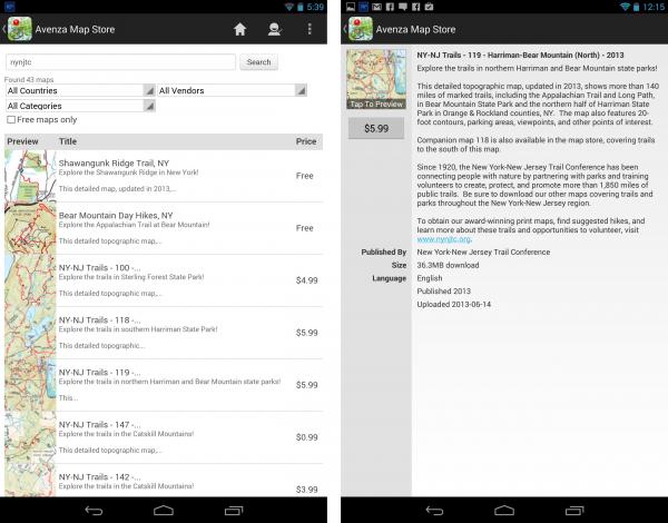
Once the app is downloaded, search for "catskill", click one of the park names below, or enter "nynjtc" to browse our entire selection of maps!
The following map titles are available in the PDF Maps map store. Click the Map Title link for more information and to download a map.
| Bundle Maps | ||
| Map Title | Map Numbers | Map Thumbnail |
| Catskill Single Map (Expanded Coverage Area) |
140, 141, 142, 143, 144 & 147 (plus expanded area for general reference) |
 |
| For-Sale Maps | |||
| Map Title | Map Number | Parks | Map Thumbnail |
| Catskill (North Lake) - 2016 | 140 | North/South Lake Campground, Escarpment Trail, Kaaterskill Falls, Long Path, North Mountain |  |
| Catskill (Northeastern) - 2016 | 141 | Blackhead Range, Hunter Mountain, Devil's Path, Escarpment Trail, Tremper Mountain, Overlook Mountain, Kaaterskill Falls, North/South Lake Area, Long Path |  |
| Catskill (Central) - 2016 | 142 | Panther Mountain, Balsam Mountain, Belleayre Mountain, Dry Brook Ridge, Balsam Lake Mountain, Halcott Mountain, Bearpen Mountain, Long Path |  |
| Catskill (Southern) - 2016 | 143 | Slide Mountain, Burroughs Range, Peekamoose Mountain, Beaver Kill Range, Vernooy Falls, Long Path, Finger Lakes Trail |  |
| Catskill (Western) - 2016 | 144 | Delaware Wild Forest, Trout Pond, Little Pond, Mongaup Pond, Frick Pond, Finger Lakes Trail |  |
| Catskill (Long Path North) - 2016 | 147 | Huntersfield Mountain, Ashland Pinnacle, Richmond Mountain, Mount Pisgah, Mount Hayden, Long Path |  |
| Catskill Hikes - Kaaterskill Falls & North/South Lake, NY | --- | North/South Lake Campground, Kaaterskill Falls, Kaaterskill Rail Trail |  |
...We are continually adding maps, so be sure to check back often for new additions!
Learn much more about our app maps, different ways to use the maps, and a full list of available maps by visiting this page.
How do I get maps on my Apple device?
Follow these 5 easy steps to get maps on your Apple device:
- Download and install the free PDF Maps app from the App Store or iTunes.
- Click here to go to the App Store directly or search for "Avenza PDF Maps" in the Apple App Store on your mobile device.
- PDF Maps requires iOS 4.0 or later running on an iPhone 3GS or better, 3rd generation iPod Touch or better, or any iPad.
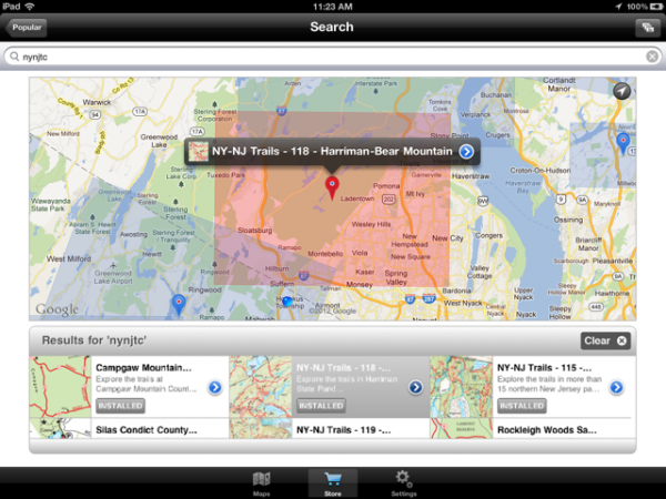
- Once installed, navigate to the Map Store and search for "nynjtc" to find our selection of both free maps and maps available for purchase (the Search function is accessed by tapping the Magnifiying Glass button; note that this currently only brings up 40 maps due to app limitations, so a direct search of a park name or map name is best).
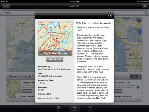
- Tap on a map to view a preview and description.
- Free maps can be downloaded directly by tapping 'Free' and then 'Install Now'.
- Maps available for purchase can be downloaded through an in-app purchase using your Apple iTunes account. Tap the price, and then 'Buy Now' (you may be prompted for your iTunes account password).
- Your device must be connected to the internet (wi-fi or cell signal) to download maps.
- The app will switch to the Maps library, and once the map is downloaded and extracted, it will appear in your Map Library.
- Tap on the map to open it and start using the map!
How do I get maps on my Android device?
Follow these 5 easy steps to get trail maps on your device:
- Download and install the free PDF Maps app from the Google Play Store.
- Click here to go to the Google Play Store directly or search for "Avenza PDF Maps" in the Google Play Store on your mobile device.
- PDF Maps requires Android version 4.0 or later.
- Once installed, navigate to the Map Store and search for "nynjtc" to find our selection of both free maps and maps available for purchase (the Search function appears after tapping the Magnifying Glass labeled 'Find Maps Around Me'; clear the coordinates in the search field and enter 'nynjtc'; note that this currently only brings up 40 maps due to app limitations, so a direct search of a park name or map name is best).
- Tap on a map to view a preview and description.
- Free maps can be downloaded directly by tapping 'Install'.
- Maps available for purchase can be downloaded through an in-app purchase using your Google Play account. Tap the price, and then 'Buy Now' (you may be prompted for your Google Play account password).
- Your device must be connected to the internet (wi-fi or cell signal) to download maps.
- The app will switch to the Maps library, and once the map is downloaded and extracted, it will appear in your Map Library.
- Tap on the map to open it and start using the map!
Remember: Batteries die. So be sure to have a print map on hand. Grab a printed map from a park office or, where available, our printed maps are light-weight backups AND they are printed on waterproof, tear-resistant Tyvek, so be sure to visit our online store for all your print map needs!


