North of the Mohawk River
In these sections the Long Path still needs much work. The trail follows mostly rural roads, first through farmlands in northern Schenectady County and southern Saratoga County, later on through large wooded areas. The countryside is hilly most of the way, but when the Long Path enters the Adirondack Park and reaches the Northville-Placid Trail the terrain has become mountainous.
39. Mohawk River to Saratoga County Line
Section 39: Mohawk River to Saratoga County Line
Quick Facts
Distance: 9.1 miles
Parks: Lock 9 State Canal Park
Maps: Interactive Map
Print-Friendly Version: Link
General Description
Jim Schaefer has scouted a route through the back roads of the West Glenville Hills that features the beauty and vistas of the hill country. The route takes the hiker on low volume roads near several landmarks described by Vincent Schaefer.
Access
Follow the NY Thruway (I-87) to I-90W. In Glenville take NY Route 5W to NY Route 103S. The entrance of Lock 9 Park in Rotterdam Junction is just south of the intersection, before the bridge.
Parking
0.00 Lock 9 Park near the intersection of NY Route 103 and NY Route 5. (42.87930°, -74.03993°) (under construction)
0.10 Stewart’s at the corner of Route 103 and Route 5. (42.88028°, -74.03968°)
1.90 Wolf Hollow (south end).
3.10 Wolf Hollow (north end).
5.90 Touareuna Road. (42.92920°, -74.08754°)
Camping
None
Trail Description
0.00 Lock 9 Park (Lock 9 Park is currently under construction but a Stewart’s Shop at the corner of Routes 103 and 5 has a restroom and room for parking).
0.10 Intersection of Route 103 and Route 5 near Lock 9 of the Erie Canal on the Mohawk River. Proceed west on Route 5 (turn left from Route 103). Hikers should walk on the far left shoulder facing traffic; this is a busy and dangerous road.
2.30 Intersection of Route 5 and Wolf Hollow Road (Schenectady County Route 59) . Turn right and proceed north on Wolf Hollow Road. This is Hoffman’s where an historic ferry crossed the Mohawk River. It also is the ancient site of the battle between the Iroquois and Mohican leaders, noted on NY State signs on the nearby Touareuna Road. A native village site sits atop the hill to the NE.
2.90 Reach Y intersection and bear left into Wolf Hollow. Wolf Hollow is closed to vehicles but is passable for hikers. The alternate route is to continue right (north) on Hoffman's Hill Road Extension which is the signed detour for vehicles. The distance is nearly the same.
4.10 Wolf Hollow rejoins Hoffman's Hill Road Extension. Bear left and continue on Wolf Hollow Road.
4.50 Reach intersection of Wolf Hollow Road and West Glenville Road (Schenectady County Route 40). Turn left and proceed west on West Glenville Road.
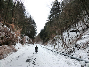
Wolf Hollow. 2013 [JAKOB FRANKE]
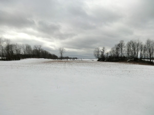
Off-road north of West Glenville Road. 2013 [JAKOB FRANKE]
Off-road walk begins at mile 4.4. To drive to the other end of the off-road section continue for 0.7 miles on West Glenville Road and turn right onto Touareuna Road. In 1 mile the trail reaches Touareuna Road on the right. There is room to park a couple of cars here.
4.70 The Long Path turns left and enters a field on the south side of West Glenville Road. There is a turn blaze on a tree where the trail leaves the road. The trail continues west through the field generally parallel to the road.
4.90 The trail leaves the field on the south side of the road, crosses West Glenville Road, and enters the woods on the north side on an unpaved lane – blazes mark this crossing. There is a white Cape Cod house near this crossing point. Once off the road you see a trailer to the left. The trail forks several times - keep right each time.
5.25 A stone wall appears on the right. The trail veers left and enters a hemlock grove.
5.35 Leave the hemlock grove, turn right (east) and walk along the edge of the hayfield to the southeast corner. On a clear day there are pleasant views of the distant hills. Soon there is a large stone pile in the woods to the right. Turn left and follow the northern edge of the field, observing a stone fence on the right.
(Aside: There are several hayfields to be passed. There is usually a trail mowed along the edge. Since the farmer does not always mow exactly the same areas, some of the blazes may appear off the current trail. In consideration of the farmer’s kindness, do not cut across the fields.)
5.50 Turn right, cross a hedgerow and stone fence into another hayfield, and proceed northerly along the eastern edge. At the corner of the field, turn left (west) along a stone fence and woods on your right.
5.65 Enter the mixed woods just west of the northeastern corner of the field, following a narrow foot/horse trail. There is a wetland and small pond down the hill from the trail, a nice spot for a snack.
5.70 Cross a small stream on stones, entering a meandering trail cut through a very young woods and passing by another hemlock grove.
5.75 The trail passes by another small stream and reaches an area that was hit by a tornado. Most of the toppled trees have been salvaged and there is a fair amount of logging debris.
5.90 The trail reaches a woods road near the end of the logging area and continues on this road. Soon another woods road is crossed. Continue straight ahead; there is a stone wall to the left, then to the right.
6.05 Cross stone wall and continue. The stone wall is now to the left again.
6.10 Turn right at the next crossing of woods roads.
6.15 Turn left (west) onto a gravel road to Touareuna Road, where there is room to park a couple of cars. Do not block the gate!
This is presently the end of the off-road portion of the Long Path and the end of the blazing. Resume road walk.
6.20 Turn right (north) onto Touareuna road.
6.50 Intersection of Fairbanks Road (Schenectady County Route 44) on left. Bear right and continue east on Touareuna Road.
7.00 Intersection at Green Corners. Bear right at first intersection and continue approximately 200 ft to STOP sign. Go straight across at STOP sign and proceed east on Potter Road (Schenectady County Route 42).
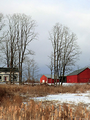
8.30 Intersection of Potter Road and Hart Road. Turn left onto Hart Road and proceed north. There is a large white house with red barn on the left just before the intersection. There is a lot of open farm country here with scenic views in all directions.
9.10 Intersection of Hart Road and Western Avenue. Turn right at YIELD sign and proceed northeast on Western Avenue. The Saratoga County line is here. The trail description from here on is in Section 40.
Previous Section: Section 38
Next Section: Section 40
40. Saratoga County Line to the Northville-Placid Trail
Section 40: Saratoga County Line to the Northville-Placid Trail
Quick Facts
Distance: 36.6 miles
Parks: Lake Desolation State Forest, Wilcox Lake Wild Forest, Adirondack Park
Maps: Interactive Map
Print-Friendly Version: Link
General Description
Jim Schaefer has scouted a route that connects to Lake Desolation, and eventually gets to the historic Batchellerville/Edinburg Bridge, thence into the Adirondacks proper. The route takes the hiker on low volume roads near several landmarks described by Vincent Schaefer.
Access
From I-87N (New York Thruway) follow signs to I-90W / NY Thruway, and take Exit 26 for I-890W to NY Route 5, then follow signs for NY Route 5W. In about 5 mi, turn right onto Wolf Hollow Road, and in about 2 mi, continue on Green Corners Road. In 1.4 mi, make sharp right onto Potter Road, and in 1.2 mi turn left onto Hart Road. In 0.8 mi is the junction with Western Avenue.
Parking
Ample parking along roads, in Lake Desolation, Batchelerville, Edinburg, Northville, and Benson. Below are a few selected parking spots.
18.90 Gravel operation about 200 ft before Older Mountain Road. (43.12503°, -73.95140°)
24.10 Mulleyville snowmobile trail system on the right. There is room to park several cars. (43.17685°, -73.99109°)
36.60 Northville-Placid Trail (NPT) trailhead in Northville. (unlocated)
40.10 NPT trailhead at Collins Gifford Valley Road. (unlocated)
Camping
Lake Desolation State Forest between mile 21.6 and 22.5.
Trail Description
0.00 Intersection of Hart Road and Western Avenue. Turn right at YIELD sign and proceed northeast on Western Avenue, entering Saratoga County.
0.60 Intersection of Western Avenue and DeGraff Road. Turn left and proceed north on DeGraff Road. There is a farm at this intersection.
1.60 Intersection of DeGraff Road and NY Route 67 (Amsterdam Road). Turn right and proceed east on Route 67 – walk on the left side facing traffic.
2.15 Intersection of Route 67 and Consaul Road on left. There is a yellow ranch-type house at the corner. Turn left and proceed north on Consaul Road.
4.20 Intersection of Consaul Road and Kania road on left. Continue straight ahead – north – on Consaul Road.
4.80 Intersection of Consaul Road and West Galway Road (no sign). Turn right into the narrow road before the STOP sign and before the large red house. Proceed east on this narrow road which is paved starting from the intersection.
5.05 The pavement ends and the road surface becomes gravel near a large cream-colored house on the left. A “Seasonal Maintenance” sign marks the end of the pavement. Continue east on the gravel road (West Galway Road).
6.00 Reach NY Route 147. There is a large white house with red barn on the right before the intersection. To the left (north) is the Town of Galway. The post office is about 0.7 miles away and it is I mile to the Galway Market. Cross Route 147 at the intersection and continue east on Donnan Road.
7.10 Intersection of Donnan Road and Crane Road. Turn left and proceed north on Crane Road through mostly open farm country.
7.85 Intersection of Crane Road and Saratoga County Route 45. Continue across the intersection and continue north on Crane Road. There is a large brick house on the northeast corner of the intersection.
8.80 Intersection of Crane Road and Parkis Mills Road at STOP sign. Turn right and proceed east on Parkis Mills Road.
9.00 Intersection with Old Mill Road on right. Continue straight ahead on Parkis Mills Road.
9.30 Y intersection with Alexander Road. Bear right and continue north on Parkis Mills Road. There is a brown house on the corner.
9.45 Y intersection with Cruthers Road. Bear left and continue north on Parkis Mills Road.
10.10 Intersection of Parkis Mills Road and Hermance Road at STOP sign. Turn right and proceed east on Hermance Road.
11.30 Intersection of Hermance Road and Jockey Street (Saratoga County Route 52) at STOP sign followed by a YIELD sign. Go straight ahead at STOP sign and at YIELD sign and proceed northeast on Jockey Street. Jockey Street is a busy highway - walk on the left shoulder facing traffic.
11.80 Intersection of Jockey Street and Shaw Road – there is a white house on the corner. Turn right and proceed east on Shaw Road.
11.90 Y intersection of Shaw Road and Baptist Hill Road. Bear left and continue east on Shaw Road.
12.20 Welch Road on the left - continue straight on Shaw Road.
12.40 Stanton Road on right - continue straight on Shaw Road.
13.30 Enter Town of Milton from Town of Galway. Shaw Road becomes Grenell Road at the town line – continue east on Grenell Road.
13.70 Pass Grenell Cemetery on the right.
14.00 Intersection of Grenell Road and Armer Road. The name of Grenell Road changes back to Shaw Road at this intersection. Go straight across the intersection and continue east on Shaw Road. There is an older white house at the northwest corner.
14.65 Intersection of Shaw Road and NY Route 29. There is a large brown sign for Camp Boyhaven at the corner. Proceed straight across Route 29 and proceed north on Boyhaven Road. Pass Camp Boyhaven on the right.
15.55 Intersection of Boyhaven Road and Middle Grove Road (Saratoga County Route 21). Go straight across at STOP sign and continue north on Boyhaven Road, into the Town of Greenfield.
16.05 Intersection of Boyhaven Road and Young Road. Go straight across at STOP sign and continue north on Boyhaven Road.
16.80 Intersection of Boyhaven Road and Kilmer Road. Turn left and proceed north on Kilmer Road.
17.60 Intersection of Kilmer Road and Barney Road at STOP sign. Continue straight across to second STOP sign and onto Lake Desolation Road (Saratoga County Route 12). Proceed north on Lake Desolation Road. Vistas of Berkshires and Hudson Valley, otherwise deep woods.
18.90 Large gravel operation on right a couple of hundred feet before Older Mountain road. There is room here for parking. Continue north on Lake Desolation Road.
20.10 Reach Hamlet of Lake Desolation; Hoffman Road on the right with lots of mailboxes and home-made street signs. Pass Tinney’s Tavern on the left. Continue straight ahead on Lake Desolation Road and proceed north. Lake Desolation is along the road on the right. Some sections of the road are unpaved over the next several miles.
21.00 Pass North End Road on the right.
21.60 Enter DEC lands (Lake Desolation State Forest) on the left.
22.00 Plank Road (woods road) to the right. Continue straight.
22.50 The Long Path enters the Adirondack Park – the Park boundary is not marked by a sign. This also is the end of the State Forest.
23.00 Enter Town of Edinburg and leave Town of Greenfield – continue northwest. Lake Desolation Road has now become Fox Hill Road.
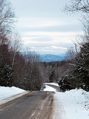
Saratoga County. 2013 [JAKOB FRANKE] Fox Hill Road. 2013 [JAKOB FRANKE]
24.10 Mulleyville snowmobile trail system on the right. There is room to park several of cars.
24.70 Small quarry on the right which is suitable for parking.
26.40 Parking area on the right in an area where there is active logging.
27.30 White church on left (Sacandaga Christian Fellowship). Continue northwest on Fox Hill Road.
27.40 Pass Adirondack Bible College on the right.
29.30 Pass Horse Hill Road on the right. Great views north toward the Adirondacks.
30.00 Intersection of Fox Hill Road and South Shore Road (Saratoga County Route 7). Turn left at STOP sign and proceed south on South Shore Road in the Hamlet of Batchellerville. There is a small grocery store on the left.
30.15 Intersection of South Shore Road and Saratoga County Route 98. Turn right and cross Great Sacandaga Lake on the 3000’ Batchellerville bridge.
30.85 Intersection of Saratoga County Route 98 and Wessels Road on the west side of the Sacandaga Reservoir.
31.35 Intersection of Saratoga County Routes 98, 4, and 5 in the hamlet of Edinburg. There are a store with deli and gas station, a diner, and the Edinburg Rural Museum at the corner. Turn right onto Saratoga County Route 4 (N. Shore Road).
31.50 The Nellie Tyrrell Edinburgh Museum is on the right.
31.65 County Route 4 turns right. Continue straight onto Military Road. The historical Barker store is at the corner, as is an historical marker for the Beecher store.
31.90 Turn left onto Airport Road.
32.30 Robinson cemetery is on the left. Soon you will pass an airfield on the left with good views.
32.60 Wheeler Road is on the left – continue straight.
33.10 Turn left onto Tennantville Road.
33.80 Turn right onto Johnson Road.
34.00 Turn left onto Tennantville Road. In about 200 ft you are entering the Town of Northampton in Fulton County.
35.40 Cross Ridge Road (Fulton County Route 149) onto S. Main Street Extension and enter the Village of Northville. There are a few stores, restaurants, and a gas station in town.
36.60 At 162 S. main Street, just before Bridge Street, is the entrance to Waterfront Park with the Northville trailhead of the Northville Placid Trail. See http://www.nptrail.org/
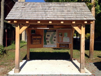
Trailhead of the Northville-Placid Trail 2014
The following is a description of the roadwalk from Northville to the new (2015) Collins Giffford Valley Road trailhead of the Northville-Placid Trail:
0.10 Turn left onto Bridge Street and cross the Sacandaga River
0.70 Western end of the bridge across the Sacandaga River. Turn left onto CR152.
1.80 CR152 turns left; continue straight on CR152A.
1.90 Cross NY Route 30. Continue on Mountain Road (CR123).
2.70 Turn right onto Collins Gifford Valley Road.
3.50 The new NPT trailhead is on your left.