CCC Camp

Crom Pond Trail in FDR State Park
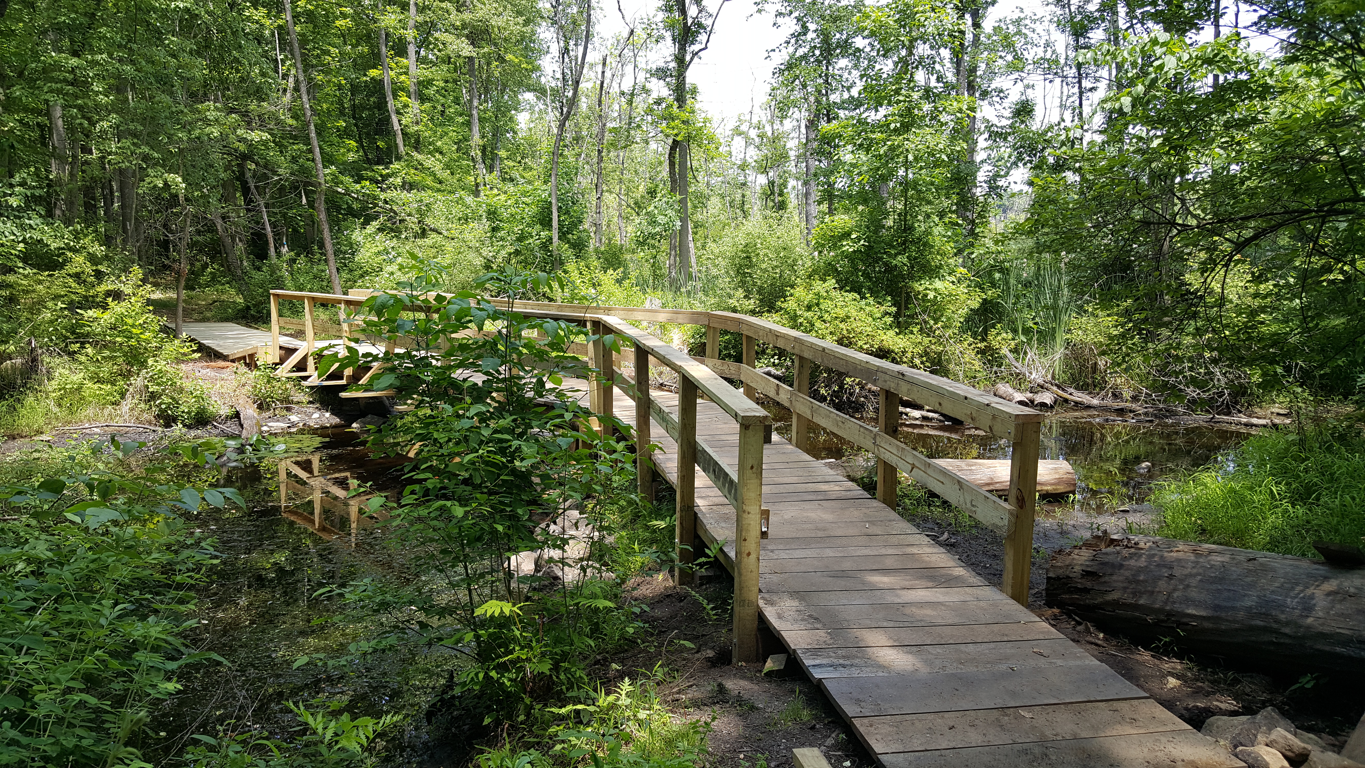
Outlet bridge
NYNJTC maintained: 
1
Summary: 

A bridge over a gently flowing stream is always a pleasant destination. Choose one of the two hikes to visit two bridges which were built by the Friends of FDR, an Eagle Project, and the New York-New Jersey Trail Conference.

1 hours
Easy
2 miles
Route type: 
Out and back
Allowed on leash
Bikes allowed
Fees
Woods
Historic: 
Franklin D. Roosevelt State Park
Westchester County
NY
Westchester
07/20/2017
07/20/2017
Driving: 

From the Taconic State Parkway, take the FDR State Park Exit 16 [41.284528, -71.816886]. There is a daily entrance fee in season and on weekends during the spring and fall. Get an Empire State Passport. From the park entrance road keep right and follow the the signs to the swimming pool parking area. The trailhead is on eastern edge of the parking lot just south of the entrance/exit split. Look for a bench and white trail markers on a post. 

For the alternate hike, take Baldwin Road Exit 14, from the Taconic State Parkwary and turn east. At the triangle intersection, bear left onto Mohansic Avenue East. The road bends right at the junction with Old Mohansic Avenue East (gated) [41.271991, -73.802436] where there is free, very limited roadside parking. Don't block the gate. Use the alternative hike description.

From FDR State Park's swimming pool parking lot, look for a bench on the east side, near a post with white tag blazes. Walk down the woods road and at a broad intersection in 0.2 mile, turn right onto the Crom Pond Trail. Crom means crooked in Dutch. Head down the stone steps. In 0.3 mile, turn right onto a narrow path. Cross a 70' long board walk in the wetlands, turn left to cross a stone wall and a short board walk. The path reaches a bridge built thanks to an Eagle project and east side of the bridge has a ramp that hugs the side of a large rock.

HOTW Date: 
Thu, 07/27/2017
HOTW Count: 
1

Parvin State Park

Historic: 
Complete: 
Yes
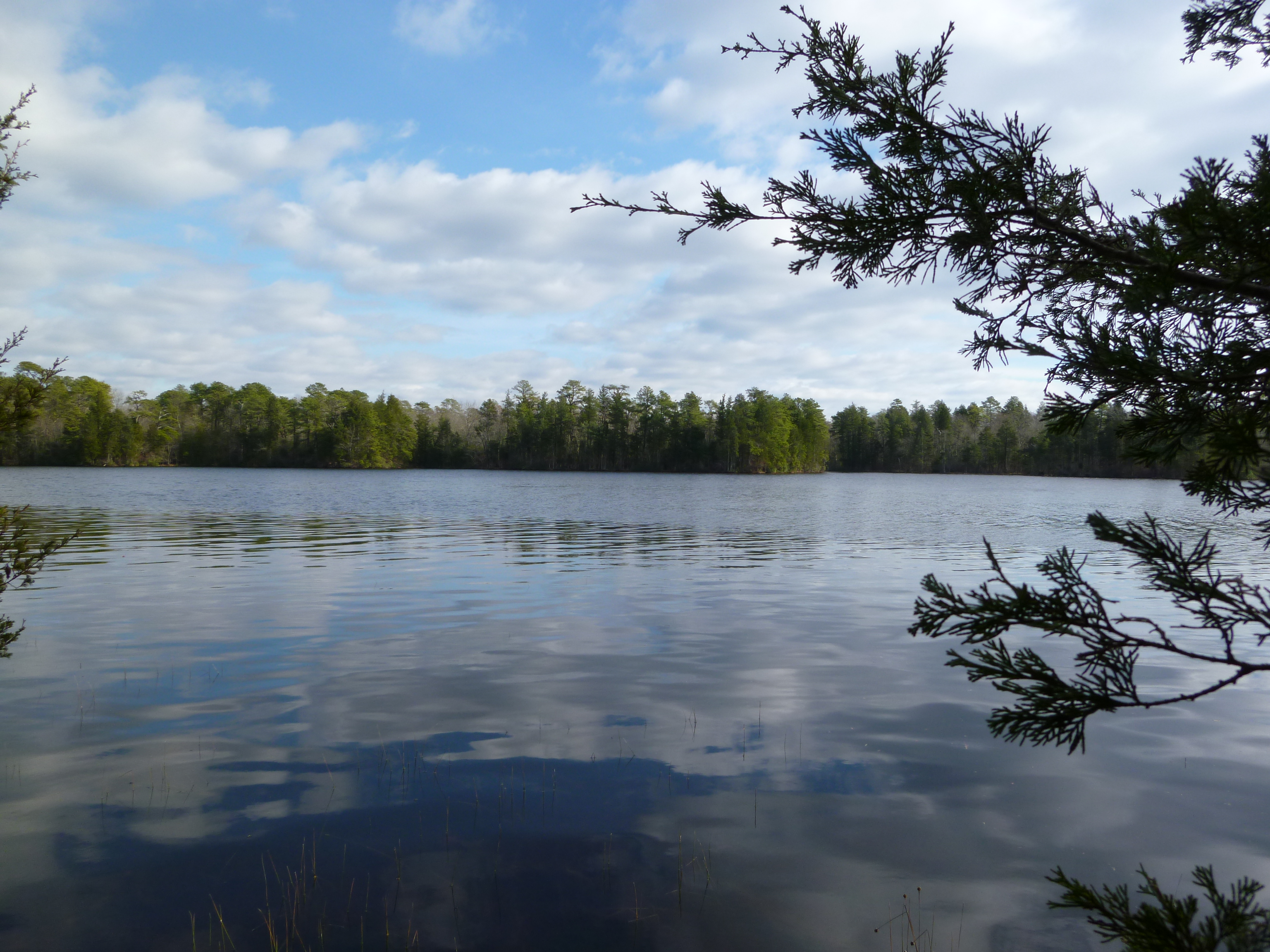
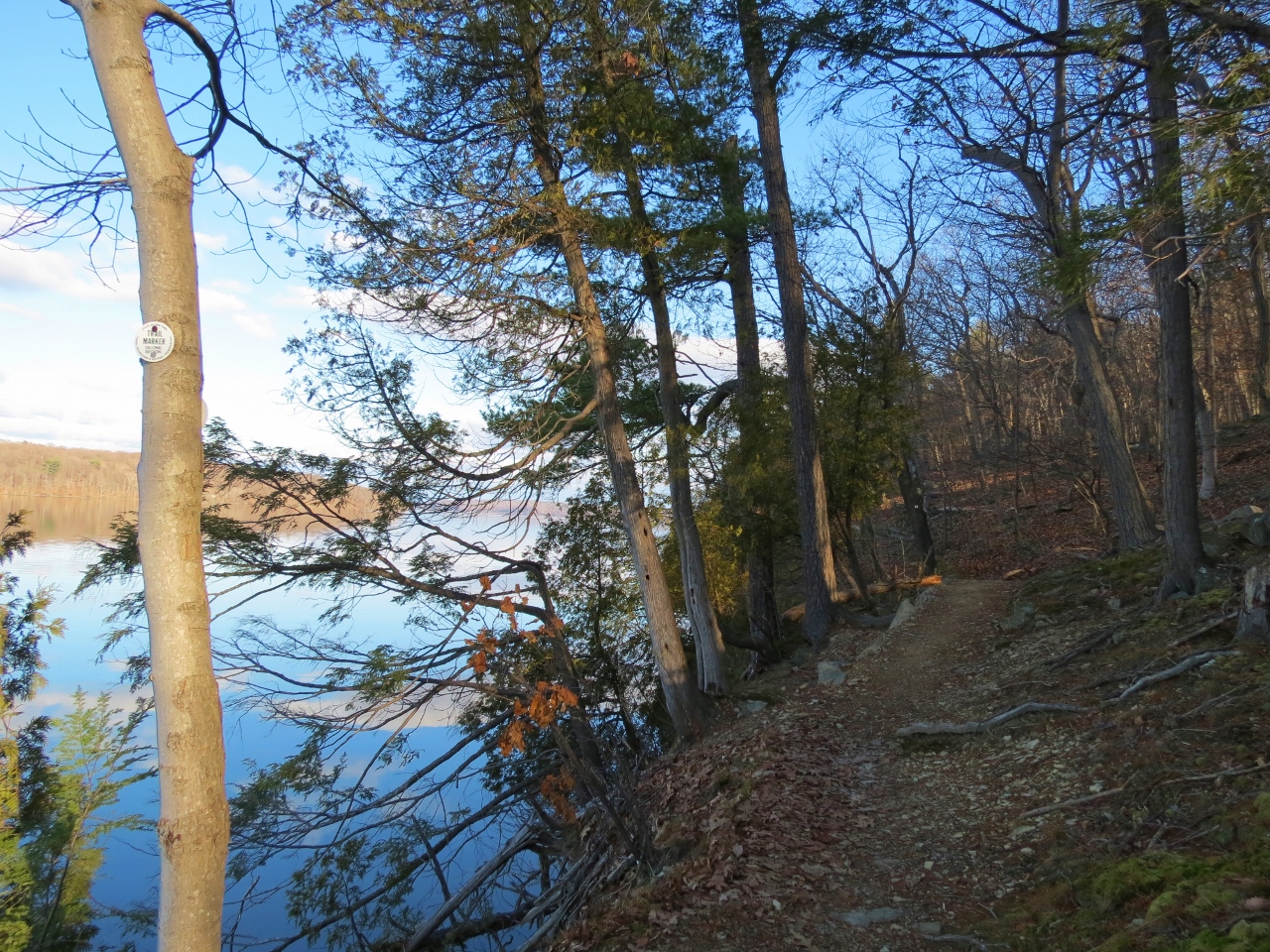
Parvin Lake - Photo by Daniel Chazin
NYNJTC maintained: 
0

Hidden in the southwestern part of the state is Parvin State Park, a park whose history is as varied as its wildlife. 


Hiking
Dogs on leash
5 miles
2092 acres
Lat/Lon: 
39.510971, -75.132372
Pittsgrove
Salem
NJ
Cluster/Park: 
Park

Situated on the edge of the Pine Barrens, the park not only has pine forests typical to the area but also a swamp hardwood forest. Spring bursts out in bright colors and rich fragrances with blossoming dogwood, laurel, holly, magnolia, wild azalea and over 200 kinds of flowering plants. Thundergust Lake, Parvin Lake and Muddy Run are popular for fishing and boating. Swimming is allowed in Parvin Lake only.

There is a 4.6-mile loop walk using the Parvin Lake Trail, Long Trail, and Thundergust Lake Trail.  Use the Web Map link on this site to view a trail map.


From Route 55 north or south, take Exit 35 and follow signs to the park. The park is located between Centerton and Vineland on Route 540 (Almond Road).

Fees: 
Yes, click on 'Contact Information' for further information
Last Update: 
06/29/2017
Modified By: 
Phil McLewin
Landowner: 
NJ DEP

Mills-Norrie State Park

Historic: 
Complete: 
Yes
Trail along the Hudson River - Photo credit: Daniela Wagstaff
NYNJTC maintained: 
1

This parkland combines both Ogden and Ruth Livingston Mills State Park and Margaret Lewis Norrie State Park. The two host so many activities there is likely to be something to interest anyone.

Hiking
Mountain biking
Bridle path
X-C skiing
Dogs on leash
6 miles
1000 acres
Lat/Lon: 
41.846641, -73.937765
Staatsburg
Dutchess
NY
Cluster/Park: 
Park

Besides a multi-use trail system, Mills-Norrie State Park maintains a golf course, a marina on the Hudson, picnic areas, camping and cabins, and an environmental center. Included within the park is the Staatsburg State Historic Site, a Beaux-Arts era Stanford White-designed mansion with views across the Hudson to the Catskills that is seasonally open for tours. There are fees for some activities, please check with the parks.


Trail uses include hiking, biking, horseback riding, and snowmobiling. Cross-country skiing is available in winter on the golf course. Park borders the Hudson River with scenic trails. 

Use the Web Map link on this site to view a map of trails and other attractions. 


5 miles north of Hyde Park, west of US 9 on Old Post Rd.  Park entrance GPS coordinates: 41.846641, -73.937765

Fees: 
Yes, click on 'Contact Information' for further information
Last Update: 
04/11/2017
Modified By: 
gayle edgerton; Phil McLewin
Landowner: 
NYS OPRHP
Manager: 
NYS OPRHP

Franklin D. Roosevelt State Park

Historic: 
Complete: 
Yes
At the boat rental dock - FDR State Park Photo: Jane Daniels
NYNJTC maintained: 
1

Not to be confused with FDR's home in Hyde Park. FDR Park is a convenient place to go for a walk on its wide roads which have few elevation changes and little chance of getting your feet muddy. It connects via more primitive trails to the Mohansic Trailway into Yorktown Heights.

Hiking
Mountain biking
X-C skiing
Accessible
Dogs on leash
5 miles
841 acres
Lat/Lon: 
41.283678, -73.808129
Yorktown Heights
Westchester
NY
Cluster/Park: 
Park

FDR State Park

FDR State Park is a large multi-use facility with picnic tables, boat rentals, playing fields, and a swimming pool. In season and weekends, picnickers arrive by the carful and busload, filling the park with sounds of people enjoying the outdoors and smells wafting from grills. During weekends in spring and fall, road races and walkathons utilize the park roads. On weekdays and off season weekends, local residents walk, jog, or bike along the park roads in relative isolation. There is also a disk golf course.

The trails at FDR are blazed. On the easternmost part of the park, a road built by the Civilian Conservation Corps provides a quiet place to walk under tall trees. A paved path essentially paralleling the park road to the swimming area is handicapped accessible.

In 2015-2017, volunteers built bridges to connect the park to Baldwin Road. 

A trail map link appears on the park's web page (use Contact Information below)

From the Taconic State Parkway, take the FDR Park exit. In season, there is an entrance fee daily; in spring and fall, the entrance fee is only on weekends and holidays.

Westchester County
Fees: 
Some times and places; check with park
Last Update: 
07/07/2011
Modified By: 
Phil McLewin
Landowner: 
NYS OPRHP
Manager: 
NYS OPRHP
Region - Maintenance: 

Blue Mountain Reservation

Historic: 
Complete: 
Yes
Loundsbury Pond: Photo: Jane Daniels
Keeping your goslings in a row Photo: Jim Simpson
The road less taken Photo: Jane Daniels
NYNJTC maintained: 
0

The rolling, boulder-strewn terrain of Blue Mountain Reservation also includes ponds, streams, hardwood forest, and two mountains with panoramic views of the Hudson River.

Hiking
Mountain biking
Bridle path
X-C skiing
Dogs on leash
23 miles
1583 acres
Lat/Lon: 
41.269704, -73.922316
Peekskill
Westchester
NY
Cluster/Park: 
Park

Rolling woodlands with large granite boulders, glacial erratics, and rock outcroppings comprise the landscape of Blue Mountain Reservation. Massive rock formations tower above trails while stately trees, tiny lichen, and abundant ferns make a picturesque setting. Blue Mountain Reservation was originally part of Van Cortlandt Manor, purchased from local Native Americans in 1677. Much later the Loundsbury family owned and operated a sand, gravel, cement, brick and general contracting business. The gravel pit was located at the present day beach parking lot.

The trails in Blue Mountain Reservation meander up hills and down through valleys. Aside from the singel-track trails created by mountain bikers, the trails are on woods roads. Blazes and numbered posts change all too frequently because groups decide on their own to mark a trail. Hikers seeking solitude might prefer weekday visits to avoid the heavy mountain bike activity on weekends.The official park trail map designates most intersections with numbers, but unfortunately these numbers do not appear on the ground at most intersections. It is best to print out the trail map from the Blue Mountain website, but the colors on the map indicate the degree of difficulty of the trail, not the blaze color. If available pick up a free map from the entrance kiosk. A five-mile loop includes both Mt. Spitzenberg and Blue Mountain. The north end of the 12-mile Briarcliff-Peekskill Trailway is within Blue Mountain Reservation.

From the north: Take NY Route 9 south. Exit at Welcher Avenue; turn right and follow to the park entrance. From the south: Take NY Route 9A to NY Route 9 north. Exit at Welcher Avenue, turn left and follow to park entrance.

Public transportation: Take Metro-North Hudson line to the Peekskill station. From the station, head east on Hudson Avenue for 0.7 mile to Walnut Street and a sign To DePew Park. Follow Walnut Street into DePew Park and take the Lake Mitchell Trail to the swimming pool parking lot to go into Blue Mountain Reservation. . 

Fees: 
Some times and places; check with park
Landowner: 
County
Manager: 
Westchester County Parks
Region - Maintenance: 

Belleplain State Forest

Historic: 
Complete: 
Yes
East Creek Pond at Belleplain State Forest - Photo by Daniela Wagstaff
NYNJTC maintained: 
0

A state forest used for recreation, timber production, wildlife management and water conservation.

Hiking
Mountain biking
Bridle path
X-C skiing
Accessible
20 miles
21254 acres
Lat/Lon: 
39.2525955,-74.9036991
Woodbine
Cape May
NJ
Cluster/Park: 
Park

Belleplain State Forest

Motorized routes, blazed multi-use trails, and the abandoned railroad bed of the former Pennsylvania-Reading Seashore Lines criss-cross the state forest. The East Creek Trail extends for nearly 7 miles around Lake Nummy [a former cranberry bog]; two nature trails are accessible to people with disabilities.  Use the Web Map link on this site to view a trail map.

Click to read a detailed description of a hike on the East Creek Trail.

Travel south on the Garden State Parkway to Exit 25 for County Highway 623 toward Ocean City/Marmora. Park entrance from here is roughly 13 miles (20 minutes) ending at 995-999 Henkensifkin Rd, Woodbine, NJ 08270 – GPS Coordinates: 39.249047, -74.841188


Fees: 
Some times and places; check with park
Last Update: 
04/13/2017
Modified By: 
Phil McLewin
Landowner: 
NJ DEP
Manager: 
NJ DEP
Region - Maintenance: 

Bear Mountain State Park

Historic: 
Complete: 
Yes
View of Anthony's Nose from Hessian Lake at Bear Mountain - Photo by Daniel Chazin
NYNJTC maintained: 
1

Bear Mountain State Park is one of the paramount attractions in the Hudson Highlands region, offering both family-related activities and ample hiking trails, many with scenic views.

Hiking
X-C skiing
Accessible
Dogs on leash
45 miles
5067 acres
Lat/Lon: 
41.312863, -73.988953
Bear Mountain/Rockland
Orange
NY
Cluster/Park: 
Park

Bear Mountain State Park

A trail map set published by the Trail Conference (TC) for the combined parks is available for purchase.   Use the Web Map link on this site for a view of trails covering only Bear Mountain SP. 

One of the biggest attractions of Bear Mountain State Park is hiking; this is also an especially historic place to enjoy the outdoors.

The very first segment of the Appalachian Trail (white 2" x 3" blaze), from Bear Mountain Bridge to Arden, was completed in 1923.  The lowest point along the AT is 124 feet above sea level at the Trailside Historical Museum in the zoo (just to the west of the Bear Mountain Bridge.)  This section of the AT, stretching from the main parking area near the Inn through the zoo, is wheelchair accessible. Today an 18 mile segment passes through Bear Mountain-Harriman State Parks from Bear Mountain Inn west to NJ 17 and Arden Valley Road.  At 2,175 miles, the AT is now one of the longest blazed foot trails in the world.

Read information about the Trail Conference's Bear Mountain Trails Project.  

The “Bicentennial Trails” were blazed in 1975 for the bicentennial celebration to commemorate the strategically important military events occurring in the Hudson Highlands during the American Revolution.  The 1777 Trail (blazed red “1777” on round white tag, 10.6 miles) and the 1779 Trail (blazed blue “1779” on round white tab, 8.5 miles) follow routes by British and American troops during the Revolutionary War. 

  • The 1777E Trail (Fort Clinton branch), one of three 1777 Trail segments, travels south and then west from the main parking lots ending, in 2.3 miles, near the abandoned hamlet of Doodletown  -- which has its own fascinating history.
  • A 1779 Trail trailhead is located at Fort Montgomery Historic Site, across the Popolopen Creek where separate parking is available. The 1777W and 1779 trails are co-aligned here.     

The Major Welch Trail (blazed red ring on white, 2.6 miles) ascends Bear Mountain’s north slope; its trailhead is a little south of Hessian Lake and travels to the east of the lake.  The trail was named in 1944 in memory of Major William A. Welch, the first general manager of the Palisades Interstate Park.  Welch was basically responsible for launching Bear Mountain SP and Harriman SP trail networks. The trail ascends nearly 1,000 feet to terminate at the summit close to Perkins Memorial Tower where it meets the Appalachian Trail.  

An online map produced by NYS parks (use on Contact Information on this site) identifies 16 trails in Bear Mountain SP, several extend into Harriman SP.   They range in length from 0.2 mile to 6.5 miles, totaling just over 45 miles.  Be aware when planning a hike with this map that distances are for Bear Mountain SP only.


Driving: From the Palisades Interstate Parkway (north or south), get off at exit 19 (Bear Mtn. Park) and take Seven Lakes Drive for 3½ miles to the Bear Mountain Circle. At the circle, take the second right. Follow the signs to Parking Lots. If you miss exit 19, take the Parkway to the Bear Mountain Bridge Circle. At this circle, make the first right onto 9W south and go to the traffic light. Bear right and go up the hill. Parking fees apply.  GPS coordinates for main parking lot entrance: 41.312863, -73.988953

  • Experience a spectacular drive along the entire length of Seven Lakes Drive from Sloatsburg, NY, through Harriman SP into Bear Mountain SP. From the south or east take I-287/I-87 to New York State Thruway exit 15A, at end of ramp turn left onto 17N.  Proceed north through Sloatsburg to the third traffic light turn right onto Seven Lakes Drive. In approximately 14 miles at the traffic circle with Route 6, take the second right to Route 6 East (which becomes co-aligned with the Palisades Interstate Parkway).  Merge right from the fast lane, exit 19 will come quickly on the right.

Public transportation: Short Line buses run from the New York Port Authority Bus Terminal to Bear Mountain Inn (to find the schedule enter destination city as “Bear Mountain”).


Fees: 
Some times and places; check with park
Last Update: 
03/05/2017
Modified By: 
Phil McLewin
Landowner: 
NYS OPRHP

Bass River State Forest

Historic: 
Complete: 
Yes
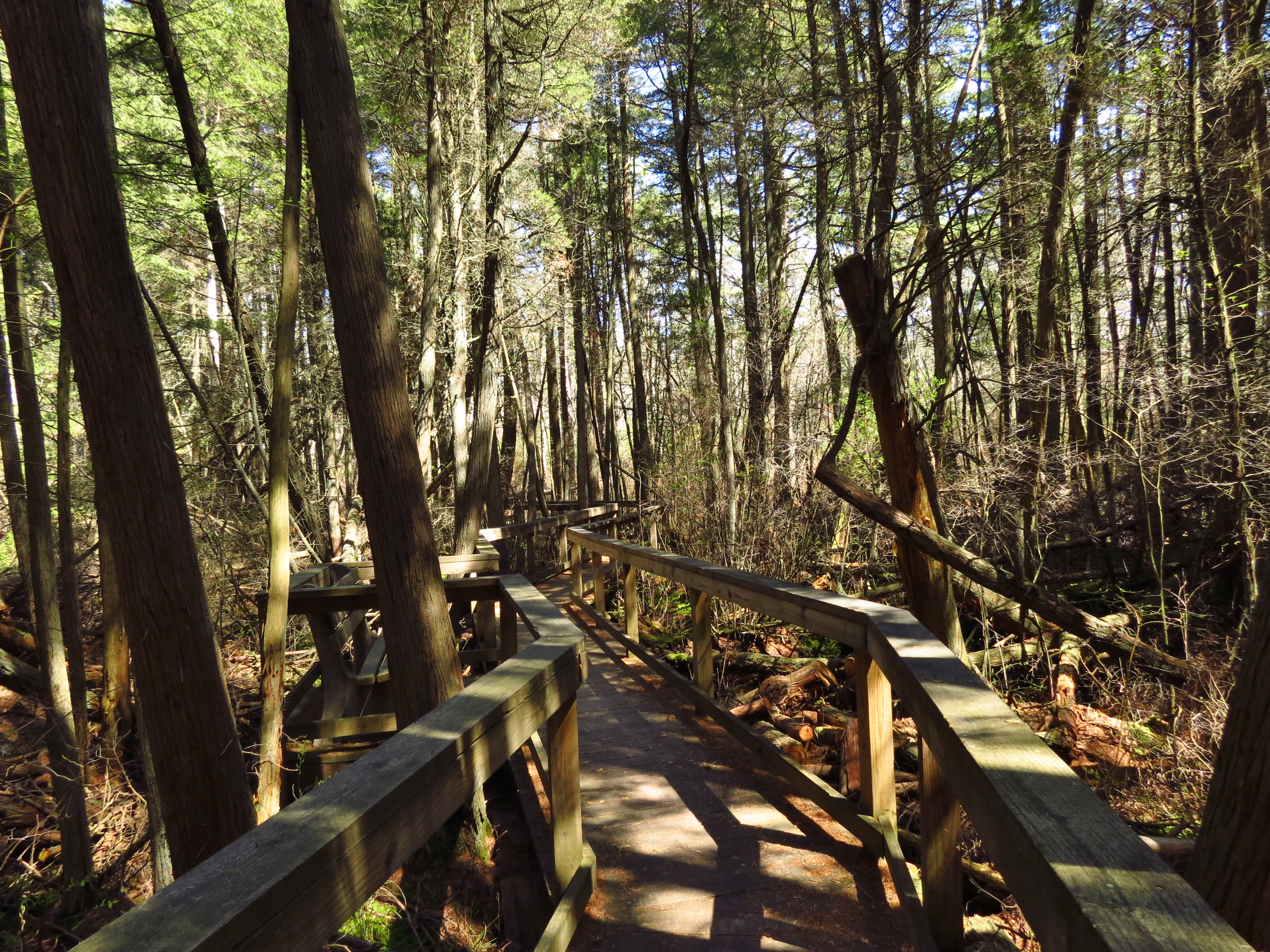
Bass River State Forest - Boardwalk across the white cedar bog - Photo by Daniela Wagstaff
NYNJTC maintained: 
0

New Jersey’s first state forest, with its many recreational activities centered at Lake Absegami.

Hiking
Bridle path
X-C skiing
23 miles
29147 acres
Lat/Lon: 
39.646969, -74.422590
Tuckerton
Ocean
NJ
Cluster/Park: 
Park

Bass River State Forest

Acquired in 1905, Bass River State Forest was the first state forest in New Jersey.  A Civilian Conservation Corps camp on the parkland lasted from 1933 to 1942. Camp S-55’s most noteworthy feat was the creation of the 67-acre Lake Absegami, by damming two streams flowing through the forest. Forest headquarters is still at Lake Absegami, where there are camping areas, a beach, cabins, shelters, lean-tos, a nature center, and a short nature trail that traverses a cedar swamp.

The forest has 13 easy walking (non-ADA accessible) blazed trails varying in length from 0.4 to 4 miles, and a segment of the Batona Trail.  Most trails start at the south end of the day-use parking area near the beach. With a map and compass, it is possible to hike any number of circular routes over the sand roads in the area through typical Pinelands forests.

Use the Web Map link on this site to view a trail map.


From northern New Jersey, take Exit 52 [New Gretna] of the Garden State Parkway and turn right onto County 654 (East Greenbush Road), following the signs to the park. From southern New Jersey, take Exit 50 [New Gretna, US 9] to New Gretna and turn left onto County 679. After 1.5 miles, bear right onto County 654. At the junction with Stage Road, bear right and follow the signs to the park headquarters.

GPS Coordinates: 39.621038, -74.423115

Fees: 
Some times and places; check with park
Last Update: 
07/10/2019
Modified By: 
Daniel Chazin
Landowner: 
NJ DEP
Region - Maintenance: 

Bear Mountain-Harriman State Parks

Historic: 
Complete: 
Yes
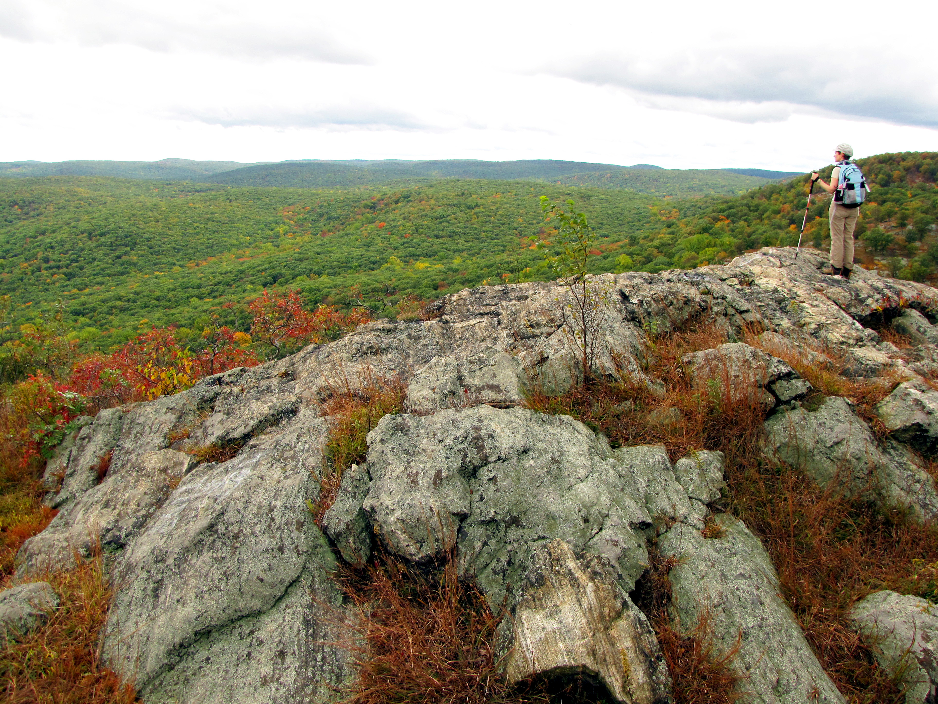
View from The Timp - Harriman-Bear Mountain State Parks  - Photo credit: Dan Balogh
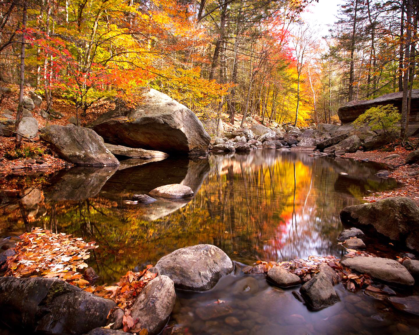
Autumn reflections along the Stony Brook Trail - Photo credit: Susan Magnano
Hudson River from Bear Mountain - Harriman-Bear Mountain State Parks  - Photo credit: Josh Howard
NYNJTC maintained: 
1

Bear Mountain and Harriman State Parks in New York combine to cover nearly 52,000 acres of mostly forested landscape with hundreds of miles of trails--including the Appalachian Trail--a rich hiking resource close to New York City.

Hiking
Accessible
Dogs on leash
235 miles
52000 acres
Lat/Lon: 
41.230332, -74.086882
Bear Mountain
Rockland
NY
Cluster/Park: 
Park

Bear Mountain-Harriman State Parks

With more than 235 miles of trails, approximately fifty marked trails, and three-dozen plus woods trails not to mention unmarked trails, it seems best to feature just a few major trail access points with parking areas.

  • Reeves Meadow Visitors Center: One of the most popular trails in the park, the Pine Meadow trail [5.5 miles; red on while] leads to the north shore of Pine Meadow Lake. A 0.2-mile hike east from the parking area towards Sloatsburg on Pine Meadow Trail connects to Seven Hills Trail [blue dot on white]; 300 feet east of the visitors center on Pine Meadow Trail is the trailhead [on the right] of the Reeves Brook Trail [white].
  • Bear Mountain Inn: The large parking area [though it becomes full in good weather, or on special holidays] is an access point to several trails, including the Appalachian [white], Anthony Wayne [2.8 miles, white], 1777E [red "1777" on white], Suffern-Bear Mountain [23.5 miles, yellow], and Cornell Mine Trails [2.5 miles, blue]. Also the Twin Forts Trail, a short path connecting the sites of the historic Fort Clinton and Fort Montgomery [including the modest Fort Montgomery visitor center] and also leading to the Timp-Torne [11.2 miles, blue] and Popolopen Gorge trails [4.5 miles, red on white].
    • Significant improvements are underway for trails in this section of the park; volunteers are welcomed to join the NYNJ Trail Conference's Bear Mountain Trails Project.
  • Anthony Wayne Recreation Area: The mid-point of the Anthony Wayne Trail [2.8 miles; white] forms a loop with the Popolopen Gorge Trail [red on white] at Turkey Hill Lake and the Timp-Torne Trail [blue] on the west end of West Mountain.
  • Elk Pen Parking Area: On the western side of the park, there is access to the Appalachian Trail, Arden-Surebridge Trail [6.3 miles, red triangle on white] and Island Pond.

The Appalachian Trail [18.0 miles, white] traverses the northern section of the park, extending from the Bear Mountain Bridge at the Hudson River west to NY 17. On the way, it intersects or runs jointly with eleven other marked trails, and it can be combined with these trails to make a variety of loop hikes.

This section of the Appalachian Trail in the park was the first of the 2,160 mile-long A.T. to be completed, and much of it still follows the original route. Improvement are still being made to the A.T. on Bear Mountain which is the focal point of a multi-year, multi-agency trail building and rehabilitation project being led by the Trail Conference. Learn more about the Bear Mountain Trails Project.

  • Before proceeding west on the A.T. from Bear Mountain Inn, hikers may wish to follow the trail east, through a pedestrian tunnel under US 9 W, into the Trailside Museum and Zoo, which features native plants, animals, reptiles and birds. A sign on the A.T. as it passes through the museum marks the lowest point on the entire trail from Maine to Georgia - 124 feet above sea level.
  • Both ends of the trail in the park are readily accessible. See "Let's Go/Directions to Trailhead" to either Bear Mountain Inn or Elk Pen Parking Area.

Doodletown near Bear Mountain, an isolated hamlet surviving for 200 years -- but a ghost town since the mid-1960s -- is a popular destination for hikers.  Click for more information. 

For a collection of detailed hikes go to the “Find a Hike” page, scroll down to “Harriman State Park” and “Harriman-Bear Mountain State Park.”

  • Reeves Meadow Visitors Center: From NY 17 in Sloatsburg take Seven Lakes Drive 1.4 miles.  GPS:  41.174182, -74.168434
  • Bear Mountain Inn: From the Palisades Interstate Parkway [north or south], get off at exit 19 [Bear Mtn. Park] and take Seven Lakes Drive for 3½ miles to the Bear Mountain Circle. At the circle, take the second right. Follow the signs to Parking Lots. If you miss exit 19, take the Parkway to the Bear Mountain Bridge Circle. At this circle, make the first right onto 9W south and go to the traffic light. Bear right and go up the hill. Parking fees apply.  GPS: 41.312055, -73.988693
  • Anthony Wayne Recreation Area: From the Palisades Interstate Parkway, take Exit 17.  GPS: 41.297022, -74.027669
  • Elk Pen Parking Area: Take Route 17 north through Southfields, NY, turn right [east] onto Arden Valley Road, pass over the NY State Thruway [no access], then turn right on Elk Pen Road. From Route 17 south, Arden Valley Road is two miles south of the Harriman train station. [Google Maps: "Rt 17 and Arden Valley Road, NY 10975" The satellite view will show the parking area.]                                   GPS: 41.265345, -74.153499
  • Public transportation: Short Line buses from the New York Port Authority Bus Terminal to the Bear Mountain Inn also stop, if requested, along US 9W at Tomkins Cove and Jones Point. Short Line buses and Metro-North trains to Suffern, Sloatsburg, Tuxedo, Southfields, Arden, and Harriman give access to trails on the west side of the parks.
Fees: 
Some times and places; check with park
Last Update: 
12/01/2016
Modified By: 
Phil McLewin
Landowner: 
NYS OPRHP
Region - Maintenance: 

Ward Pound Ridge Reservation

Historic: 
Complete: 
Yes
Raven Rocks at Ward Pound Ridge Reservation - Westchester County
Dancing on Dancing Rock at Ward Pound Ridge Reservation - Photo: Jane Daniels
By a pond at Ward Pound Ridge Reservation - Photo: Jane Daniels
Hiking through laurel at Ward Pound Ridge Reservation - Photo: Jane Daniels
NYNJTC maintained: 
1

Hilly terrain in Ward Pound Ridge Reservation offers a mix of second-growth hardwood forest, hemlock, laurel, bold rock outcroppings, steep ravines, wetlands, and open meadows.

Hiking
X-C skiing
Accessible
Dogs on leash
42 miles
4700 acres
Lat/Lon: 
41.258383, -73.602232
Lewisboro,Bedford
Westchester
NY
Cluster/Park: 
Park

Ward Pound Ridge Reservation

The largest park in Westchester County, Ward Pound Ridge has areas with lots of people and places where few are encountered. Picnic areas, Trailside Museum and the park office are along Reservation Road, which crosses the park east-west and parallels the Cross River.  The southern part of the park offers a more secluded atmosphere. It is reached most easily from the Michigan Road parking and picnic area, which also serves as the center for winter ski touring. Camping in CCC era lean-tos is available.

Hikers have lots of choices in the 41.9 miles of trails in the park:

  • Blazed by volunteers in 2010, the 4.5-mile Rocks Trail follows footpaths for most of its route and traverses some of most beautiful areas of the park. It is named for six special features that it passes along the way, each of which includes the word "Rock" in their names: Dancing Rock, Bear Rock, Spy Rock, Castle Rock, Raven Rocks and Indian Rock Shelter.
  • North of Reservation Road, the Brown Trail offers a pleasant 3.8-mile walk along the Cross River. It is accessible from the picnic areas along Reservation Road.   
  • The Blue Trail extends south from the Kimberly Bridge picnic area through the eastern side of the park. One side of this 3.8-mile loop rises through open forest to the highest point in the park (860 feet). Laurel is in bloom in June along this trail. 
  • From the Michigan Road picnic area, the Red Trail offers access to a variety of scenery along its 5.6-mile loop.
  • Side trails lead to Leatherman's Cave, a former CCC camp, and a view over the Cross River Reservoir.

Cross-country ski traffic on the red, green and yellow trails is one way: counterclockwise.  Hikers may choose to hike the loops in either direction.

Take I-684 North to Exit 6 (Cross River), which briefly joins the Saw Mill River Parkway, then exits to N.Y. Route 35. Turn right and follow Route 35 east for 3.7 miles to N.Y. Route 121. Turn right onto Route 121, cross a bridge over the Cross River, then immediately turn left and enter Ward Pound Ridge Reservation. Continue for 0.7 mile to the tollbooth (a $10 parking fee is charged on weekends, daily in the summer). To reach the trailhead for most of the park's trails, make the first right beyond the tollbooth onto Michigan Road and continue for 0.7 mile to a parking area just before a turnaround circle at the end of the road.
Fees: 
Some times and places; check with park
Nearby Parks: 
Last Update: 
11/05/2016
Landowner: 
County
Manager: 
Westchester County Parks