 New York-New Jersey Trail Conference
Jenny Jump Mountain Short Loop Hike
Directions to trailhead
Take I-80 west to Exit 12 (Hope/Blairstown). Turn left at the bottom of the ramp and proceed south on County 521 for 1.1 miles to the old Moravian village of Hope. Turn left at the blinking light onto County 519 (Johnsonburg Road). Continue for 1.0 mile and turn right onto Shiloh Road. In 1.1 miles, turn right onto State Park Road and proceed to the park entrance, 1.0 mile on the left. After entering the park, bear right, continue for 0.1 mile, and park in a small parking area opposite a restroom building.
Hike Description
From the parking area, proceed ahead on the paved road, which curves to the right. You will pass a sign marking the trailhead of the Summit and Swamp Trails, and go by another parking area to the right. At the end of the second parking area (where the pavement ends), you'll notice a sign marking the start of the blue-blazed Spring Trail. Follow this trail ahead along a woods road, passing through a clearing. Soon, the trail begins to run along the base of the south side of the ridge.
A short distance beyond, the Spring Trail passes near the edge of a rocky ravine, with views over the ravine from rock outcrops to the right of the trail. It then swings left and continues along the base of the ridge on a relatively level footpath. At 0.6 mile, after passing cliffs on the left, the trail turns left and makes a short but steep ascent to the ridge, where it reaches a junction with the yellow-blazed Summit Trail.
Turn left, following the yellow blazes, which head southwest along the ridge of Jenny Jump Mountain. According to folklore, the mountain derives its name from Jenny Lee, a young woman living with her aged father on the mountain. While in a remote area on the mountain, she was accosted by (depending on the account) either a spurned suitor or a Native American. After being chased to the edge of the cliff, she chose “death before dishonor” and jumped. (In one account, however, she lived to tell the tale.)
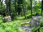
After walking along the summit ridge for about 300 feet, you’ll reach a west-facing viewpoint over the Delaware Water Gap fr om a rock outcrop to the right of the trail. A bench has been placed here. Then, in 0.2 mile, you’ll come to two large glacial erratics in an open area. The one on the right is form
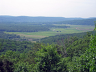
 ed of sandstone with calcareous layers, while the one on the left is composed of Precambrian granite gneiss (which forms the underlying bedrock). About 100 feet further along the trail, a side trail leads left to a southeast-facing viewpoint, which includes both forest and the fertile fields of the Great Meadows.
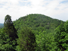
The yellow trail now widens into a woods road and, in 0.2 mile, turns right and begins a steady descent. Just beyond this turn, at a flat rock along the trail, a side trail leads left to a panoramic viewpoint from a rock outcrop a mid cedars. The Pinnacle is directly ahead, with the farmlands of the Great Meadows visible to the left. Glacial striations are clearly visible on the surface of the rock outcrop.
After enjoying the view, return to the main trail and turn left, continuing to descend. Soon, the red-blazed Swamp Trail joins from the right. After skirting Campsite #9, the joint red and yellow trails bear left, pass two cabins, and end at the parking area where the hike began.