 New York-New Jersey Trail Conference
Mayapple Hill and Lenape Trail Loop
Directions to trailhead
Take Garden State Parkway exit 145 to I-280 West. From I-280 West take exit 10 toward West Orange/South Orange/Montclair. In .2 mile turn left on Northfield Avenue. Continue for 2.7 miles then turn right on Cedar Avenue and proceed .4 mile to Mayapple Hill parking.
Hike Description
Construction of trails in the Mayapple Hill section of South Mountain Reservation from June through October 2012, has provided new urban hiking opportunities. Where the yellow-blazed Lenape Trail previously terminated at the southern end of the Mayapple Hill parking lot, it has now been extended from the opposite northern corner of the lot through a wooded undeveloped open space, which was added to South Mountain Reservation in 2009. This trail extension, in addition to a new loop trail around Mayapple Hill, forms an interconnecting network of trails.
To start the hike, locate the kiosk off to the side of the parking lot. Facing the kiosk, turn right and walk towards the white building off of a drive that exits the parking towards picnic areas. The yellow-blazed Lenape Trail starts just to the left of this restroom building. Follow the yellow blazes through the woods for about a quarter of a mile.
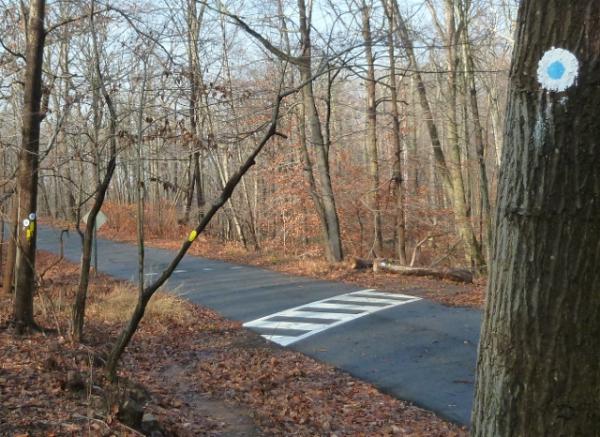
 Just before a pedestrian crosswalk over paved Cedar Avenue, a park access road, the blue-dot-on-white-blazed trail joins in from the right. This new loop trail around Mayapple Hill will be the return route. For now follow the combined yellow/blue-dot-on-white trail over the crosswalk and back into the woods. At a short boardwalk over a wet area, the blue-dot-on-white blazes leave to the left. Stay with the yellow blazes for now but remember this intersection for later.
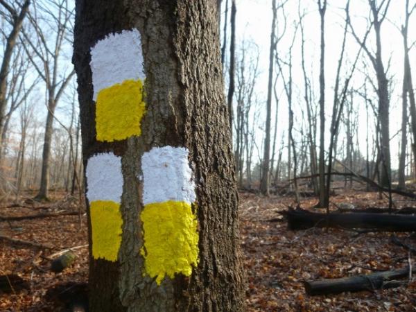
Continue on the yellow-blazed trail passing the entrance then the exit of the white/yellow loop trail. The yellow trail switchbacks sharply to the left at old concrete fence posts, descends and crosses a creek on wide, flat stepping stones, then ends at Whitbay Drive in BelAir Estates. This is the end of the Lenape Trail extension but the intent is to eventually continue the trail on the other side of Whitbay to join up with the main Lenape Trail near I-280 which will completely connect all of the main Essex County Parks. For now, retrace back to the first white/yellow trail blaze.
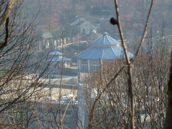
Turn left on the white/yellow trail for a half-mile loop then rejoin the yellow-blazed Lenape Trail continuing left. At the short boardwalk from earlier in the hike, turn right on the blue-dot-on-white trail. This trail will loop around the backside of Mayapple Hill with residences to the right. After the trail crosses over the original section of the Lenape Trail then paved Cedar Avenue, it continues along a ledge overlooking Orange Reservoir, South Mountain Arena and Turtle Back Zoo down to the right. A blue-line-on-white trail to the left provides a shortcut back to the parking lot but to get your full 4 miles worth, continue on until the blue-dot-on-white trail meets up with the yellow-blazed Lenape Trail at the crosswalk on Cedar Avenue from the beginning of the hike. Turn left here and follow the yellow blazes all the way back to the restroom building and the parking lot.
Turn-by-Turn Description
[ 0.00] Start on the yellow-blazed Lenape Trail to the left of the restroom building
[ 0.25] Cross paved Cedar Avenue when blue-dot-on-white joins in from the right
[ 0.35] Keep straight on yellow when blue-dot-on-white leaves to the left at boardwalk
[ 0.40] Keep straight on yellow when white/yellow goes right
[ 0.80] Keep straight when white/yellow goes right (other end of white/yellow loop)
[ 1.00] Cross creek on large boulders
[ 1.25] Reach paved Whitbay Drive and retrace
[ 1.45] Cross creek on large boulders
[ 1.65] Turn left on white/yellow (at the time of this hike, white/yellow not yet cleared, lots of blow downs)
[ 2.20] Turn left on yellow when white/yellow ends
[ 2.25] Turn right on blue-dot-on-white at boardwalk when yellow goes left
[ 3.00] Blue dot trail turns left on unmarked coming in from right then leaves to the right when unmarked veers left
[ 3.10] Cross over old section of yellow-blazed Lenape Trail running parallel to Cedar Avenue
[ 3.15] Cross paved Cedar Avenue
[ 3.30] Keep straight when blue-line-on-white goes left back to the parking lot
[ 3.65] Cross paved Cedar Avenue then small creek
[ 3.75] Left on yellow Lenape Trail when yellow/blue dot crosses road to the right
[ 4.00] Back at parking lot