 New York-New Jersey Trail Conference
Cattus Island
Directions to trailhead
Take the Garden State Parkway to Exit 82 (Toms River/NJ 37), and proceed east on NJ 37 for 4.4 miles to Fisher Boulevard. Take the jughandle turn onto Fisher Boulevard, turn left, and proceed north for 2.0 miles. Just beyond the Bellcrest Plaza shopping center, turn right onto Cattus Island Boulevard, and in 0.1 mile turn left and enter the park. Continue for 0.5 mile to the parking area.
Hike Description
Cattus Island, named for John V. A. Cattus, who acquired the island in 1895 and used it as a vacation home for many years, was first settled in the mid-1700s. Today, it offers the hiker the opportunity to traverse interesting salt marshes and pine forests along Barnegat Bay.
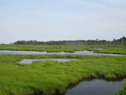
From the parking area, follow the asphalt path to the Cooper Environmental Center. (The environmental center building was heavily damaged by Hurricane Sandy in October 2012, but it was repaired and reopened to the public in spring 2017). Turn left and walk around the porch, then descend a ramp. After passing a kiosk, turn right onto a sand road, which soon crosses a salt marsh and reaches the higher, drier area known as Cattus Island. The body of water on the left is Mosquito Cove.
Just beyond the marsh, you’ll notice a triple blue blaze on a tree to the left. Turn left onto this blue-blazed footpath, the Island Loop, which winds through a pine forest. Soon, you’ll come out at the shore of Mosquito Cove at the old Boathouse Landing, once the site of a wooden dock.
 Continue to follow the blue blazes through an oak/pine forest, with an understory of highbush blueberry. You'll also notice some holly trees along the way. You’ll pass the gnarled trunk of a dead cedar tree as well as the trunks of many pine trees felled by Hurricane Sandy.
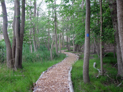
A short distance beyond, the white/blue-blazed Cedar Line Short Cut Trail begins on the right. You should continue ahead on the blue-blazed Island Loop, which follows a raised wood-chip path and wooden boardwalk through an area of dense phragmites. Soon, the trail comes out on the shore of Barnegat Bay, with broad views across the bay. Several cedar trees shade this pleasant spot, and a bench offers the opportunity to rest and take in the views.
Proceed ahead on the blue-blazed trail until you reach the sand road. Turn left onto the road, which leads across a causeway, bordered by salt marsh on both sides and lined with cedars. To the left, you’ll notice a wooden osprey nesting site. The road ends at the narrow sandy beach that forms the northern tip of Cattus Island. Again, a bench is provided here if you wish to take a break. You can follow the narrow strip of sand to the extreme northern end of the island. When you’re ready to continue, retrace your steps, following the sand road across the causeway to the main body of the island.
At the end of the causeway across the salt marsh, turn left onto the blue-blazed Island Loop. This trail follows a raised wood-chip path across a wet area, with a boardwalk on one section. After passing through an open area, with several large pines felled by Hurricane Sandy, you'll reach an observation blind over a salt marsh, with an osprey nesting platform visible in the distance. The trail continues through an area dominated by highbush blueberry.
Soon, you’ll notice the trailhead of the white/blue-blazed Cedar Line Short Cut Trail on the right. To the right, a large clearing, with several benches, marks the site where the island's residents once lived.
Continue ahead on the blue-blazed trail, which traverses a dense stand of phragmites and reenters the woods on a sandy footpath, passing stands of holly. After arriving at another observation blind, you’ll cross a dense area of phragmites on a boardwalk and emerge onto the sand road. Proceed across the road and continue to follow the blue-blazed trail for a short distance until you again reach the sand road. Turn right onto the road and follow it back to the Cooper Environmental Center, then take the wide path back to the parking area where the hike began.