New Maps Cover 15 Northern NJ State Parks
Title
Body

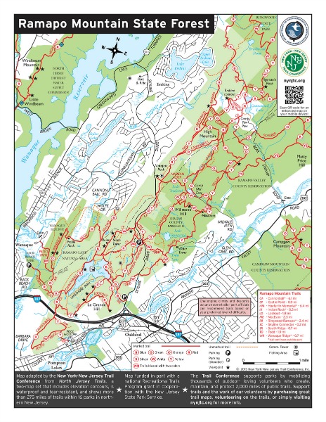
The Trail Conference, in partnership with the New Jersey State Park Service, is currently finishing up a project to produce maps for 15 state parks and forests in northern New Jersey. We hope these new maps will bring more awareness to the efforts of the Trail Conference and our outstanding volunteers who help keep trails open and safe for everyone to enjoy.
Print copies of these maps are available from most of the park’s offices and visitor centers. The maps can also be obtained in digital format, both as a regular PDF in 8.5”x11” format for viewing on a computer and/or printing at home, and a GPS-enhanced version for use with the free PDF Maps app by visiting our website at nynjtc.org/map/njstateparkmaps.
While the Trail Conference is making these park maps available for free, we do ask that if you like them, please consider making a donation, becoming a volunteer, or becoming a member of the Trail Conference. You can also show your support by purchasing our full-featured maps, which are available in print format on waterproof and tear-resistant Tyvek. Our popular Kittatinny Trails, North Jersey Trails, and Jersey Highlands Trails map sets include several of these New Jersey state parks.
The Trail Conference would like to acknowledge the contributions of the many great people who made these maps possible. Suse Bell served as volunteer coordinator for this project, keeping everything on track by facilitating communications among the cartographer, Jeremy Apgar, and everyone else involved. A few volunteers helped provide GPS data for the maps, including Ed Burdzy and Paul Cashen, and even more Trail Conference volunteers provided valuable field-checking and review expertise, including Alan Abramowitz, Estelle Anderson, Daniel Chazin, David Day, Monica Day, Gene Giordano, Bob Jonas, Howie Liebmann, Paul Makus, Keith Scherer, Karen Schoof, Brian Sniatkowski, and Don Tripp. Thanks also to all of the park superintendents and everyone else at New Jersey State Parks, including Steve Ellis and Diane Lowrie, who helped us create the best maps possible for park visitors.
Maps were funded in part with a national Recreational Trails Program grant in cooperation with the New Jersey State Park Service.
The 15 state parks and forests include:
• Abram S. Hewitt State Forest
• Allamuchy Mountain State Park
• Kittatinny Valley State Park
• Long Pond Ironworks State Park
