New maps are expected by December 20!
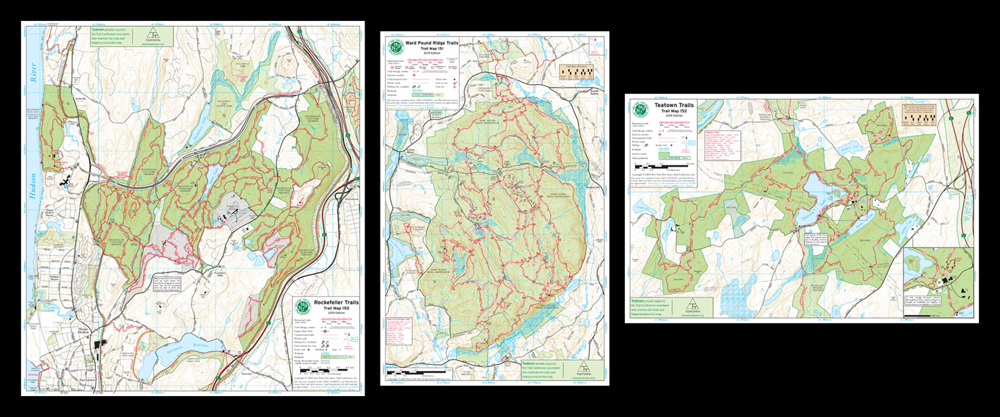
 Coming later this fall, the new Westchester Trails map set is sure to become the go-to resource for discovering and exploring trails in Westchester County. The first edition of this three-map set focuses on Rockefeller State Park Preserve (the largest state park in Westchester County), Ward Pound Ridge Reservation (the largest Westchester County Park), and Teatown (the largest privately owned preserve in the county). All maps include detailed junction-to-junction trail mileage numbers, 10-foot elevation contour lines, parking areas, and much more.
The maps will be available in print format in vibrant color on waterproof, tear-resistant Tyvek. They will also be available in digital format on Apple and Android devices through the Avenza Maps app. The maps are currently at the printer, and we expect them to be available to order by December 20. Visit www.nynjtc.org/maps/westchester-trails-map to learn more and order the map when it becomes available.
The first map, Map 130, features the vast trail network at Rockefeller State Park Preserve, including the nearby Rockwood Hall Area. Several unnamed trails have recently been named and are in the process of being marked with signposts; the map includes these updates. Points of interest throughout the Preserve, including Eagle Hill, Raven Rock, and Spook Rock, are identified on the map. In addition, surrounding parks and their trails are shown, including Peabody Preserve, Pocantico Park, Tarrytown Lakes Park, and portions of the Riverwalk near Tarrytown. Large sections of both the Old Croton Aqueduct and North County Trail are shown.
The second map, Map 131, features the trails at Ward Pound Ridge Reservation. The latest changes in this large trail system are included, with junction numbers shown to match on-the-ground signage. Popular destinations like Leatherman's Cave, Dancing Rock, and Bear Rock Petroglyph are indicated. Just outside the Reservation's boundary, trails are shown in Armstrong Preserve, Lewisboro Town Park, Old Field Preserve, and Richards Preserve.
The last map in the set, Map 132, covers the varied trail network at and around Teatown. The map front includes a large detailed map of Teatown itself, while a map on the reverse zooms out to cover the Greater Teatown area. Several recent trail changes at Teatown are reflected on the map, including a new Three Lakes Loop Trail that takes hikers past Teatown Lake, Vernay Lake, and Shadow Lake. The Greater Teatown map shows Teatown at the center of a larger area of connected and nearby parks. To the northeast, the Teatown-Kitchawan Trail extends to Kitchawan Preserve and the North County Trail; to the northwest, the Briarcliff-Peekskill Trail extends to Croton Gorge Park and the Old Croton Aqueduct.
The detailed trail mileages included on the three maps are a useful way to plan routes or navigate on the trails. In addition, 10-foot elevation contour lines help to show the underlying terrain and make it easier to determine which trail sections may include challenging climbs or descents. Parking areas, including roadside pulloffs, are noted on the maps. Several public transportation access points are shown, including multiple Metro-North Hudson Line train stations, making it possible to explore many of these trails without needing a car. Scenic viewpoints, historical points of interest, and lakes and streams are also identified throughout the maps, and UTM gridlines further aid with navigation. The backs of the maps include useful information about the parks, park regulations and contact information, tips on how to use the maps and practice Leave No Trace principles, and much more.
