2023 - 13th edition
Our East Hudson Trails Map is a three-map set featuring trails in the New York Highlands east of the Hudson River.


2023 - 13th edition
Our East Hudson Trails Map is a three-map set featuring trails in the New York Highlands east of the Hudson River.
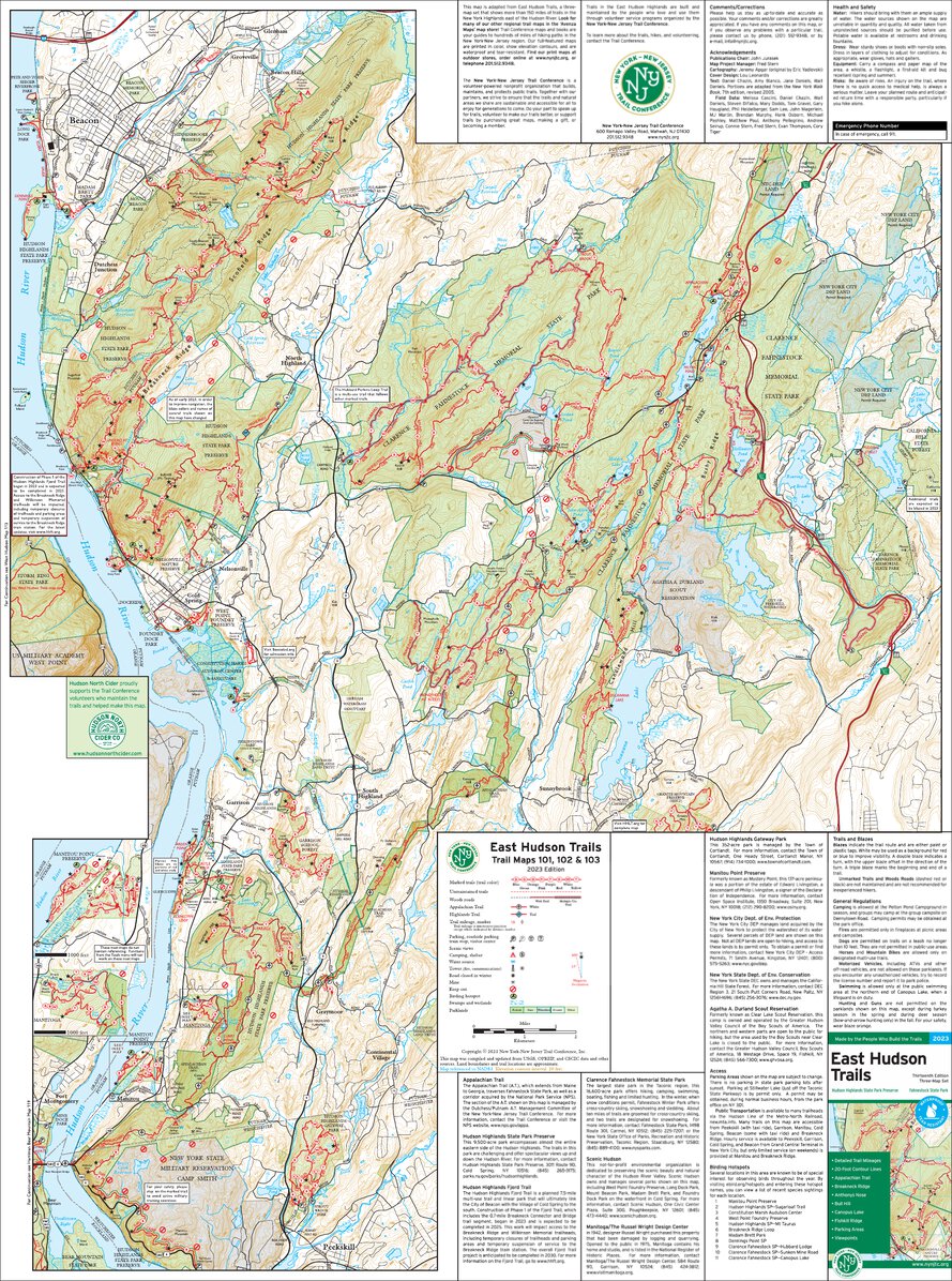
Our East Hudson Trails Map is a three-map set featuring trails in the New York Highlands east of the Hudson River. The maps are printed in vibrant color on waterproof and tear-resistant Tyvek, and are a must-have for enjoying the rich outdoor experiences throughout the Hudson Highlands region. The 2023 update includes several new trails and significant trail changes in places like Hudson Highlands State Park Preserve and Fahnestock State Park, along with more detailed trail lines, adjusted viewpoint stars, parking access updates, new Birding Hotspot locations, and more.
Map features include:
Our East Hudson Trails Map is also available on Apple and Android mobile devices through the Avenza Maps app. Click the links above to download these popular maps, or learn more about the app here.
Special thanks to volunteer project manager Fred Stern and all the volunteers and park partners who helped produce this map revision!

This map was also produced with support from Hudson North Cider, a proud supporter of our volunteers!
Trail Conference maps are built on more than 85 years of mapping experience. They are the trusted source for reliable trail information in the New York-New Jersey metropolitan region. These maps are "Made By the People Who Build the Trails" and are regularly updated with changes to the trails.


Write a review