The New York-New Jersey Trail Conference, with more than 80 years of trail mapping experience in the New York Metropolitan area, produces highly-acclaimed trail maps that are simplistic in design, yet are detailed, accurate, and attractive.
A well-designed trail map can sometimes make all the difference between a trail user having an enjoyable experience, and a trail user getting lost and needing to be rescured. Trail maps often need to be designed for a broad spectrum of users, and good design choices are especially important when it comes to ensuring the maps can be used by novice trail users to prevent them from getting lost.
Here are some examples of Trail Conference trail maps that demonstrate some of the typical design styles used on our maps.
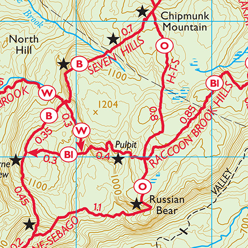
A snippet of our most popular "Harriman-Bear Mountain Trails" map set, this map shows our standard red trail lines with blaze color symbols, junction-to-junction trail mileage numbers, trailhead arrows at the beginning and end of marked trails, identification of significant points of interest along the trails, and detailed elevation contour background. Our simplified color scheme allows the trail network to appear very prominent on the map, and this typical look of our trail maps has become synonymous with accurate and reliable trail information in our region.
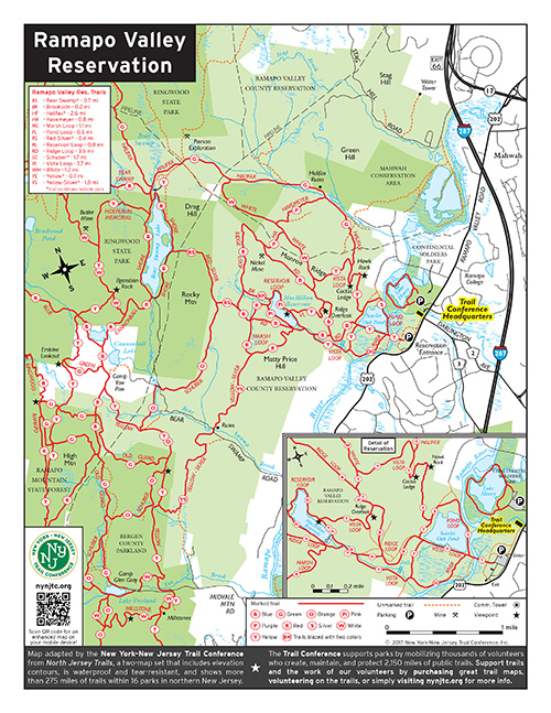
For some maps, we remove background topographic details to further simplify the map and make it more approachable to a broader spectrum of park visitors. This popular map of a county reservation retains our typical red trail lines with blaze color symbols, and the removal of elevation contour lines makes it much easier for users to follow the network of trails shown on the map. This particular map also highlights our use of inset maps for showing busy or complex areas in greater detail.
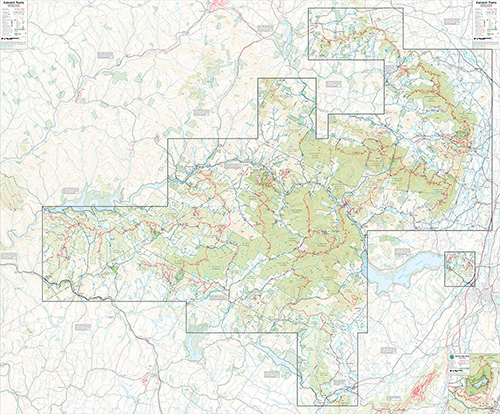
We produce maps for an array of coverage areas, from a tiny town park map all the way up to our largest map here of the entire Catskill Mountains region of New York (covering more than 1.5 million acres). No matter the size of the map, we strive to ensure that key qualities of ease of use, accuracy, and attractiveness are followed, and the importance of paying attention to the tiniest details cannot be overstated.
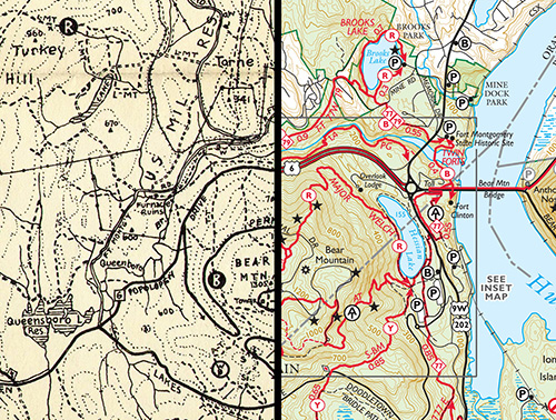
This is a side-by-side comparison of maps produced about 83 years apart covering the very popular Bear Mountain State Park. From the first true trail maps of the region, produced by William Hoeferlin starting in the early 1930s, to the Trail Conference's current lineup of 11 major map sets and countless other trail maps, the Trail Conference has learned a great deal about what does and does not work regarding trail map styles, especially in terms of ease of use and readability by users.