Building an Identity for the Highlands Trail
August 15, 2022
New York-New Jersey Trail Conference
Title
Building an Identity for the Highlands Trail
Body
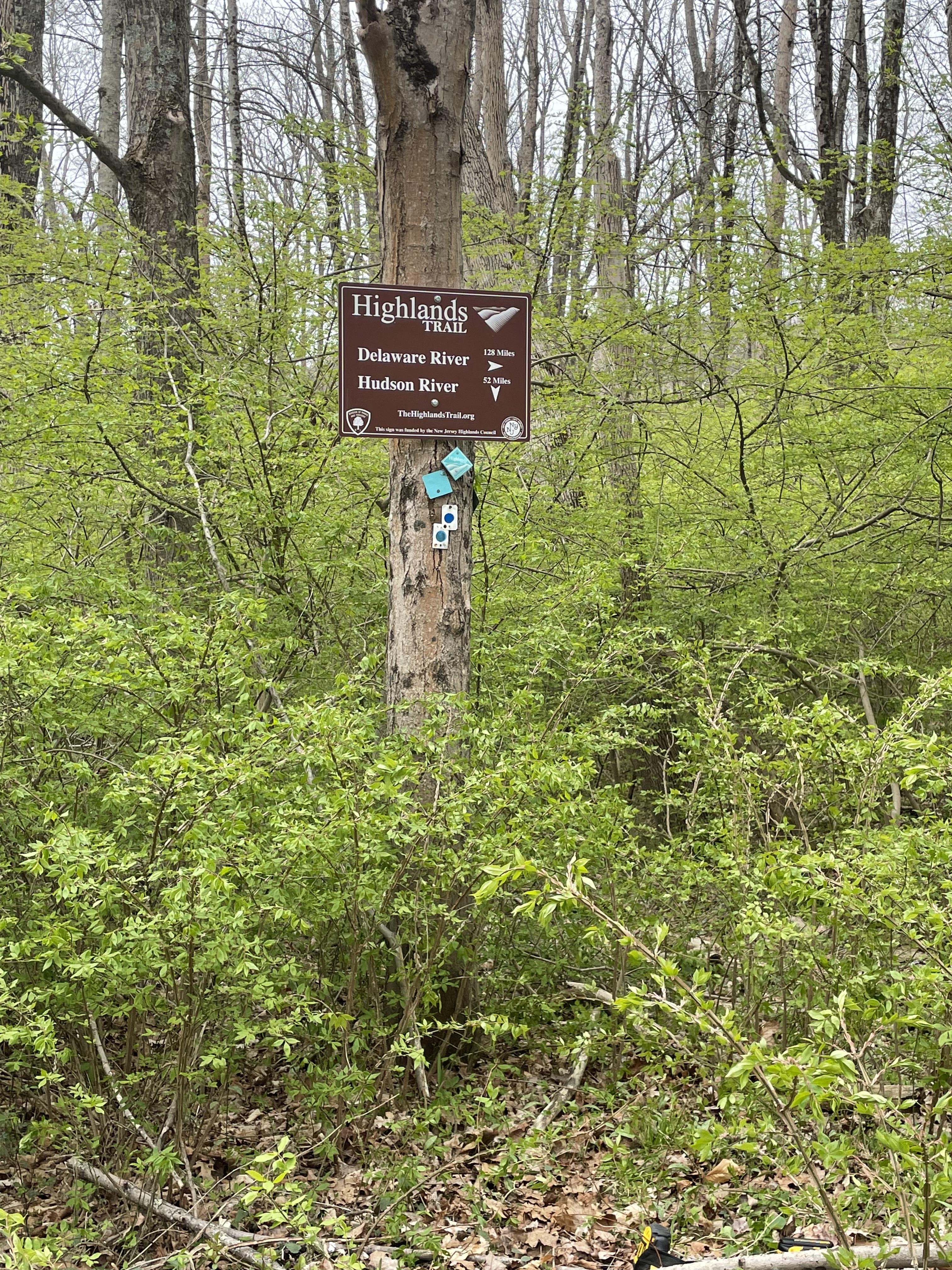
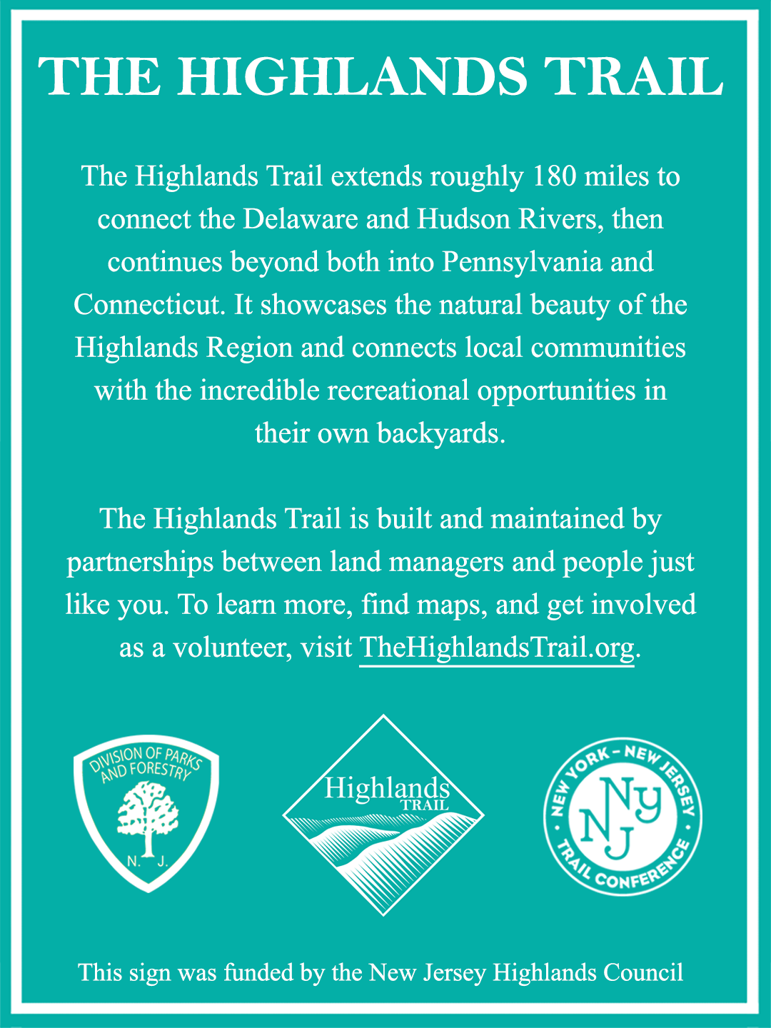
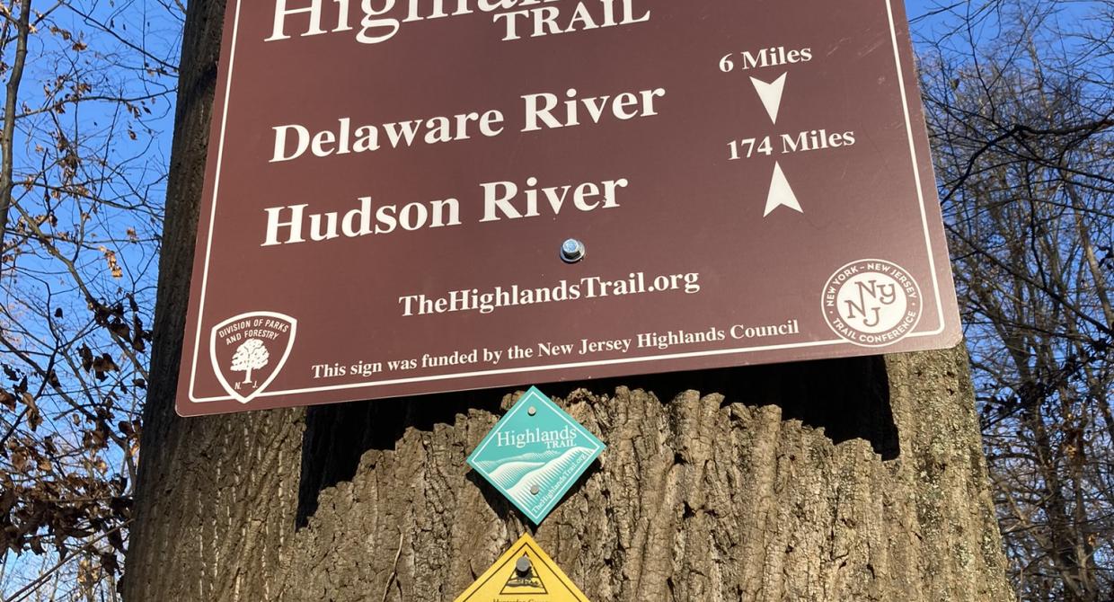
Visitors to the Highlands Trail in New Jersey experience brand new signs installed along the length of the New Jersey section. This is the result of a successful collaboration between the New Jersey Highlands Water Protection & Planning Council (Highlands Council) and the Trail Conference. The New Jersey section of the Trail extends approximately 130 miles from the Riegelsville Bridge in Pohatcong northeast to the New York state line in Sterling Forest. In fact, the Trail travels further into New York towards its current terminus at Storm King Mountain on the Hudson River, but this campaign was focused on New Jersey.
This signs campaign was sponsored through a grant from the Highlands Council intended to compliment the Council’s recently published New Jersey Highlands Economic Sustainability Development Plan. This plan identifies outdoor recreation, together with heritage tourism as core tenets for the future of the Highlands. The three types of sign hikers will see on the trail include: Trailhead signs mounted at parking lot kiosks and trail intersections identifying the Highlands Trail with a short description of the region it traverses. These are colored in the iconic teal shade used for the Highlands Trail blazes; Long-distance signs indicating the distance to the Hudson and Delaware Rivers, the portion of the Trail the Trail Conference maintains; and directional signs installed in locations to help visitors find parking or navigate the Trail between park units. The purpose of these signs is to grow the identity of the Highlands region and establish the Highlands Trail as a premier hiking destination right here is our backyard!
Each of these signs and the new tag blazes on the Trail feature the updated web address: http://www.thehighlandstrail.org inviting people to visit the Trail’s landing page and learn more. This page, hosted on the Trail Conference website, includes detailed information about the Trail as well as maps and guides for hiking the whole route. New to the page, thanks to the Highlands Council grant, is a digital map of the whole New Jersey Highlands Trail. This map is available as a PDF or free download on the Avenza App. Just search “Highlands Trail” in the app’s store.
The Trail Conference is very grateful to the Highlands Council for being such a proactive partner in promoting the Trail, which has been a long-term project for the Trail Conference. Our shared vision for this campaign is to raise awareness and educate people about the Highlands Region, and inspire more exploration of our local backyard and the wealth of scenic vistas, ecological diversity and wildlife it has to offer.