Harriman-Bear Mountain Trails Map 2020 Now Available!
Title

Body
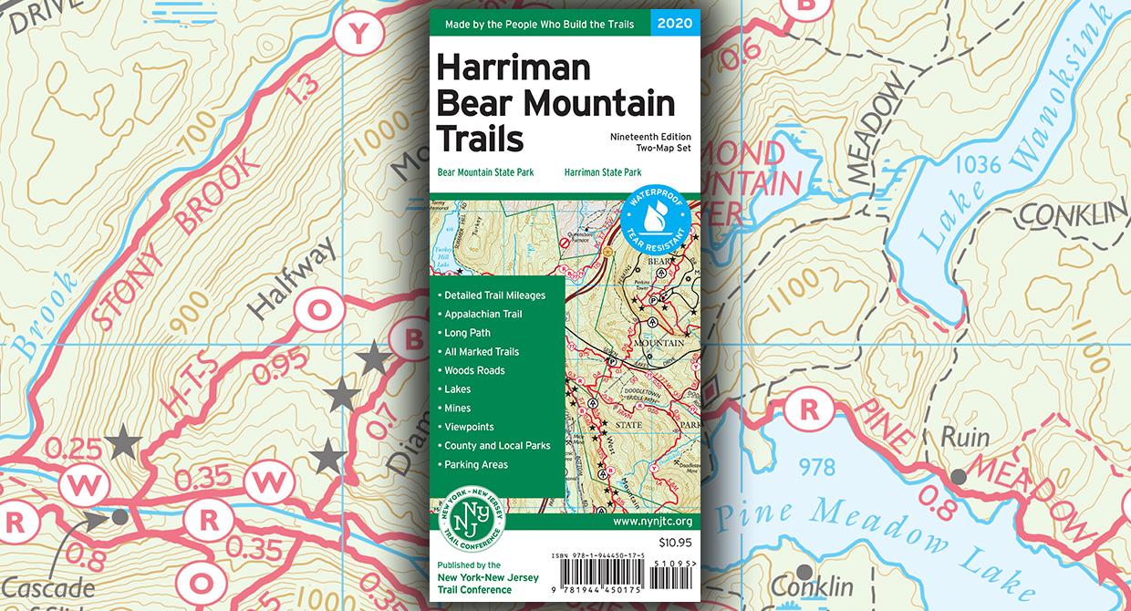
The revised 19th edition of our popular Harriman-Bear Mountain Trails map set is available in print and digital formats!
Did you know that the 1st edition of our Harriman-Bear Mountain Trails map set was created in 1975? 45 years later, the 19th edition of our popular map set has been completed updated for 2020 and is now available, just in time for fall. This two-map set covers more than 230 miles of marked trails and is a must-have for your adventures on the large network of trails in Harriman and Bear Mountain State Parks.
All maps feature detailed junction-to-junction trail mileage numbers, 20-foot elevation contour lines, parking areas and public transportation information, viewpoints and other points of interest, UTM gridlines, and tables of detailed trail information.
The Harriman-Bear Mountain Trails maps are available in print format, in vibrant color on our popular waterproof, tear-resistant Tyvek; shop online, visit our headquarters, or look for them at an outdoor retailer near you.
In addition, the maps are also available on Apple and Android devices through the Avenza Maps app. To get the latest maps, and to help ensure the Trail Conference receives as much of your support as possible, please consider making your purchase directly from the following links rather than within the app itself: Combined Map (save with this map that combines the two section maps!), Map 118 (Southern Section), and Map 119 (Northern Section). If you are currently using the previous 2018 edition of these app maps, you should see an "update available" notice within the app, and you will have the option to download the latest 2020 maps at a discount.
About the Map
List price: $10.95 ISBN: 978-1-944450-17-5New York-New Jersey Trail Conference (2020)
At a Glance
- More than 230 miles of marked trails within Harriman and Bear Mountain State Parks, as well as surrounding parklands
- Sections of the Appalachian Trail and Long Path
- Detailed junction-to-junction trail mileage numbers on the map front
- 20-foot elevation contours
- 1:36,000 scale (1 inch = 3,000 feet)
- Convenient map sizes to carry and use on the trail
- Complete trail index and guide to trail blazing on map backs
- Enlarged inset map of popular Bear Mountain area
- State land boundaries
- Unmaintained trails and woods roads
- Shelters
- Springs, viewpoints, mines, and other points of interest
- Parking areas
- Public transportation
- Park contact information, history, and regulations
- UTM grid with latitude/longitude markings
Special Thanks
Special thanks go out to volunteer project manager John Mack and all the volunteers and park partners who helped produce this map revision. New for this edition, birding hotspot locations were recommended by Anne Swaim, Executive Director of Saw Mill River Audubon (SMRA), and Phil Heidelberger, Trail Conference volunteer and SMRA Board Member, with review by Rockland Audubon birders Alan and Della Wells, Harriman-Bear Mtn birders Drew Panko and Trudy Battaly, and Mearns Bird Club birder Gerhard Patsch.This map was also produced with support from Storm King Adventure Tours, a proud supporter of our volunteers!
About the Trail Conference
The New York-New Jersey Trail Conference is a volunteer-powered, 501(c)3 nonprofit organization that builds, maintains, and protects public trails. Together with our partners, we strive to ensure that the trails and natural areas we share are sustainable and accessible for all to enjoy for generations to come. Do your part to speak up for trails, volunteer to make our trails better, or support trails by purchasing great maps, making a gift, or becoming a member.
New York-New Jersey Trail Conference maps are built on more than 85 years of mapping experience. They are the trusted source for reliable trail information in the New York-New Jersey metropolitan region. These maps are "Made By the People Who Build the Trails" and are regularly updated with changes to the trails.


