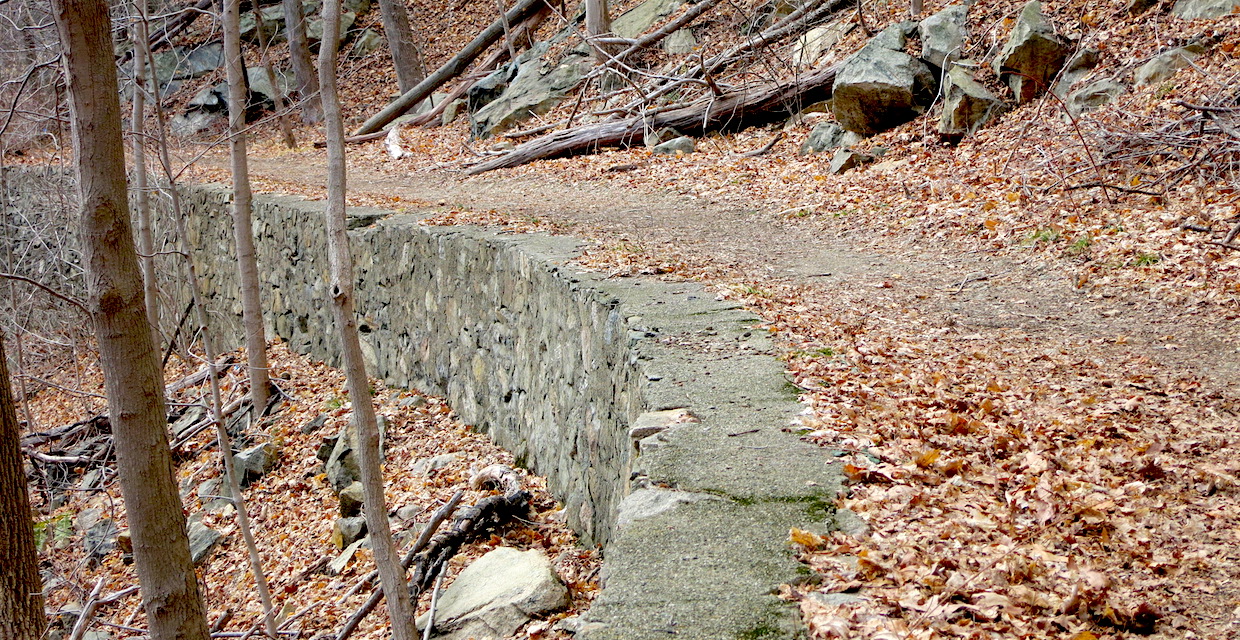
Ruin

South Beacon Mountain Firetower and Scofield Ridge

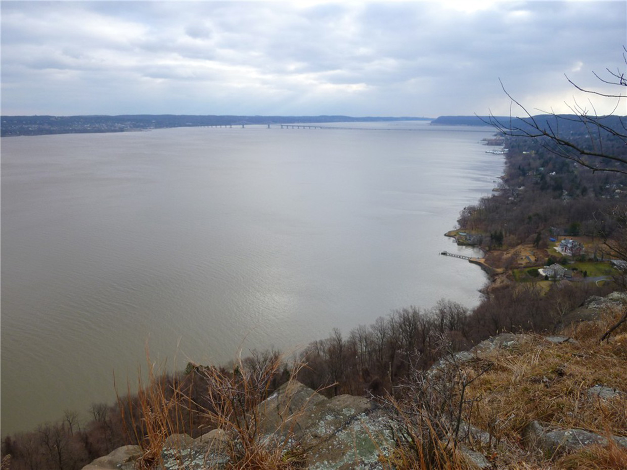
Beacon reservoir from fire tower - Photo: Daniel Chazin
NYNJTC maintained: 
1
Summary: 

This hike climbs to the firetower atop the summit of South Beacon Mountain and follows the Scofield Ridge, passing many panoramic viewpoints over the Hudson River and the surrounding mountains.

7 hours
Strenuous
8 miles
Route type: 
Circuit
Allowed on leash
Historic feature
Public Transportation
Views
Historic: 
Hudson Highlands State Park Preserve
East Hudson Highlands
NY
Dutchess
102 East Hudson Trails North
06/02/2006
08/17/2014
Driving: 

From the east end of the Bear Mountain Bridge, proceed north on N.Y. 9D for 14.5 miles. As NY 9D (Wolcott Avenue) curves sharply to the left at Bob’s Corner Store in Beacon, turn right onto Howland Avenue. Immediately, turn right into the parking area for Scenic Hudson’s Mount Beacon Park.

Train: 

Take the Metro-North Hudson Line to the Beacon station. The trailhead is approximately 1.5 miles from the train station.  To reach the trailhead from the station turn right (south) onto Beekman Street (towards Dia Beacon).  In 0.4 mile, Beekman Street ends, and you should continue along Wolcott Avenue (Route 9D).  In about another mile, Wolcott Avenue makes a sharp right turn.  At this bend, turn left onto Howland Avenue.  The trailhead is on your right.

This hike begins with a steady, steep climb of 1,000 feet of elevation in the first mile, and the overall elevation gain exceeds 2,000 feet. It is not an easy hike, but the spectacular views that it affords are ample reward for the strenuous ascents. Much of the land traversed by the hike has been protected through the efforts of Scenic Hudson, which preserves open space in the Hudson River valley.

Reference/Source: 
Bergen Record: Hike of the Week

Ramapo Lake Loop

Ramapo Lake - Photo by Daniel Chazin
NYNJTC maintained: 
1
Summary: 

This hike loops around scenic Ramapo Lake.

2 hours
Easy
4 miles
Route type: 
Circuit
Allowed on leash
Historic feature
Views
Historic: 
Ramapo Mountain State Forest
Ramapo Mountains
NJ
Bergen
Passaic
115 North Jersey Trails East
01/09/2003
03/03/2021
Driving: 

Take I-287 to Exit 57 (Skyline Drive/Ringwood) and proceed north on Skyline Drive (following the signs to "Ringwood"). Just ahead on the left is the Ramapo Mountain State Forest parking area.

At the southern end of the parking area, a triple black-square-on-blue blaze marks the start of the Ramapo Lake Spur. Follow the trail into the woods, passing stone ruins. After going up a steep pitch, the trail continues to climb on a wide, rocky path, paralleling a caCascades in the brook along the Macavoy Trail. Photo by Daniel Chazin.

Reference/Source: 
Bergen Record: Hike of the Week
HOTW Date: 
Fri, 01/08/2016
HOTW Count: 
1

Schuber/Yellow-Silver Trails Loop

MacMillan Reservoir - Photo by Daniel Chazin
NYNJTC maintained: 
1
Summary: 

This loop hike traverses lesser-used areas of the reservation, passing MacMillan Reservoir and attractive cascades, and climbs to a panoramic viewpoint over the Manhattan skyline.

5 hours
Moderate to Strenuous
8 miles
Route type: 
Circuit
Allowed on leash
Historic feature
Public Transportation
Views
Waterfall
Historic: 
Ramapo Valley County Reservation
Ramapo Mountains
NJ
Bergen
115 North Jersey Trails East
12/15/2003
05/17/2020
Driving: 

Take N.J. Route 17 to U.S. Route 202 in Mahwah. Proceed south on Route 202 for two miles, then turn right into the Ramapo Valley County Reservation parking area.

Bus: 

Short Line offers bus service from Port Authority Bus Terminal in New York City to Ramapo College, which is located about a mile to the north of the park entrance on Route 202. For schedule information, go to www.shortlinebus.com. Only limited service is available on weekends.

The hike begins at a kiosk in the southwest corner of the parking area. Just ahead, you'll notice a triple-black-square-on-yellow blaze on a tree, which marks the start of the Vista Spur Trail. Follow the black-square-on-yellow blazes as they descend wooden steps, join a wide dirt road, and continue ahead to cross the Ramapo River on a steel truss bridge.

Reference/Source: 
Bergen Record: Hike of the Week

Popolopen Gorge/Popolopen Torne Loop

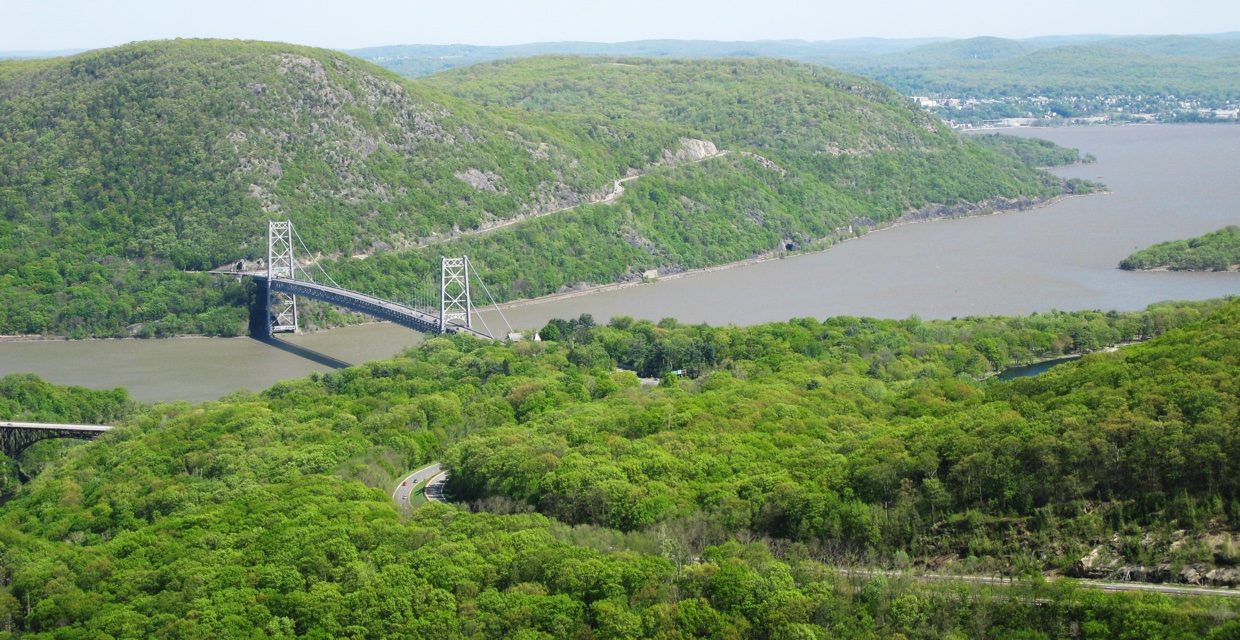
Bear Mountain Bridge and the Hudson River from Popolopen Torne - Harriman-Bear Mountain State Parks - Photo: Daniel Chazin
Trail along the route of the West Point Aqueduct - Popolopen Gorge/Popolopen Torne Loop - Harriman-Bear Mountain State Parks - Photo: Daniel Chazin
NYNJTC maintained: 
1
Summary: 

This loop hike climbs to the summit of Popolopen Torne, with panoramic views, and runs along the scenic Popolopen Gorge.

4 hours
Strenuous
5 miles
Route type: 
Circuit
Allowed on leash
Historic feature
Views
Historic: 
Harriman-Bear Mountain State Parks
NY
Orange
119 Northern Harriman Bear Mountain Trails
06/01/2004
03/08/2016
Driving: 

Take the Palisades Interstate Parkway to its terminus at the Bear Mountain Circle. Proceed north on US 9W, cross the viaduct over Popolopen Creek, and immediately turn right into the Fort Montgomery State Historic Site. Park in the parking area at the bottom of the ramp. (If the parking area is closed, or no parking spaces are available, proceed north on Route 9W to another parking area on the east side of the road and walk back to the Fort Montgomery Historic Site.)

Near the bottom of the ramp, at the entrance to the parking area, you'll see a brown post with a yellow arrow, a blue blaze, and 1777W and 1779 blazes. This marks the start of three co-aligned trails: the 1777W and 1779 Trails (which commemorate Revolutionary War events) and the blue-blazed Timp-Torne Trail. Follow these trails up stone steps and under the US 9W viaduct.

Reference/Source: 
Bergen Record: Hike of the Week
HOTW Date: 
Thu, 06/26/2014
HOTW Count: 
1

Ramapo Lake/LeGrande Hill Trails Lollipop-Loop

Ramapo Lake and the Wyanokies from the LeGrande Hill Loop Trail - Photo by Daniel Chazin
NYNJTC maintained: 
1
Summary: 

This hike leads to beautiful Ramapo Lake and climbs to several scenic overlooks on rocky footpaths.

3 hours
Moderate
4 miles
Route type: 
Lollipop
Allowed on leash
Historic feature
Views
Historic: 
Ramapo Mountain State Forest
Ramapo Mountains
NJ
Bergen
115 North Jersey Trails East
02/21/2002
03/25/2021
Driving: 

Take I-287 to Exit 57 (Skyline Drive) and proceed north on Skyline Drive. Just ahead on the left is the Ramapo Mountain State Forest lower parking area.

At the southern end of the parking area, a triple black-square-on-blue blaze marks the start of the Ramapo Lake Spur. Follow the trail into the woods, passing stone ruins. After going up a steep pitch, the trail continues to climb on a wide, rocky path, paralleling a cascading brook (particularly attractive after heavy rains). 

Reference/Source: 
Bergen Record: Hike of the Week
HOTW Date: 
Fri, 08/21/2015
HOTW Count: 
2

Mount Defiance/Glasmere Ponds Loop from Shepherd Lake

Weyble Pond - Photo by Daniel Chazin
NYNJTC maintained: 
1
Summary: 

This loop hike climbs to the summit of Mount Defiance, with panoramic views, and passes several scenic ponds.

5 hours
Moderate
7 miles
Route type: 
Circuit
Allowed on leash
Historic feature
Fees
Swimming
Views
Historic: 
Ringwood State Park
Ramapo Mountains
NJ
Passaic
115 North Jersey Trails East
05/23/2008
01/13/2021
Driving: 

Take Skyline Drive to its northwestern terminus at Greenwood Lake Turnpike (County Route 511). Turn right, continue for 1.5 miles, and turn right onto Sloatsburg Road. Continue for 2.1 miles and turn right onto Morris Road. In 1.3 miles, just before the entrance to the Skylands section of Ringwood State Park, turn left onto Shepherd Lake Road and proceed for 0.8 mile to Shepherd Lake. Past the entrance booth, bear left and park in the designated parking area (a parking fee is charged from Memorial Day weekend to Labor Day). NOTE: Shepherd Lake is a popular destination on summer weekends, and the parking area can fill up early in the day.

This hike follows a combination of footpaths, carriage roads (built for the estates that once dominated this area) and a mountain bike trail. Created primarily for bicyclists, the mountain bike trail - part of which is a narrow, "single-track" route - is also open to hikers. However, hikers should be alert for bicycles and, although park rules provide that bicyclists must yield to hikers, hikers may choose to step off the trail and allow bicyclists to pass.

Reference/Source: 
Bergen Record: Hike of the Week

Long Path/Bike Path Loop from Landing Road

View across the Hudson River from the Long Path - Photo by Daniel Chazin
View of the Hudson River from Hook Mountain - Photo credit: Daniela Wagstaff
NYNJTC maintained: 
1
Summary: 

This loop hike follows the ridge of Hook Mountain, with many views, and returns via a bike path along the Hudson River.

5 hours
Moderate
7 miles
Route type: 
Circuit
Allowed on leash
Historic feature
Views
Cliffs
Hook Mountain State Park
Rockland County
NY
Rockland
111 Hudson Palisades Trails
03/10/2006
12/28/2020
Driving: 

Take the Palisades Interstate Parkway north to Exit 4, and turn left at the bottom of the ramp onto US 9W. Continue north on US 9W for about 10 miles (2.6 miles beyond the intersection with NY 59 in Nyack). At the bottom of a hill, turn right and enter Rockland Lake State Park. Continue ahead on the main park road, which curves to the right, and proceed for 1.5 miles to a three-way intersection. Here, the main road bears left, but you should continue ahead onto Landing Road (marked by a “No Outlet” sign). After passing a fire station on the right, park in the spaces provided along the road, just before a barricade across the road.

The aqua-blazed Long Path -- which will be your route for the first part of the hike -- crosses the road near the barricade. Follow the Long Path to the north (left) as it begins to climb the ridge of Hook Mountain. In a short distance, you'll notice an old cemetery (the Wells Family Burial Ground) behind an iron fence on the right, with gravestones dating to the 1840s. You'll want to stop and take a look at this interesting feature.

Reference/Source: 
Bergen Record: Hike of the Week

LeGrande Hill/Ramapo Lake Longer Loop

Ramapo Lake - Photo by Daniel Chazin
NYNJTC maintained: 
1
Summary: 

This hike climbs to several panoramic viewpoints in the Ramapo Mountains and loops around scenic Ramapo Lake.

3 hours
Moderate
4 miles
Route type: 
Lollipop
Allowed on leash
Historic feature
Views
Historic: 
Ramapo Mountain State Forest
Ramapo Mountains
NJ
Bergen
Passaic
115 North Jersey Trails East
01/14/2005
08/21/2020
Driving: 

Take I-287 to Exit 57 (Skyline Drive) and proceed north on Skyline Drive. Just ahead on the left is the Ramapo Mountain State Forest parking area.

Stone Ruins along MacEvoy Trail. Photo by Daniel Chazin.

Reference/Source: 
Bergen Record: Hike of the Week
HOTW Date: 
Fri, 09/28/2018
HOTW Count: 
2

Huyler's Landing Trail/Dyckman Hill Trail Loop from Englewood Boat Basin

View across the Hudson River from south of Clinton Point - Photo by Daniel Chazin
NYNJTC maintained: 
1
Summary: 

This hike begins by following the shoreline of the Hudson River and continues along the top of the Palisades cliffs, with many outstanding views.

5 hours
Moderate
8 miles
Route type: 
Circuit
Allowed on leash
Historic feature
Fees
Views
Waterfall
Cliffs
Historic: 
Palisades Interstate Park - New Jersey Section
Palisades
NJ
Bergen
108 Hudson Palisades Trails
07/11/2002
04/05/2020
Driving: 

Take the Palisades Interstate Parkway to Exit 1 (Palisade Avenue, Englewood). Proceed east on Palisade Avenue and descend on the park entrance road to the Englewood Boat Basin. When you reach the traffic circle at the base of the descent, proceed north, entering the boat basin area. Continue to the northern end of the boat basin.

NOTE:  The park entrance road to the Englewood Boat Basin (known as the Dyckman Hill Road) was severely damaged by Tropical Storm Ida on September 1, 2021 and is closed to all traffic. Englewood Boat Basin may be accessed from the Edgewater park entrance at the southern end of Henry Hudson Drive. To reach this entrance, take N.J. Route 4 east to the last exit in New Jersey, and continue onto Bruce Reynolds Boulevard. In 0.2 mile, turn right onto Hudson Terrace. Proceed downhill on Hudson Terrace for 0.4 mile and turn left onto Henry Hudson Drive, entering the Palisades Interstate Park. Proceed north on Henry Hudson Drive for about 2.5 miles to the Englewood Boat Basin, and continue to the northern end of the boat basin. Metered parking is in effect in the southern part of the Englewood Boat Basin, but there is no charge for parking at the northern end of the Boat Basin.

From the northern end of the Englewood Boat Basin, proceed north along the white-blazed Shore Trail, immediately passing on the left the stone ruins of the Bloomers Bathhouse. Follow the Shore Trail as it runs along the narrow strip between the Palisades cliffs on the left and the Hudson River on the right. The trail goes through an area which is infested with poison ivy, so be sure to wear long pants and avoid touching this plant, characterized by its three leaves. Although the trail is mostly level, sections of the trail are rocky, and care should be exercised.

Reference/Source: 
Bergen Record: Hike of the Week

Indian Rock/Wanaque Ridge Trail Loop from Back Beach Park

Wanaque Reservoir and the Wyanokies from the Wanaque Ridge Trail - Photo by Daniel Chazin
View of Wanaque Reservoir and the Wyanokies from the Wanaque Ridge Trail - Photo by Daniel Chazin
NYNJTC maintained: 
1
4 hours
Moderate
6 miles
Route type: 
Lollipop
Allowed on leash
Public Transportation
Views
Historic: 
Ramapo Mountain State Forest
Ramapo Mountains
NJ
Passaic
115 North Jersey Trails East
10/12/2007
07/14/2020
Driving: 

Take I-287 south to Exit 55 (Wanaque/Pompton Lakes). Turn right at the bottom of the ramp onto Union Avenue, then turn left at the next light onto Ringwood Avenue (County 511). Continue for 0.7 mile to the next light, and turn right onto Second Avenue. At a “stop” sign in 0.3 mile, turn left onto the Boulevard. At the next intersection, bear right to continue on Fourth Avenue. In 0.2 mile, where Fourth Avenue bears left, continue straight ahead on Back Beach Road and follow it to its end at a large parking area in Back Beach Park.

Bus: 

Take NJ Transit's #197 bus from the Port Authority Bus Terminal in New York City to the intersection of Ringwood Avenue and Second Avenue in Wanaque.  Walk east on Second Avenue to its end at the Boulevard, and turn left onto the Boulevard. At the next intersection, bear right to continue on Fourth Avenue. In 0.2 mile, where Fourth Avenue bears left, continue straight ahead on Back Beach Road and follow it to its end at a large parking area for Back Beach Park. The total distance from the bus stop to the trailhead is about 0.9 mile.

At the southern end of the parking area (to the right, as you enter), you will see a kiosk and three inverted-red-triangle-on-white blazes on a tree. These blazes mark the start of the Indian Rock Trail, blazed many years ago by Joseph "Ace" Tachine (who also erected many hand-painted signs along the trail), and more recently reblazed by the New York-New Jersey Trail Conference.

Reference/Source: 
Bergen Record: Hike of the Week