Hike: Platte Clove to Overlook Mountain via Codfish Point and Echo Lake
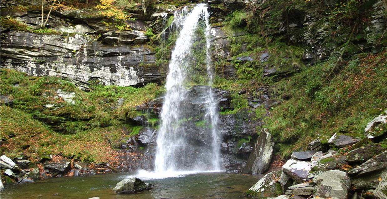
View of Plattekill Falls – Catskill Park – Photo credit: Daniela Wagstaff
This versatile route through Platte Clove Preserve and Overlook Mountain Wild Forest can be tailored for a day hike or overnight backpacking trip. Options include a moderate 4.5-mile out-and-back to Codfish Point, a scenic 8.8-mile round trip to Echo Lake, or a full 13-mile trek to the fire tower atop Overlook Mountain. Hikers can spot a car at Meads Mountain Road for a one-way shuttle.
The hike begins with a steep descent to Plattekill Falls, then follows the historic Old Overlook Road, blazed with the aqua Long Path, through quiet forests and old bluestone quarries. After the Devil’s Kitchen lean-to, a side trail leads to Codfish Point for sweeping Hudson Valley views. Continuing on, the route descends to Echo Lake, where camping is permitted, then climbs steadily to the Overlook Mountain House ruins and fire tower. Views from the summit at 3,140 feet span the entire Mid-Hudson region.
How to Get There
Trails Related to this Hike
Don’t Leave Unprepared
The digital version of this map is available exclusively at:
Detailed Hike Description
Publication: Submitted by Daniela Wagstaff on 10/15/2012, updated/verified on 07/23/2014
This hike can be done several ways – a 4.5-mile out-and-back to Codfish Point, an 8.8-mile out-and-back to Echo Lake, a 13-mile out-and-back to Overlook Mountain, a 10-mile shuttle hike by spotting a car at Meads Mountain Road (42.071036, -74.122464), or make an overnighter out of it with the availability of two shelters and campsites along the way.
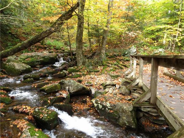
From the parking lot, walk out the drive to Platte Clove Road. Either before or after the hike, be sure to walk the short distance to the left for waterfall views from the small bridge. Just the other side of the bridge, a short footpath on the left leads to pretty cascades a little farther into the woods.
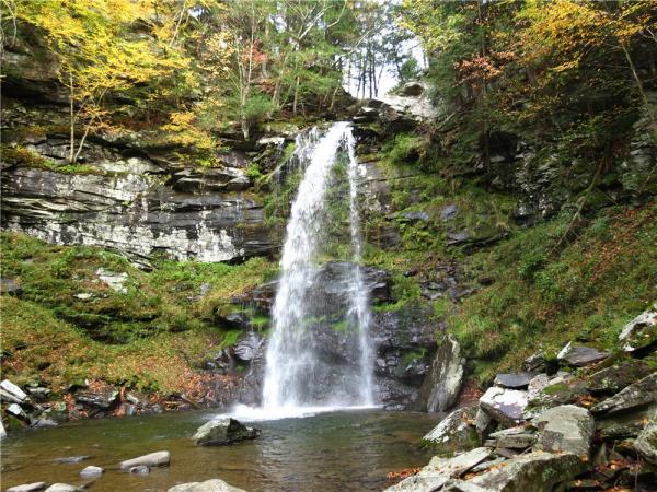
To begin the hike, exit the parking lot and turn right on Platte Clove Road, following the aqua blazes of the Long Path. In 250 yards, arrive at a red cabin on the left in the Platte Clove Preserve, used for their Artists-in-Residence program. Although the aqua blazes continue along Platte Clove Road, turn left on the gravel drive and head downhill towards the red cabin, staying to the left of the cabin and the split rail fence. Follow this trail, blazed with the blue diamond markers of the Platte Clove Preserve, as it follows a ledge cut into the canyon wall, then descends, sometimes steeply, and ends at the base of the scenic 70-foot Plattekill Falls. Retrace your steps and arrive back at the red cabin having logged the first half-mile of your hike, as well as the steepest descent and climb.
Resume following the aqua blazes a few more steps along Platte Clove Road, then turn left and proceed downhill. Before crossing the replica kingpost bridge, be sure to sign in at the trail register. The trail will follow historic Old Overlook Road, constructed in the early 1800s to access the many bluestone quarries, remnants of which are still visible along the way. The trail will be blazed with Long Path markers as well as the green diamond markers of Platte Clove Preserve as it ascends gradually and consistently.
At the “camping prohibited” sign 1.3 miles into the hike, you will be leaving Platte Clove Preserve, and the aqua and green trail markers will be replaced by round blue markers. Start watching for a clearing on the left, an old bluestone quarry where a seating arrangement has been constructed out of stone slabs. Shortly after this quarry, the red-blazed Devil’s Path joins in from the right for a short distance, then leaves to the right. Continue straight following the circular blue blazes.
The trail will pass directly in front of the Devil’s Kitchen lean-to 1.75 miles into the hike, then cross a footbridge over a creek with pretty cascades. In another .7 mile, watch for a yellow-blazed side trail to the left for a short walk to Codfish Point with sweeping Hudson Valley views on the left and an abandoned bluestone quarry on the right. Retrace back to the blue trail and turn left to continue the hike, or turn right to return the way you came for the 4.5-mile hike.
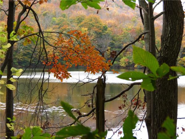
Continuing on, arrive at an intersection in 1.3 miles and turn right on the yellow-blazed trail, which will descend about 450 feet before reaching Echo Lake in .6 mile. At Echo Lake, a lean-to and campsites are available for an overnight stay. Notice the mountain ridge on the opposite side of the lake with a communications tower to the right – the blue trail follows this ridge to the communications tower, also the site of the Overlook Mountain House ruins. After visiting Echo Lake, retrace your way back up the yellow trail and turn right on the blue trail to continue to Overlook Mountain. Alternatively, turn left on blue and retrace for the 8.8-mile hike.
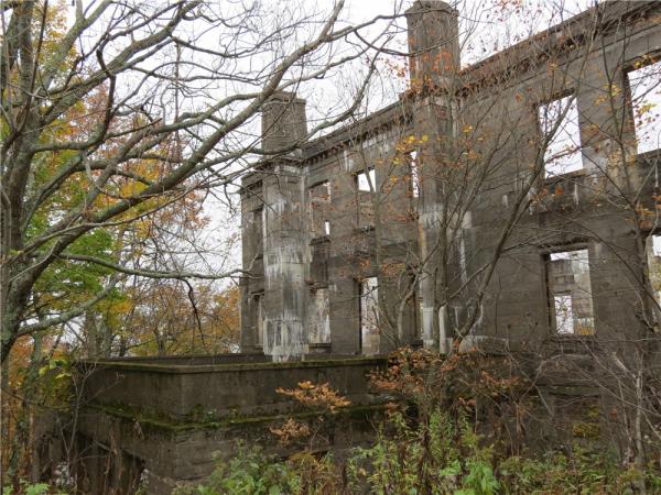
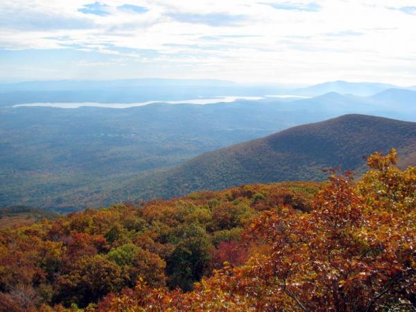
Heading towards Overlook Mountain on the blue trail, notice interesting rock formations as the elevation increases, in particular, a balancing boulder on the right. Pass through an open gate with a stop sign at the 6.8-mile point just before arriving at an intersection with the communications tower that was visible from Echo Lake. To visit the Overlook Mountain House ruins, continue straight a short distance on the red-blazed trail, then return to this intersection and stay right on the red-blazed trail to finish your ascent of Overlook Mountain. Along the way, several unmarked side trails to the right lead to an open rock outcrop with amazing Hudson Valley views. Arrive at the fire tower on Overlook Mountain 7.5 miles into the hike. At this elevation of 3,140 feet there are views all around on a clear day and if you happen to be there when volunteers are manning the fire tower (generally weekends and holidays 11 am – 4 pm, June 1 through October 13), a climb up the tower will provide breathtaking views of the entire Mid-Hudson region.
From this point, return to the communications tower intersection on the red trail and turn right on blue and follow back as it becomes the aqua-blazed Long Path in Platte Clove Preserve, which will take you directly to the parking lot where you parked off of Platte Clove Road. If you have a car spotted on Mead Mountain Road for a shuttle hike, keep left on red at the communications tower and continue downhill for 2 miles to finish the hike.
Turn By Turn Description:
[ 0.00] Exit the parking lot, turn right on Platte Clove Road
[ 0.20] Turn left just past the red cabin, keep to the left of the cabin and the split rail fence on the blue diamond trail
[ 0.35] Plattekill Falls; retrace
[ 0.50] Back at the red cabin, turn left on Platte Clove Road briefly, then left on aqua-blazed Long Path to the trail register and bridge; blazes will be Long Path markers and green diamond preserve markers
[ 1.30] Leave Platte Clove Preserve and enter Catskill Forest at camping sign (blazes change from green diamond and teal Long Path to blue circles)
[ 1.45] Old quarry on left, then a short distance later, keep straight on blue/red when the red Devil's Path comes in from the right
[ 1.55] Keep straight on blue when red leaves to the right
[ 1.75] Devil's Kitchen lean-t,o then cross the bridge
[ 2.45] Left on yellow to Codfish Point when blue goes straight
[ 2.50] Codfish Point; retrace
*** Turn right on blue for 4a .5-mile hike***
[ 2.55] Left on blue
[ 3.85] Right on yellow to Echo Lake
[ 4.50] Echo Lake lean-to, woods road continues partially around the lake; retrace
[ 4.75] Back at the lean-to, retrace the yellow trail
[ 5.45] Right on blue
*** Turn left on blue for an 8.8-mile hike***
[ 6.80] Continue straight at the stop sign on the open yellow gate
[ 6.85] Communications tower on right at intersection; continue straight to Overlook House ruins; retrace
[ 7.10] Back at the communications tower intersection, keep right on red to Overlook Mountain Fire Tower
[ 7.20] Walk around the gate
[ 7.50] Overlook Mountain Fire Tower; retrace
[ 7.70] Unmarked side trail on left to open view at ledge; retrace
[ 8.10] Turn right on blue at the communications tower intersection
*** Keep left on red if a car is spotted on Meads Mountain Road for a 10-mile shuttle hike ***
[ 8.15] Continue straight at the stop sign on the open yellow gate
[ 9.50] Straight on blue when the yellow trail to Echo Lake goes left
[10.75] Keep straight on blue when the yellow trail to Codfish Point goes right
[11.50] Cross the bridge, then pass the Devil's Kitchen lean-to
[11.75] Straight on blue/red when red comes in from the left
[11.80] Straight on blue when red leaves to the left; old quarry on the right
[12.00] Enter Platte Clove Preserve (blazes change from blue circles to Long Path and green diamond)
[12.75] Cross the bridge and sign out at the trail register
[12.80] Right on Platte Clove Road
[12.95] Left on the gravel road to the parking lot
[13.00] Back at the parking lot
Support the trails you love
Your gift helps build, maintain, and protect over 2,150 miles of trails across the region.
Join

Become a member and protect wild places
Shop

Maps, gear & books, all proceeds support trails
Volunteer

Give back by helping maintain the trails
Donate

Keep trails open and safe with a one-time gift