
Hike: Bear Mountain All Persons Trail with Optional Summit Loop
Along the All Persons Trail and Bear Mountain Summit Loop – Harriman-Bear Mountain State Parks
This accessible hike on the summit of Bear Mountain includes the Bear Mountain All Persons Trail, inviting outdoor enthusiasts of all abilities to connect with nature and soak in spectacular views.
The All Persons Trail is approximately 0.75 miles out and back and is ADA compliant. The full summit loop is approximately 1.3 miles. Taken together, this circuit showcases a beautifully crafted section of the Appalachian Trail (A.T.) on Bear Mountain, combining accessibility, panoramic views, and stonework artistry.
Beginning from the summit near Perkins Memorial Tower, the route first follows the white-blazed A.T., co-aligned briefly with the Major Welch Trail, on a 0.35-mile handicapped-accessible path past boulders and historic remnants.
After reaching a spectacular viewpoint over the Hudson River and West Point, the trail transitions into a more rugged descent through mountain laurel and blueberry thickets, featuring stone steps carved on-site. A blue-blazed side trail offers an optional out-and-back to an impressive western viewpoint over Queensboro Lake before rejoining the A.T.
The hike finishes with a steady climb on a blue-blazed connector trail, navigating cleverly placed stone steps along a long boulder, ending where it began—at the iconic Perkins Memorial Tower.
How to Get There
Trails Related to this Hike
Free Maps from The Trail Conference
Don’t Leave Unprepared
The digital version of this map is available exclusively at:

Detailed Hike Description
Publication: Submitted by Daniel Chazin on 06/02/2011, updated/verified on 05/27/2025

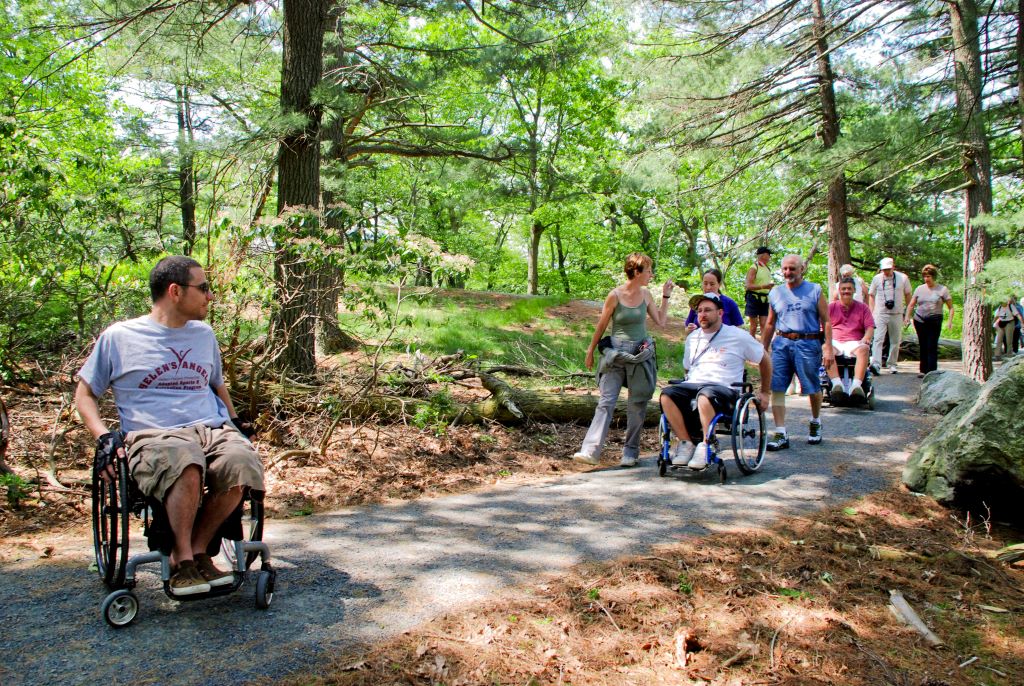
The hike begins at the Perkins Memorial Tower where you’ll find a sign for the Appalachian Trail (A.T.) on the northwest side of the parking area. Follow the white blazes of the A.T. and the red-ring-on-white blazes of the Major Welch Trail as they bear east. The first 0.35 miles of this outstanding hike is the All Persons Trail, a handicapped-accessible pathway comprised of crushed gravel that allows outdoor enthusiasts of all abilities and accessibility levels to enjoy a beautiful section of the A.T.
In 500 feet, you’ll cross a gravel service road. To the right, atop a massive boulder, are the concrete foundations of a former fire tower (replaced in 1934 by the Perkins Memorial Tower back at the parking lot). Then, a quarter mile from the start, (after crossing yet another service road) you’ll come to another huge boulder on the left side of the trail.
Pause to look around here. If the immediate environment appears different or the canopy cover overhead is thinner and letting in more sunlight, it’s because this forest is still recovering from a brush fire in 2022.

After this boulder, the Major Welch Trail breaks to the right at a fork. This is in fact the beginning of a short and accessible connector loop that returns to the A.T. in approximately 0.10 miles. As part of the All Persons Trail, it’s open to users of all abilities.
If you’d like to take it, first bear right on the red-blazed Major Welch Trail and then turn left on a blue-blazed connector trail to return to the A.T. If you prefer to skip the connector loop and head straight to the scenic overlook, remain on the A.T. by following the white blazes.
In short order, you’ll encounter the maximum grade of the All Persons Trail at 8%. Continue up the trail to reach its rewarding vista: A spectacular north-facing scenic overlook with sweeping views of the Hudson River, the Bear Mountain Bridge, Anthony's Nose, and the hills of the West Point Military Reservation.
This marks the end of the All Persons Trail section. After reveling in the view, retrace your course and return to the parking area for a roughly 0.75-mile out-and-back excursion along the A.T.
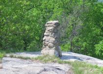
Those interested in continuing along the summit loop of Bear Mountain should bear left at the overlook, following the A.T. by descending the stone steps. Ahead, you’ll see a stone pillar that once marked the boundary between the park and West Point.
The trail again curves sharply to the left and begins to head south through dense mountain laurel thickets, with an understory of blueberry. This section of the A.T. features many stone steps, most of which were shaped on-site from native rock. In a quarter mile, you’ll pass two huge boulders to the left, with stone steps curving up from the end of the second boulder.

In another 500 feet, you’ll reach a junction atop a flat rock with a blue-blazed trail that begins on the left. This will be your return route, but continue ahead on the white-blazed A.T. About 500 feet beyond this junction, the A.T. emerges on a flat pockmarked rock surface and soon reaches the start of another blue-blazed trail at a south-facing viewpoint over West Mountain.
Turn right and follow the blue-blazed side trail, which soon emerges on another rock outcrop, with excellent views to the west (Queensboro Lake may be seen below). This side trail follows a former route of the Major Welch Trail and was blazed by volunteers as a side trail to the A.T. to preserve the magnificent views.
In 500 feet, the side trail ends at a triple blaze. Turn around, retrace your steps to the A.T., then turn left and proceed along the A.T. to the junction with the blue-blazed trail that you passed earlier. Now turn right and follow this connector trail, which soon reaches a long boulder, with stone steps ingeniously placed as the trail climbs along the boulder. The blue-blazed trail continues to climb until it reaches Perkins Memorial Drive at the base of the Perkins Memorial Tower, where the hike began.
Support the trails you love
Your gift helps build, maintain, and protect over 2,150 miles of trails across the region.
Join

Become a member and protect wild places
Shop

Maps, gear & books, all proceeds support trails
Volunteer

Give back by helping maintain the trails
Donate

Keep trails open and safe with a one-time gift