
Pyramid Mountain Loop
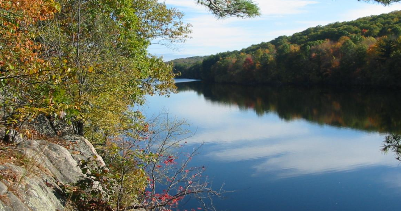
Park: Pyramid Mountain Natural Historic Area
Morris Co., NJ
GPS: 40.946535, -74.388556
Distance: 4 Miles
Difficulty: Easy/Moderate
This loop hike runs along a scenic reservoir, goes by two unusual glacial erratics – Tripod Rock and Bear Rock – and reaches two panoramic viewpoints.\
Hike Description
Pyramid Mountain Loop
From the southern end of the parking area, follow the Blue Trail, which starts just north of a kiosk and immediately passes a memorial plaque for Stephen Klein, Jr. In 150 feet, you’ll reach a junction where a branch of the Blue Trail goes off to the right. Continue ahead on the Blue Trail, which crosses Stony Brook on a wooden footbridge. Just beyond, you’ll reach a fork, where the loop of the Blue Trail begins. Bear right at the fork and follow the eastern leg of the Blue Trail, which crosses under power lines and heads north along a nearly constant contour, with huge boulders above on the left and a camp recreation area (with a grassy ballfield, a picnic area and a small pond) below on the right.
After a quarter of a mile, you’ll notice a large cairn and a triple-orange blaze to the right. This marks the start of the Orange Trail. Turn right and follow the Orange Trail, which continues on a relatively level path for another quarter of a mile, then bears right and descends to the shore of Taylortown Reservoir. It continues along the shore of this scenic reservoir, soon reaching a rock ledge overlooking the reservoir. You’ll want to stop here to enjoy the view. After briefly detouring inland and passing cliffs to the left, the trail returns to the shore of the reservoir. At a rock ledge overlooking an island in the reservoir, the trail turns left and begins to climb Pyramid Mountain. Soon, you’ll notice a huge tree, with four trunks, just to the left of the trail. Here, the climb steepens for a short distance, but the grade soon moderates.
At the top of the climb, the Orange Trail reaches a viewpoint to the east from a rock ledge, marked by a lone cedar tree. The trail now bears left and, 100 feet beyond, reaches a junction (marked by a cairn) where the Green Trail begins on the right. Turn left to continue on the Orange Trail, which runs along the ridge of Pyramid Mountain, passing through dense stands of mountain laurel. At the next junction, the Orange Trail turns right, but you should continue straight ahead, now following the Blue Dot Trail (black dot on blue)
In about half a mile, you’ll reach Tripod Rock – a huge boulder, perched on three smaller stones. Geologists explain that this boulder was deposited here by glacial action, although some believe that it may be a Native American calendar site. This unusual feature helped galvanize public support to preserve the mountain when it was threatened by development. This is a good place to take a break.
When you’re ready to continue, continue heading south along the ridge on the Blue Dot Trail. Soon, you’ll notice a purple-blazed side trail on the right. Follow this trail, which leads a short distance to Lucy’s Overlook, named for Lucy Meyer, who led the crusade to save the area from development. There are limited views to the south and west over Stony Brook Mountain from rock outcrops. Continue ahead on the purple-blazed trail until it ends at the Blue Dot Trail, then turn right onto the Blue Dot Trail.
Soon, the Yellow Dot Trail (black dot on yellow) begins on the right. Turn right, leaving the Blue Dot Trail, and follow the Yellow Dot Trail, which soon begins a steady descent. After a short level stretch, the Yellow Dot Trail bears left and crosses Bear House Brook on a wooden bridge.
Directly ahead is Bear Rock. This massive glacial erratic, which can be said to resemble a giant bear, has been a local landmark for centuries. It was probably used as a shelter by Native Americans, and today it marks the boundary between Kinnelon Borough and Montville Township. Here, the Yellow Dot Trail ends. You should turn left and follow the Orange Trail along an old woods road, bordered by a rock wall on the right. Soon, the Pink Dot Trail (black dot on pink) begins on the right, but you should continue ahead on the Orange Trail.
The Orange Trail crosses Bear House Brook on a wooden bridge and soon begins to parallel power lines on the right. In about half a mile the Orange Trail ends at a large cairn. Bear right and continue ahead on the Blue Trail, which climbs a little, then descends gradually, crossing under the power lines.
Continue ahead on the Blue Trail, bearing right at the next junction (where the loop of the Blue Trail begins). After crossing a footbridge over Stony Brook, follow the Blue Trail back to the parking area where the hike began.
Publication: Submitted by Daniel Chazin on 11/04/2005 updated/verified on 03/19/2021