Castle Point Carriageway /Lake Awosting Carriageway /Upper Awosting Carriageway Loop
Minnewaska State Park Preserve
Ulster Co., NY
GPS: 41.729, -74.237
Difficulty: Moderate
Distance: 9 Miles
This loop hike, suitable for cross-country skiing, runs along the dramatic cliffs of Shawangunk conglomerate and offers many fine views.
Hike Description
Castle Point Carriageway /Lake Awosting Carriageway /Upper Awosting Carriageway Loop
From the end of the parking area, descend on the red-blazed Lake Minnewaska Carriage Road that encircles Lake Minnewaska. This descent is rather steep for cross-country skiing, but it is not typical of the grades you’ll encounter the rest of the way. After a short descent, you’ll reach a junction with the green-blazed Upper Awosting Carriage Road (a swimming area is on the left, and restrooms are on the right). Bear left, continuing to follow the Lake Minnewaska Carriage Road, which now begins to climb. About 0.4 miles from the start, you’ll reach a junction with the blue-blazed Castle Point Carriage Road.
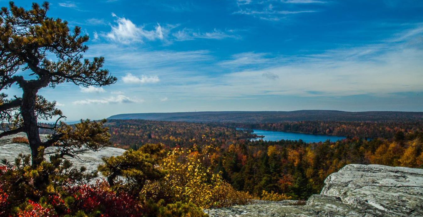
Turn right and follow the Castle Point Carriage Road, which continues to climb gradually. Soon, you’ll reach an open area, the site of a former golf course, with views of the Catskills to the north. After passing a side trail on the left, which leads to the Hamilton Point Carriage Road, there are views to the left over the Palmaghatt Ravine. Soon, you’ll reach Kempton Ledge, with excellent views across the ravine and over the Wallkill Valley beyond. The large boulder visible on the other side of the ravine is known as Patterson’s Pellet.
The carriage road continues generally uphill, with some short descents and one twisting curve. About two miles from the start, you’ll pass under a power line. A short distance beyond, you’ll reach a series of open ledges that afford broad views over Palmaghatt Ravine, with the rocky face of Gertrude’s Nose – the tip of the escarpment across the ravine – visible.
After some more twists and turns, the carriage road comes out at Castle Point, a steep promontory with panoramic views to the south and east. Lake Awosting is below to the west, and Sam’s Point may be seen directly ahead to the southwest (near the communications towers visible in the distance). The elevation of Castle Point is 2,200 feet, and you’ve climbed over 500 vertical feet from Lake Minnewaska. If it’s not too windy, this is a good place to take a break.
The carriage road, now joined by the Shawangunk Ridge Trail, turns right and begins a steady descent, immediately passing the southern end of the Blueberry Run Trail (marked by a sign). In the next three-quarters of a mile, the carriage road makes several sharp turns (skiers should exercise care). At a hairpin turn to the left, the orange-blazed Rainbow Falls Trail (along with the Shawangunk Ridge Trail) leaves to the right. After passing under the dramatic ledges of the overhanging Battlement Terrace, the Castle Point Carriage Road arrives at a junction with the Hamilton Point Carriage Road. Bear right, continuing to follow the Castle Point Carriage Road.
Soon, the Wolf Jaw Trail leaves to the left, and a short distance beyond, you’ll reach a junction with the Lake Awosting Carriage Road. To the left, this carriage road leads in about half a mile to a swimming area on Lake Awosting, open during the summer. If you would like to take a swim, turn left at this junction; otherwise, bear right, now following black blazes instead of the blue blazes that have marked the route up to this point. You’ll soon reach a beautiful viewpoint to the leftover Lake Awosting – another good spot for a break.
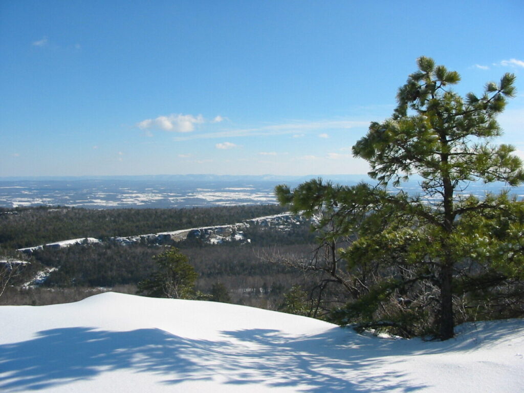
At the next junction, the black blazes turn left, but you should continue straight ahead, now following the green blazes of the Upper Awosting Carriage Road. As the carriage road bends to the right ahead, you’ll see the impressive cliffs of Litchfield Ledge. The carriage road soon begins to follow along the base of these cliffs, which often feature hanging icicles in the winter.
The carriage road crosses the orange-blazed Rainbow Falls Trail near the end of the cliffs, and it continues ahead, soon recrossing the power line. From here to the end of the carriage road at Lake Minnewaska, the route is less interesting, but the carriage road passes through pleasant woods and follows a gently descending grade – a good way to end a cross-country ski trip.
A little over a mile from the power line, you’ll reach an open area known as the Orchard (some old fruit trees from the former orchard may still be seen). Then, after a short, gentle climb, you’ll pass an excellent north-facing viewpoint to the left, with the Catskill Mountains visible in the distance. Just beyond, the Upper Awosting Carriage Road ends at the Lake Minnewaska Carriage Road, near the swimming area on Lake Minnewaska. Turn sharply left and follow the Lake Minnewaska Carriage Road uphill, back to the parking area where the hike began.
Publication: Submitted by Daniel Chazinon 02/10/2004