
Backpacking the Long Path
By Ed Walsh

Your Complete Guide to Backpacking the Long Path: Tips, Camping, and Essentials for an Epic Journey
This guide is written to assist hikers who wish to hike the Long Path from end to end in a single trip. It may also be useful to anyone planning a shorter backpack on the Long Path.
It is now possible to backpack the entire length of the trail, but it still requires quite a bit of planning. It is not possible to camp out along the trail for its entire length. Some nights it will be necessary to hike to a motel or a nearby campground.
Camping
Lean-tos or shelters located on the Long Path are three-sided, open-front structures with wood floors. They are usually buggy and almost all have resident mouse populations. In the Catskills, porcupines are a serious nuisance. They love anything salty, so hang your boots as well as your food. The Catskills, Shawangunks, and New Jersey are also home to black bears. Although bears are usually not a problem, you should know how to protect your food supply. The shelters are all first come, first served up to capacity, usually 6 to 8 people. Groups of three or more should not use the shelters unless there is remaining room in the late afternoon. They should be ready to make room for through hikers arriving late. Except for the Appalachian Trail section and the Catskills, shelters or lean-tos are rare. A tent is a necessity for backpacking this trail.
Although the Long Path passes through many State parks in its southern section, overnight camping is restricted to Cheesecote Park in the Town of Haverstraw (permit required), Harriman State Park (only within 100 yards of a lean-to), and the DEC lands along the Shawangunks.
Camping is allowed on State land in the Catskill Forest Preserve and State Reforestation Areas as long as your campsite is 150 feet from any trail, road, or water and below 3500 feet in elevation. Camping for more than three days in the same place requires a permit, as does camping with a group of ten or more. Permits can be obtained from the DEC. Only dead and down wood may be used for a campfire. A backpacking stove is highly recommended.
Overnight camping is not allowed on private property traversed by the Long Path. Permission to hike on these parcels was granted only after negotiations with the landowner. Please remember that you are a guest there. Do not do anything that might jeopardize these agreements. Campfires, horses, mountain bikes, and motor vehicles are not allowed on private property crossed by the Long Path. Most of the private property is closed during big game hunting season. Some of this land is open for hunting, which usually extends from the Monday before Thanksgiving until the second week in December. For your safety do not hike on these sections during the hunting season.
Post Offices
The Long Path passes by or near 23 Post Offices. A list appears in the back of this chapter. Many long-distance backpackers arrange a series of mail drops along the way by mailing food or supplies to themselves. This helps to lighten their load and allows the hiker to purchase his food in bulk and save money. The package should be addressed to the hiker c/o General Delivery with the words, “Hold for Hiker arriving on or about…” on the package. Post Offices are not obligated to hold these packages for more than 30 days, so if you are planning a long trip it will be useful to prepare these food drops ahead of time and have a friend or family member mail them to you as you hike. It’s a good idea not to seal these packages until they are ready to mail. Hikers usually find that they have packed too much food (or not enough) or have forgotten to include some useful piece of equipment. The Post Offices are usually open Monday through Friday from 8:00 AM to 5:00 PM and on Saturdays from 8:00 AM to noon.
How to Use This Guide
- The sections listed here correspond to the sections in the Long Path Guide. The distances given are south to north. If camping is not allowed on a section that cannot be reasonably hiked in a day, directions are given to the nearest public accommodation (campground or motel).
- If using a motel or commercial campground, please mention the Long Path when registering.
Sections 1 through 10
Section 1
New York City to Route 9W at Lamont-Doherty
| Lean-tos | None |
| Camping | None. Bus service to and from the trail is available for most of this section. |
| Lodging | There are many hotels in Fort Lee; the closest to the Long Path is an Econolodge (201-944-5332) located directly across the street from where the trail goes up the Palisades, north of the GWB. Of course, New York City is just across the bridge. |
| Food | There are many restaurants and stores located in Fort Lee. The closest to the trail is the G.W. Grill, next to the Econolodge. The gas station at mile 1.45 offers Dunkin Donuts, vending machines, telephones, water and restrooms. There is also food at the State Line Lookout snack bar (Lookout Inn) at mile 11.35. |
| Post Office | None |
Section 2
Route 9W at Lamont-Doherty to Nyack (Mountainview Avenue)
| Lean-tos | None |
| Camping | None. Bus service to and from the trail is available for most of this section. |
| Lodging | Super 8 Motel 845-353-3880. Located right on the trail before it crosses Route 59.Best Western Motel 845-358-8100. 0.50 miles east on Route 59. |
| Food | There is a snack bar and deli on the east side of Route 9W in Palisades (0.95 mi). The village of Piermont has restaurants and cafes. Near the intersection of Route 59 are a convenience store and a McDonalds.0.05 miles east on Route 59 are the Old World Food Market, delis, Dunkin Doughnuts, and Chinese restaurant. 0.75 miles east on Route 59 is the village of Nyack with many restaurants and food shops.0.20 miles west on Route 59 is Alain’s French Bistro (expensive but good!), and 0.60 miles west on Route 59 are a supermarket, pharmacy, deli, and Chinese restaurant. |
| Post Office | Palisades 10964 – at mile 0.55 turn left onto Oak Tree Road for 0.10 miles.Piermont 10968 – at mile 3.25, after crossing the Sparkill Creek, turn west (left) onto Piermont Avenue for 20 yards. |
Section 3
Nyack (Mountainview Avenue) to Long Clove (Route 9W)
| Lean-tos | None |
| Camping | None. Although the Long Path traverses much State land in this section, camping is not allowed. Ed & Eudora Walsh (845-429-8550) will allow through hikers to camp in their backyard if prior arrangements are made. Bus service to and from the trail is available for most of this section. |
| Lodging | Raintree Motel 845-268-5600. At mile 5.75, Rockland Lake Road, turn left for 0.20 miles past the firehouse, then right for 1.00 miles to Route 9W. The motel is across the street on the left. Holiday Court Motel 845-268-3300. At mile 5.75, Rockland Lake Road, turn left for 0.20 miles past the firehouse, then right for 1.00 miles to Route 9W. The motel is 0.20 miles north (right) on 9W. Green Inn Motel on the Lake 845-268-6836. At mile 5.75, Rockland Lake Road, turn left for 0.20 miles past the firehouse, then right for 1.00 miles to Route 9W. The motel is 0.10 miles farther north on Route 9W. |
| Food | Near mile 2.1 are a convenience store and restaurants. There are restaurants both north and south on Route 9W from the intersection with the park road at Rockland Lake. From the northern end of this section there are a deli, laundromat, Dunkin Donuts, pizza restaurant, Chinese restaurant, and Rick’s Club American, 1 mile south on Route 303. |
| Post Office | None |
Section 4
Long Clove to Mount Ivy
| Lean-tos | None |
| Camping | None. Although the Long Path traverses much State land in this section, camping is not allowed. Ed & Eudora Walsh (845-429-8550) will allow through hikers to camp in their backyard if prior arrangements are made. Bus service to and from the trail is available for most of this section. |
| Lodging | Rockland Motel 845-354-1373. 1.30 miles south on Route 202 (mile 6.80) in Mount Ivy. |
| Food | From the southern end of this section, there is a restaurant, bakery, and laundromat 1 mile south on Route 303.0.20 miles west from mile 1.20 is a deli. Along Route 202, which is 0.15 miles north of the end of this section, are several restaurants and stores. See Section 5. |
| Post Office | Pomona 10970. At mile 6.85 turn right for 0.15 mi to Route 202, then turn left (west) onto Route 202 for 0.90 miles. |
Section 5
Mount Ivy to Lake Skannatati
| Lean-tos | Big Hill Shelter mile 5.80Water is available at stream crossing 1 mile south on LP or follow LP to AT&T right of way, turn left and follow for 1 mile to Breakneck Pond. |
| Camping | In Cheesecote Park in the Town of Haverstraw camping is allowed with permit only (845-429-2200). The park is open from April 1 through November 30. In Harriman State Park camping is only allowed within 100 yards of a shelter. |
| Lodging | Rockland Motel 845-354-1373. 1.30 miles east on Route 202 in Mount Ivy |
| Food | At mile 0.15, to the right (east) on Route 202, is a deli, restaurant, pizzeria, bank and laundromat.At mile 0.20, about 0.1 mile straight ahead past the Parkway underpass, is a diner, and 0.40 miles farther west on Route 202 is a shopping plaza with a supermarket, pharmacy, bank, laundromat and restaurants. |
| Post Office | Pomona 10970. At mile 0.20 continue west on Route 202 for 0.80 miles. |
SECTION 6-1
Lake Skannatati to intersection with the Appalachian Trail
| Lean-tos | Cohasset Shelter mile 4.45. 0.85 miles past the intersection with the Appalachian Trail, north on the original Long Path. Shelter is made of corrugated metal, no water. Note that this shelter is primarily for the use of a girl’s camp. Be prepared to vacate if they request to use it. (To continue on the suggested route the hiker must backtrack to the intersection of the AT). Distance from Big Hill Shelter – 8.15 miles.Fingerboard Shelter mile 1.50 north on the Appalachian Trail (please note that the LP follows the Appalachian Trail south here. To continue on the suggested route the hiker must backtrack 1.50 miles). Water 0.50 miles on blue-blazed side trail at Lake Tiorati. Distance from Big Hill Shelter – 8.80 miles. |
| Camping | In Harriman State Park camping is allowed only within 100 yards of a shelter. |
| Lodging | None |
| Food | None |
| Post Office | None |
Turn south on the Appalachian Trail which nearly parallels the Long Path to the Shawangunk Ridge.
It is 49.6 miles from this junction to the Shawangunk Ridge Trail.
By taking this route you will have continuous camping opprtunities from LP mile 42.75 at Cheesecote Town Park (which you already passed) to Cole Hill State Forest, which is 15 miles from the end of the trail.
Intersection with the Appalachian Trail to US Route 6
| Lean-tos | Mile 4.45 Cohasset Shelter (no water); mile 8.00 Stockbridge Shelter (no water) |
| Camping | None |
| Lodging | None |
| Food | None |
| Post Office | None |
LP SECTION 6-2
Intersection with the Appalachian Trail to US Route 6
| Lean-tos | Mile 4.45 Cohasset Shelter (no water); mile 8.00 Stockbridge Shelter (no water) |
| Camping | None |
| Lodging | None |
| Food | None |
| Post Office | None |
SECTION 7
US Route 6 to NY Route 32 (Town of Woodbury)
| Lean-tos | None |
| Camping | None |
| Lodging | Mile 7.35: Americas Best Value Inn, 1.3 miles from the trail. Continue straight on Estrada Road, and in 0.7 miles turn left (south) onto Route 32. The motel is on the right in 0.6 miles. |
| Food | Mile 9.80: Continue straight on Pine Hill Road for 0.3 miles (the road changes to Park Ave when it crosses the creek). Turn right on NY 32, restaurants and a deli are on NY 32.Mile 11.60: restaurant at 1 Quaker Road (Peppy & Eddy’s – Italian food). About 0.25 mile south on Rte 32; turn right on Evans Drive, and immediately right again on Quaker Road. |
| Post Office | Highland Mills 10930. At mile 9.80 continue 0.3 miles on Pine Hill Road which changes to Park Ave when it crosses the creek. Turn right on NY 32, the Post Office is 0.2 miles on the left. |
Section 8
NY Route 32 (Town of Woodbury) to Heritage Trail in Monroe
| Lean-tos | None |
| Camping | None |
| Lodging | None |
| Food | Mile 0.00: restaurant at 1 Quaker Road (Peppy & Eddy’s – Italian food). About 0.25 mile south on Rte 32; turn right on Evans Drive, and immediately right again on Quaker Road. More restaurants farther south on Route 32.Mile 8.00: about 0.5 miles north along Route 208 is Rambler’s Rest, a bar/restaurant. |
| Post Office | Woodbury 10930. At mile 0.00 go 1.5 miles south on Route 32. |
SECTION 9
Heritage Trail (Orange County rail-trail)
| Lean-tos | None |
| Camping | None |
| Lodging | Mile 4.15: Holiday Express (845-469-3000) – follow Route 94 south for 0.7 miles to Route 17M, then 2 blocks west.Mile 8.50: Anthony Dobbins Stagecoach Inn (845-294-5526) – follow Route 207 north for 0.5 miles to 268 Main Street.Mile 8.50: Comfort Inn (845-291-1282) – follow Route 207 about 1 mile south across Route 6/17, then turn right to 20 Hatfield Lane. |
| Food | Mile 4.15: there are restaurants, delis, and laundromat near the station in Chester.Mile 8.50: there are restaurants, delis, and stores in the Village of Goshen. |
| Post Office | Chester 10918, at 76 Brookside Avenue – mile 4.15. Go 0.7 miles south on Route 94 to Route 17M, then 2 blocks west, opposite the Holiday Express.Goshen 10924, at 20 Grand Street – mile 8.50. Take first right off West Main Street. |
SECTION 10
Heritage Trail in Goshen to Mountain Road in Greenville
| Lean-tos | None |
| Camping | None |
| Lodging | Mile 2.05: Days Inn (845-374-2411) – Follow routes 6 & 17M west for 0.5 mile, on the left. |
| Food | Mile 1.45: Mason’s Marketplace (deli) and tap room is on the right. Mile 4.75: deli |
| Post Office | Mile 2.05: New Hampton 10958, at 5070 NY State Route 17M – Follow routes 6 & 17M west for 0.75 mile, on the right. |
Sections 11 through 20
SECTION 11
Mountain Road in Greenville to the Basha Kill
| Lean-tos | None |
| Camping | The trail passes through DEC forest parcels at miles 0.00-2.00 and 2.40-3.15, and at mile 5.65 more DEC land can be found east of the trail.Camping is also allowed in the Gobblers Knob section (DEC land) between miles 8.40 and 10.20. The stream in this section is seasonal.American Family Campground, Guymard Turnpike, Godeffroy, NY. 845-754-8388. Hot showers, pool, cabins, laundry. April 15 to October 15. At mile 3.65 turn left on Guymard Turnpike and cross the bridge. 1.80 miles west on the Guymard Turnpike, on the left. Caters mainly to RV’s. Distance from High Point Shelter – 16.70 miles. |
| Lodging | None |
| Food | Otisville 1 mile right on Rte 211. General stores, ice cream store, bar/restaurant, pizzeria |
| Post Office | Otisville 10963 – at mile 8.10 go 1 mile right (east) on Route 211. |
SECTION 12
Basha Kill to Ferguson Road
| Lean-tos | None |
| Camping | Camping is allowed in the Wurtsboro Ridge State Forest between miles 6.20 and 10.20. |
| Lodging | Mile 5.25 in Wurtsboro. Days Inn. About 1 mile from the trail, south on Rte 209. 845-888-2727. |
| Food | Wurtsboro, mile 5.25. Restaurants, deli. Supermarket about 1 mile from the trail, south on Rte 209. |
| Post Office | Wurtsboro 12790 – mile 5.35, on the trail. |
The Village of Wurtsboro is a good place for a layover day. A motel, restaurants, supermarkets, and pharmacy are all within walking distance. You can also rent a glider at the nearby airport.
SECTION 13
Ferguson Road to Sam’s Point Preserve
| Lean-tos | None |
| Camping | Camping on DEC land from mile 0.00 to about mile 6.45.Mile 5.60: Spring Glen Campground is about 2 miles down the mountain, on Lewis Road. Tel. 845-901-1991. |
| Lodging | None |
| Food | Spring Glen Market is next to the Spring Glen post office. |
| Post Office | Spring Glen 12483. About 2 miles down the mountain from mile 5.60, on Old Route 209.Cragsmoor 12420. About 2.20 miles from Sam’s Point Preserve at the end of this section. |
SECTION 14
Sam’s Point Preserve to Berme Road
| Lean-tos | None |
| Camping | Mile 8.05, in Witch’s Hole State Forest (NYDEC), about 0.5 miles west on Smiley Carriage Road. Camping is allowed 150 feet away from the trail and water. A stream is reached just as you cross into the state forest. If the stream is dry a reliable pipe spring is about 0.4 mile further down the hill.Mile 11.45: John and Christy Adams – 0.45 miles past the end of this section – allow camping in their backyard if prior arrangements are made. Tel. 845-551-6858. Email: [email protected] |
| Lodging | None |
| Food | None |
| Post Office | Cragsmoor 12420. About 2.20 miles from Sam’s Point Preserve at the beginning of this section. |
SECTION 15
Berme Road to Riggsville
| Lean-tos | None |
| Camping | Mile 0.45: John and Christy Adams allow camping in their backyard if prior arrangements are made. Tel. 845-551-6858. Email: [email protected] Camping is permitted on state land along this section. |
| Lodging | Mile 1.4 – Colonial Motel in Kerhonkson – 1.1 mi north on US Route 209. |
| Food | Mile 1.4 – White Wolf Restaurant & Lounge in Napanoch – 0.8 mi south on Route 209 (open at 4.30 pm for dinner; closed on Mondays). Ricke Len’s Country Restaurant & Pizza – 1.4 mi south on Route 209 in Napanoch, serving breakfast, lunch and dinner. Walmart Supermarket. |
| Post Office | Mile 1.4 – Wawarsing 12489, corner of Port Ben Road and Route 209, on the trail. |
SECTION 16
Riggsville to Bull Run
| Lean-tos | None |
| Camping | Camping is permitted on State land at elevations below 3500 feet and at least 150 feet from water or trails. Water is available at Vernooy Kill Falls, mile 1.70, intermittently along the trail, and at Sundown.Sundown primitive campsite is at the junction with Peekamoose Road at mile 9.65. No facilities. Water available from Rondout Creek. |
| Lodging | None |
| Food | None |
| Post Office | None |
SECTION 17
Bull Run to Denning Road
| Lean-tos | Bouton Memorial lean-to – mile 5.20, 0.20 miles on a side trail. Water from a spring on the LP. Distance from Sundown – 5.20 miles |
| Camping | Camping is permitted on State land at elevations below 3500 feet and at least 150 feet from water or trails. |
| Lodging | None |
| Food | None |
| Post Office | None |
SECTION 18
Denning Road to Wittenberg Mountain
| Lean-tos | Terrace Mountain lean to – mile 8.40, 1.05 miles from the Long Path. No water available. Distance from Bouton lean-to – 11 miles |
| Camping | Woodland Valley State Campground 845-688-7647. Mile 8.40, May 15 – October 12, showers, flush toilets. Distance from the Long Path 2.75 miles.Camping is permitted on State land at elevations below 3500 feet and at least 150 feet from water or trails. There are designated campsites between Slide and Cornell Mountains. |
| Lodging | None |
| Food | None |
| Post Office | None |
SECTION 19
Wittenberg Mountain to Phoenicia
| Lean-tos | Terrace Mountain lean-to, 1.05 miles from the Long Path. |
| Camping | Mile 0.00: Woodland Valley State Campground, 2.75 miles from the Long Path.Camping is permitted on State land at elevations below 3500 feet and at least 150 feet from water or trails.Mile 9.80: Black Bear Campground on Bridge Street in Phoenicia. Tel. 845-688-7405 |
| Lodging | Mile 9.30: Phoenicia Lodge (Tel. 845-688-7772). About 0.7 miles west of the trail at the corner of Woodland Valley Road and NY Route 28.Mile 9.85: Phoenicia Belle (B&B) Tel. 845.-688-7226. Turn left on Main Street for 0.1 miles. |
| Food | There is a grocery store, restaurants and pharmacy in Phoenicia. Brio’s Restaurant is highly recommended. |
| Post Office | Phoenicia 12464 – At the intersection with Main Street, continue straight ahead for about 75 yards. The Post Office is on the right. |
Phoenicia is a good town for a layover day. Besides resupply, you can spend the day fishing or tubing on the Esopus.
SECTION 20
Phoenicia to Silver Hollow Notch
| Lean-tos | Baldwin Memorial lean-to – Mile 3.20. Pipe spring, 50’ to left of trail. Distance from Terrace Mountain lean-to 14.05 miles. Tremper Mountain lean-to – Mile 4.00. No water. Distance from Baldwin lean-to 0.80 miles. |
| Camping | Mile 0.00: Black Bear Campground on Bridge Street in Phoenicia. Tel. 845-688-7405Camping is permitted on State land at elevations below 3500 feet and at least 150 feet from water or trails. |
| Lodging | Mile 0.00: Phoenicia Lodge (Tel. 845-688-7772). About 0.8 miles west of the trail at the corner of Woodland Valley Road and NY Route 28.Mile 0.00: Phoenicia Belle (B&B) Tel. 845.-688-7226. On Main Street in Phoenicia, less than 0.1 miles from the trail. |
| Food | There are a grocery store, restaurants, and pharmacy in Phoenicia. |
| Post Office | Phoenicia 12464 – At the intersection with Main Street continue straight ahead for about 75 yards. The Post Office is on the right. |
Sections 21 through 30
SECTION 21
Silver Hollow Notch to Platte Clove Road
| Lean-tos | Mink Hollow lean-to – Mile 4.40. Distance from Tremper lean-to – 11.20 miles |
| Camping | Camping is permitted on State land at elevations below 3500 feet and at least 150 feet from water or trails. |
| Lodging | None |
| Food | None |
| Post Office | None |
SECTION 22
Platte Clove Road to Palenville
| Lean-tos | None |
| Camping | Camping is permitted on State land at elevations below 3500 feet and at least 150 feet from water or trails. |
| Lodging | Catskill Mountain Lodge 518-678-3101. Mile 10.00 – continue on Route 23A for 0.40 miles, then turn right on Route 32A for 1 mile. Motel and restaurant.Clark House B&B 518-678-5649. Mile 10.00 – continue on Route 23A for 0.40 miles. |
| Food | Mile 10.00 – continue 0.20 miles to Palenville, which has a deli, and a general store with Coleman fuel available. |
| Post Office | Palenville 12463 – Mile 10.00 – continue on Route 23A for 0.30 miles. |
SECTION 23
Palenville to North Lake
| Lean-tos | None |
| Camping | North Lake State Campground 518-589-5058. Mile 4.80. 219 sites, showers, swimming. Reservations recommended. Distance from Mink Hollow – 24.90 miles.Camping is permitted on State land at elevations below 3500 feet and at least 150 feet from water or trails. |
| Lodging | Catskill Mountain Lodge 518-678-3101. Mile 0.00 continue on Route 23A for 0.40 miles, then turn right on Route 32A for 1 mile. Motel and restaurant.Clark House B&B 518-678-5649. Mile 0.00 continue on Route 23A for 0.40 miles. |
| Food | Mile 0.00. Continue 0.20 miles to Palenville, which has a deli, and a general store with Coleman fuel available. |
| Post Office | Palenville 12463 |
SECTION 24
North Lake to Batavia Kill
| Lean-tos | Batavia Kill lean-to. Mile 9.80, 0.25 miles on a side trail. Water available from stream. Distance from North Lake – 10.05 miles |
| Camping | North Lake State Campground. Mile 0.00. 219 sites, showers, swimming $16 reservations recommended. Camping is permitted on State land at elevations below 3500 feet and at least 150 feet from water or trails. |
| Lodging | None |
| Food | None |
| Post Office | None |
SECTION 25
Batavia Kill to Route 23
| Lean-tos | Batavia Kill lean-to. Mile 0.00, 0.25 miles on a side trail. Water available from stream. Elm Ridge lean-to. Mile 7.40, water from a pipe spring 0.1 miles south. Distance from Batavia Kill – 7.40 miles |
| Camping | Camping is permitted on State land at elevations below 3500 feet and at least 150 feet from water or trails. |
| Lodging | Kopper Kettle Inn and Restaurant 518-734-3575. 2.50 miles west on Route 23.Hamilton Motel 518-734-3190. 2.80 miles west on Route 23.Hillside Mountain Inn 518-734-3668. 2.50 miles west on Route 23. |
| Food | Kopper Kettle. 2.50 miles west on Route 23.Village of Windham, 3.60 miles west on Route 23 has restaurants, delis and a small grocery. |
| Post Office | Windham 12496 – 3.90 miles west on Route 23 |
CAUTION: Water is scarce throughout the next 3 sections, especially during the summer months.
SECTION 26
Route 23 to Greene County Route 10
| Lean-tos | None |
| Camping | Camping is permitted on State land at elevations below 3500 feet and at least 150 feet from water or trails. The first 0.75 miles of the LP in this section is on State land. The trail is on private property for the next 2.5 miles and camping is not permitted. Beyond that the trail enters Mount Hayden State Forest and remains on State land to the end of this section. Camping is permitted following the same rules as above. |
| Lodging | Kopper Kettle Inn and Restaurant 518-734-3575. 2.50 miles west on Route 23.Hamilton Motel 518-734-3190. 2.80 miles west on Route 23 |
| Food | Kopper Kettle. 2.50 miles west on Route 23.Village of Windham, 3.60 miles west on Route 23 has restaurants, delis and a small grocery. |
| Post Office | Windham 12496 – 3.90 miles west on Route 23 |
SECTION 27
Greene County Route 10 to South Mountain Road
| Lean-tos | Mile 5.25. Approximately 3 miles west on the red trail is the Hunterfield lean-to. |
| Camping | The first 0.55 mile are on private land, camping is not allowed. The remainder of this section is in a State Reforestation Area. Camping is permitted on State land at elevations below 3500 feet and at least 150 feet from water or trails. Distance between State lands – 10.10 miles |
| Lodging | None |
| Food | None |
| Post Office | None |
SECTION 28
South Mountain Road to Conesville
| Lean-tos | None |
| Camping | Camping is permitted only on State lands at the beginning of this section. |
| Lodging | None |
| Food | |
| Post Office | None |
SECTION 29
Conesville to Doney Hollow
| Lean-tos | None |
| Camping | Nickerson’s Campground 607-588-7327. Mile 3.25, hot showers (coin operated), pool, laundry & store. Distance from Huntersfield lean-to – 11.50 miles.Max V. Shaul State Campground 518-827-4711. Mile 8.70, 6.70 miles north on Route 30 from the intersection with Westkill Road. 32 sites, hot showers, flush toilets. Open mid-May through mid October. |
| Lodging | None |
| Food | Clarks Bar & Restaurant. Mile 0.40 on the right side of 990V.Nickerson’s Campground – small store & ice cream |
| Post Office | Gilboa 12076 – Mile 1.60. About 0.15 mile left (south) on Route 990V.North Blenheim 12131 – Mile 8.35 – about 0.2 miles from the trail. |
SECTION 30
Doney Hollow to West Fulton
| Lean-tos | Rossman Hill. Mile 5.85, water 100 yards in front of the lean-to from a well, may be dry in summer, fill up at streams before lean-to. Distance from Nickerson’s – 13.25 miles |
| Camping | Camping is allowed throughout the Eminence State Forest. Watch for private property signs toward the end of this section near West Fulton. Distance to State land from Nickerson’s – 7.10 miles.Max V. Shaul State Campground 518-827-4711. Mile 8.40, 4.00 miles to the right on West Fulton Road and another 0.20 miles north on Route 30.Water is readily available throughout this section. The streams at mile 4.10 and 4.55 and the well at mile 5.80 may be dry in summer. |
| Lodging | None |
| Food | None |
| Post Office | West Fulton 12194 – Mile 8.70, turn right onto West Fulton Road for 0.20 miles. |
Sections 31 through 35
SECTION 31
West Fulton to Middleburgh
| Lean-tos | None |
| Camping | Camping is allowed in the State Reforestation Areas, 150 feet from trails or water. There is private property at the beginning and the end of this section.Max V. Shaul State Campground 518-827-4711. Mile 0.00, 4.00 miles to the right on West Fulton Road and another 0.20 miles north on Route 30. It can also be reached by heading south on Route 30 for 3.00 miles from the intersection with Hardscrabble Road, mile 7.65. 32 sites, hot showers, flush toilets. Open mid-May through mid October. |
| Lodging | None |
| Food | Mile 8.70, 0.10 miles south on Route 30 is a farm stand. Mile 11.75, 1 mile north on Rte. 30 is a Grand Union supermarket. On Main Street in Middleburgh – Mrs. K’s Restaurant, Stewart’s & Red Barrel (not recommended, may not be friendly to hikers) on left, Hubie’s Pizzeria & Restaurant on right. |
| Post Office | West Fulton 12194 – Mile 0.00, turn right onto West Fulton Road for 0.20 miles. Middleburgh 12122 – Mile 11.75, follow the LP for an extra 0.15 miles. |
SECTION 32
Middleburgh to Albany County Line
| Lean-tos | Cotton Hill – Mile 6.75, no water at lean to. Get water at mile 6.15 at small stream just before crossing Treadlemire Rd. or at a pump (not reliable) on Treadlemire Road opposite a green barn (the pump may need to be primed). Distance from Rossman Hill lean-to – 21.40 miles |
| Camping | Camping is allowed in the State Reforestation Areas, 150 feet from trails or water. At mile 9.45, the trail enters private land. Distance between Patria and Cotton Hill State Forests – 9.75 miles |
| Lodging | None |
| Food | Mile 0.00 Middleburgh has delis, restaurants and grocery stores and a bank. |
| Post Office | Middleburgh 12122 – Mile 0.15 on the trail |
SECTION 33
Albany County Line to Switz Kill
| Lean-tos | Mile 11.45 – Lean-to is on private land, water from the creek below the Lean-to. Distance from Cotton Hill Lean-to here is 16.7 miles.It is 20.45 miles from here to the northern terminus of the trail. |
| Camping | Camping is only allowed on the State Reforestation Areas in this section, not in the Wildlife Management Area. State Forest is reached at 3.60 miles and continues until the Long Path reaches Beaver Road at mile 5.05. Distance from Cotton Hill State Forest – 5.95 miles |
| Lodging | None |
| Food | None |
| Post Office | None |
SECTION 34
Switz Kill to East Berne
| Lean-tos | None |
| Camping | Cole Hill State Forest. Miles 2.75 through 4.75. Distance from Partridge Run Forest – 11.45 miles |
| Lodging | None |
| Food | None |
| Post Office | None |
SECTION 35
East Berne to John Boyd Thacher State Park
| Lean-tos | There is a lean-to in John Boyd Thacher Park but it is not available for overnight use. |
| Camping | The beginning of this section is entirely on private property and the end is in John Boyd Thacher State Park. Neither allows overnight camping. Camping is available at Thompson’s Lake State Campground, 4 miles from Thacher Park on Route 157. 518-872-1674. 140 sites, hot showers, flush toilets, swimming. Distance from Cole Hill State Forest – 11.45 miles |
| Lodging | Altamont Old Stone Inn B&B, 1160 Bern-Altamont Rd., Altamont. 518-861-0200. |
| Food | None |
| Post Office | None |
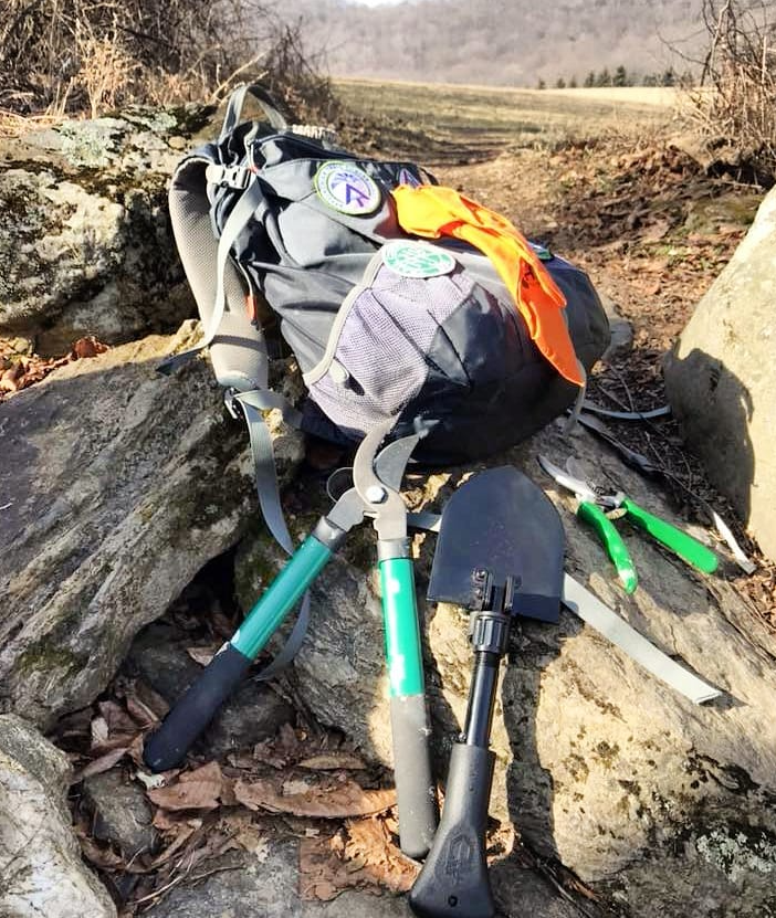
Join the Legacy: Volunteer as a Long Path Trail Maintainer
Help preserve the Long Path for future generations by becoming a Trail Maintainer. Your efforts ensure that hikers continue to enjoy its breathtaking views and serene landscapes. Whether you’re an experienced hiker or new to the trails, your contribution makes a real difference.