Highlands Trail Guide: Segment #4
Route 23 to Route 181 (NJ)
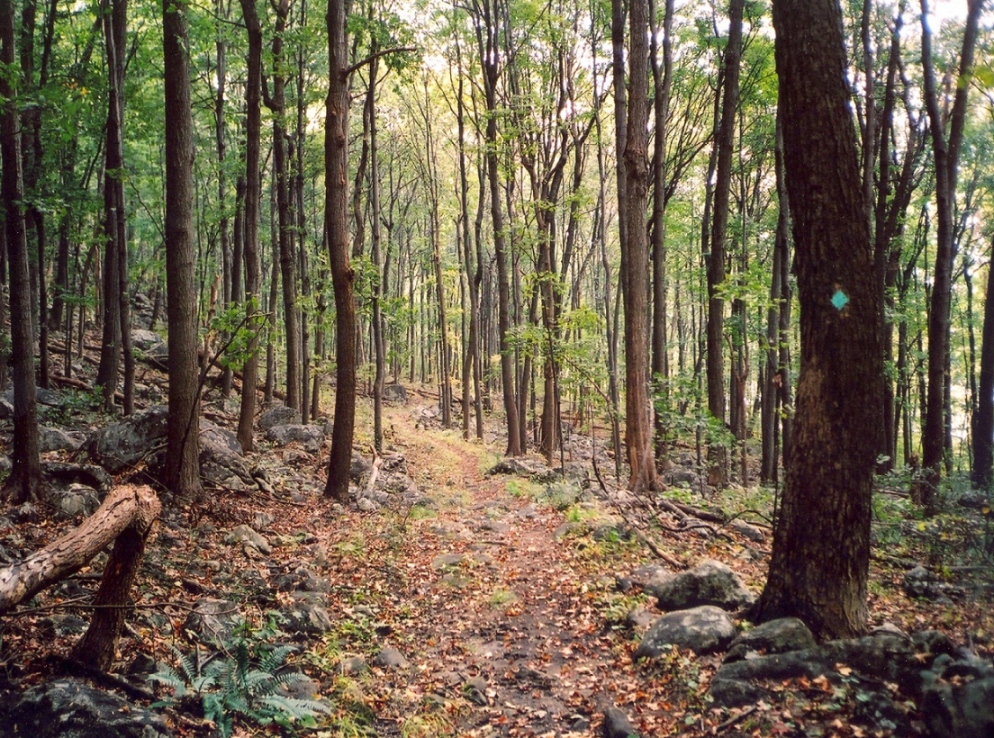
Highlands Trail above Ryker Lake – Photo Glenn Oleksak
Free Highlands Trail Maps from The Trail Conference
Active Trail Segment Alerts
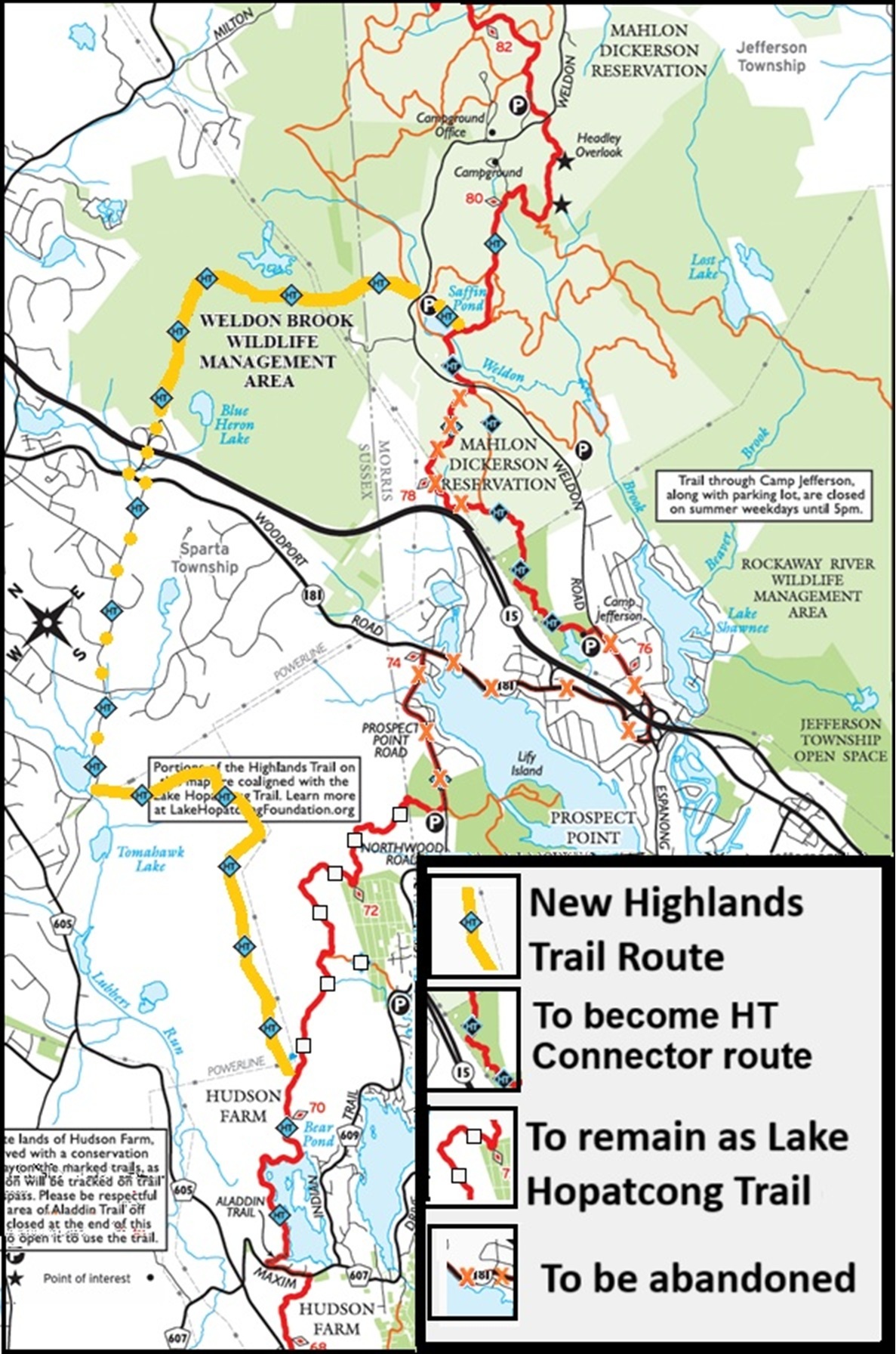
Reroute alert March 2025: The Highlands Trail is being rerouted between Hopatcong and Mahlon Dickerson County Reservation. See the Map of the reroute.
Pequannock Watershed: A permit is needed to hike in Newark’s Pequannock Watershed, and the Highlands Trail traverses the southwest portion of the Watershed land for the first 5 miles of this section. Obtain a permit and details on restrictions by calling (973) 697-1724 or visiting www.newarknj.gov/card/recreational-permit. Some of the Highlands Trail on the watershed property experiences closures during hunting seasons.
Sparta Wildlife Management Area: Due to past (and future?) tree canopy clearing in the area (but not directly on) of the trail, NJDEP has signs at the entrance off of Rock Lodge Road stating: “Restricted Area Keep Off.” We suspect they leave them up to dissuade ATV traffic. The Highlands Trail is open, and hikers may pass the signs and continue on the trail.
Detailed Trail Description
0.0 Cross Route 23 at the light at Canistear Road, turn left, and follow Route 23 until it crosses the Pequannock River.
0.3 Turn right off the highway just past the bridge and into the woods in the Newark Watershed property. Ascend a ridge and continue to a view of Oak Ridge Reservoir at 1.9 miles. From here, turn west, following woods roads and narrow trails, crossing two ridges and several wide woods roads.
3.8 Arrive at Holland Mountain Road. Turn right on Holland Mountain Road, then quickly turn left at the end of a guardrail. Follow the trail down into a small valley on some narrow paths and some wide, ATV-rutted woods roads. Cross two streams before ascending out of the small valley.
4.6 Reach and cross Rock Lodge Road and continue over a hill, turn left onto a woods road, and reach Rock Lodge Road again, where you leave the Newark Watershed property.
5.0 Turn right onto Rock Lodge Road.
5.2 Fall Drive bears off to the right, but bear left at the fork.
5.3 The pavement ends. “Restricted Area Keep Off” signs here are to dissuade ATV traffic, but we are allowed to hike past them. Enter Sparta Mountain Sanctuary and Sparta Mountain Wildlife Management Area on a dirt road. This blazed dirt road forks several times. In some areas, it’s difficult to blaze at the forks. If in doubt, take the straightest route, keeping to the right.
6.5 Turn left off the dirt road onto a narrow trail, eventually coming to a woods road. Following woods roads and narrow paths, pass Ryker Lake, cross Russia Brook at 7.8 miles on a small bridge, and come out to Ridge Road.
7.9 Cross Ridge Road and enter the driveway of Kean University’s Skylands campus. You are now in the Mount Paul section of Kittatinny Valley State Park. A small hiker parking area is available here under the power lines. Turn right at the parking area, following the power lines for a few hundred feet before turning left into the woods. Go over two hills with fern-filled valleys between them and come out to a woods road.
9.1 Turn right onto the woods road and almost immediately left onto another woods road, then turn right onto a faint woods road at 9.3 miles. At 9.6 miles, turn left on a narrow trail out to Sparta Mountain Road.
10.0 Cross Sparta Mountain Road and enter Mahlon Dickerson Reservation, where camping is available. Almost immediately reach the junction with the Pine Swamp Trail (white). Follow the co-aligned Pine Swamp and Highlands Trails to the left. Eventually, bear left on the white trail on the Highlands Trail up to the picnic area.
11.5 Reach the north parking and picnic area. Off to your left, the trail re-enters the woods from the parking lot.
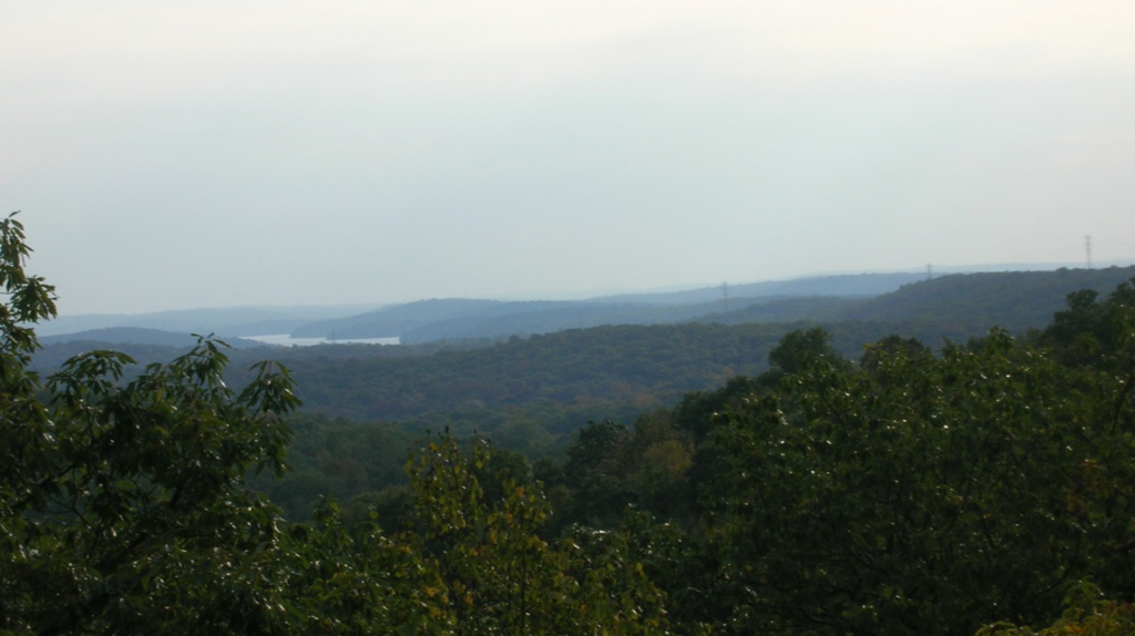
11.6 Cross Weldon Road. Reach Headley Overlook with a view toward the south, including Lake Hopatcong, at 11.9 miles. After passing a second overlook, turn right on the co-aligned Highlands Trail/yellow-blazed woods road. You will soon pass within view of the camping area. At about 13.3 miles, the yellow trail branches off to the right. Continue straight on the Highlands Trail.
13.5 Come out to Saffin Pond at the dam. Turn right as soon as you reach the dam and pass along Saffin Pond on a rugged trail.
Note: Straight ahead, the old HT route, now an HT spur marked with teal diamond blazes with black centers, continues across the dam bridge and on to end at Camp Jefferson. Part of the old route has been abandoned. Description below.
13.8 Arrive at the large Saffin Pond parking area. Turn left and follow the trail along the edge of the parking area. Cross Weldon Road to the junction of the HT and the green trail that follows the old RR bed. Bear left on the HT and follow the narrow, multi-use trail mostly uphill to the power lines. This trail was built and maintained by mountain bikers and recently blazed as part of the Highlands Trail.
14.6 Cross the power lines and follow woods roads through Weldon Brook Wildlife Management Area. The HT turns from one wood’s road to another at several junctions.
16.2 Exit the woods onto the dead end of Blue Heron Road. Parking is available here at a large park and ride lot.
THE HT SPUR TRAIL TO CAMP JEFFERSON: 2.4 miles
0.0 Cross the dam, with Saffin Pond on your right. Turn left onto the old Ogden Mine Railroad bed.
0.4 Turn right off the railroad bed and shortly cross Weldon Road. Turn left and follow the old Winona Trail – now a dirt road. The portion of HT that used to go to the right has been abandoned.
1.1 Turn left uphill off of Winona Trail on a narrow trail and follow it to the power lines. NOTE: Past this point, you are leaving Mahlon Dickerson’s property and entering Jefferson Township’s Camp Jefferson property. The section through Camp Jefferson is closed on weekdays while camp is in session between 9 am and 3 pm in June, July, and August. Hiking in this section is prohibited during these times.
1.5 Go under a power line tower, re-enter the woods, and quickly come to a junction with the Lower Trail (blue) on your left. At this point, Camp Jefferson’s Upper Trail (yellow) joins the HT. Continue on the co-aligned HT/yellow trails, passing the Middle Trail (orange triangles) on your left along the way. Pass the other end of the Lower Trail (blue) on your left, then turn left on a woods road and drop down to Camp Jefferson. Walk out at the end of the lake and past the cabins to the parking lot.
2.4 HT Spur trail ends by the Camp Jefferson basketball court near the parking lot. Going south from Route 511, follow the trail over a small hill and come to the abandoned Erie RR Greenwood Lake Branch. Turn left on the elevated RR bed. Continue straight across a weedy area where the RR bed was removed for a gas pipeline crossing, then shortly turn right off of the RR bed and follow the trail up and over Horse Pond Mountain for 3.0 miles to a junction with the Stonetown Circular Trail (red) and a teal diamond with black center HT Connector Trail, which leads down to Lake Riconda Drive.


Join

Become a member and protect wild places
Shop

Maps, gear & books, all proceeds support trails
Volunteer

Give back by helping maintain the trails
Donate

Keep trails open and safe with a one-time gift