Highlands Trail Guide: Segment #5
Route 181 to Route 206 (NJ)
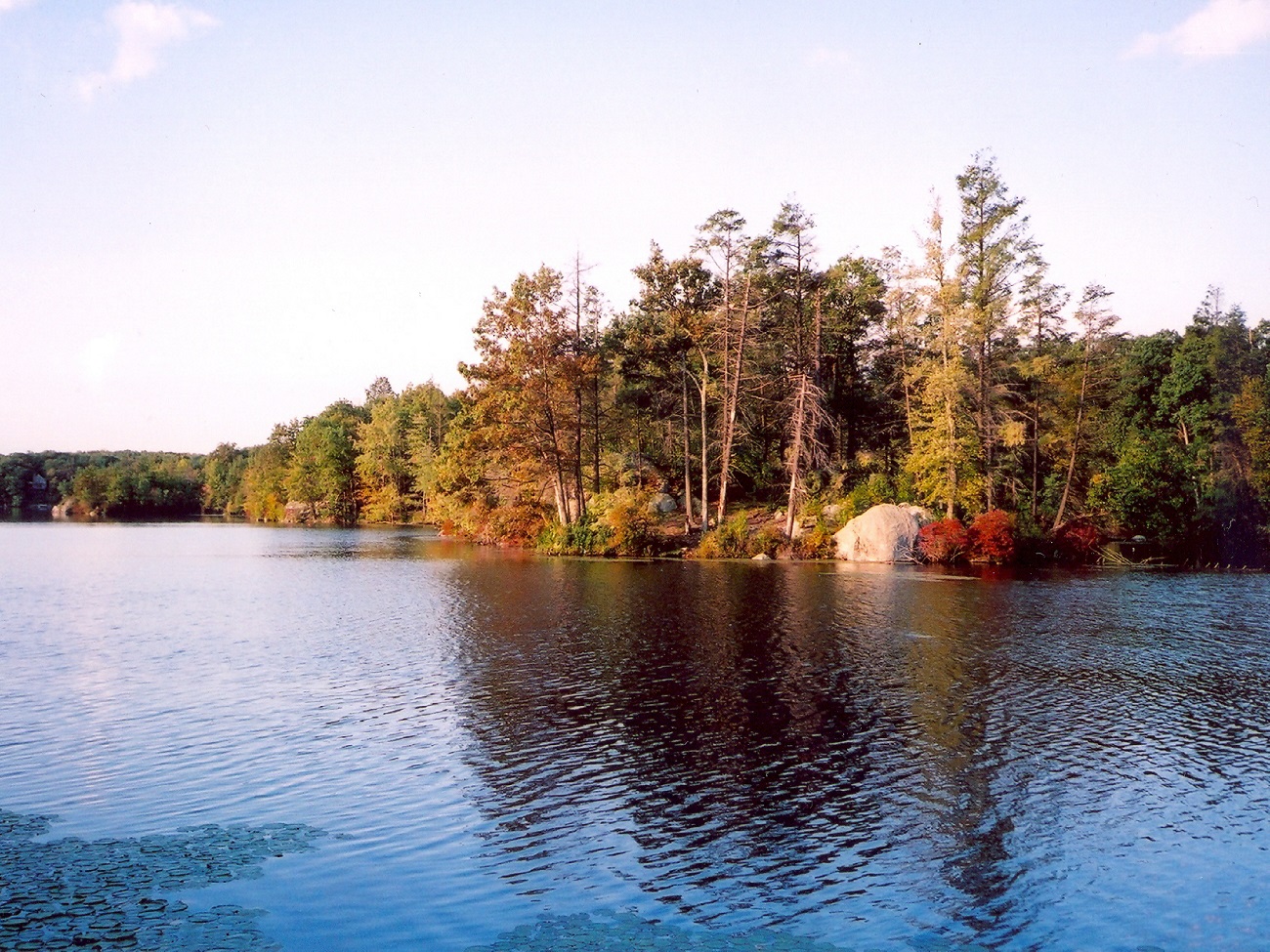
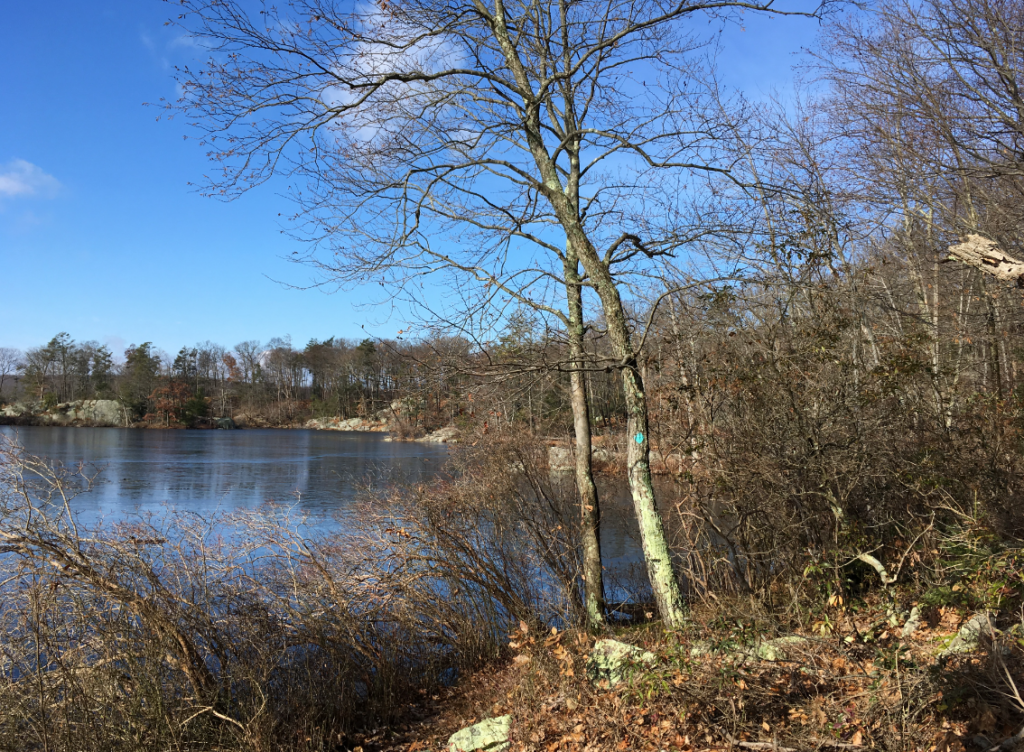
Bear Pond – Photo Glenn Oleksak
Free Highlands Trail Maps from The Trail Conference
Active Trail Segment Alerts
Trail Closure Alert: Beginning in July 2026, the section of the Highlands Trail between Rt 605 and Lackawanna Drive will be closed to the public while EPA addresses contamination in and around the Mansfield Dump Superfund site. EPA anticipates the trail will be closed from July 2026 to July 2027 during the site cleanup. More information about this closure is available in the corresponding Trail Alert.
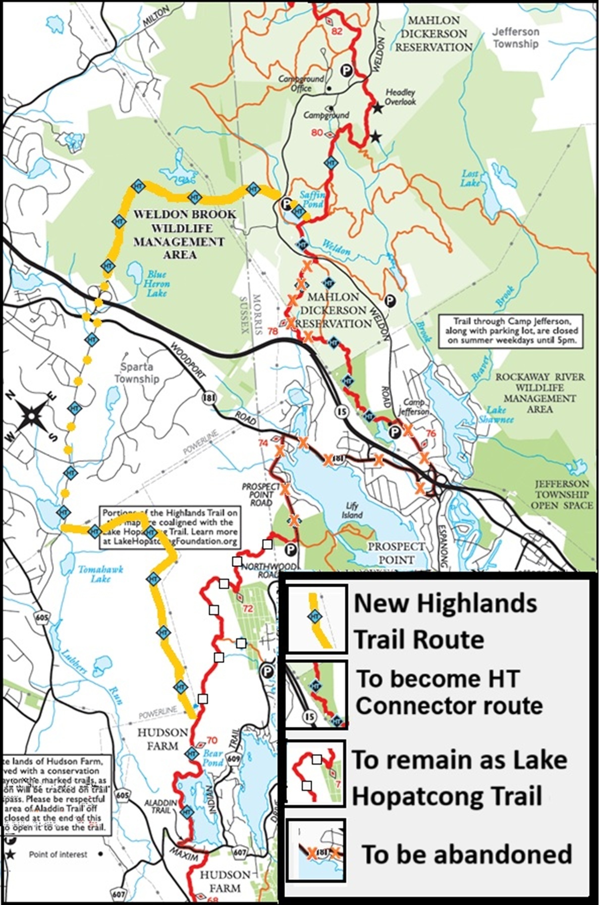
Reroute Alert March 2025: The Highlands Trail is being rerouted between Hopatcong and Mahlon Dickerson County Reservation. See the Map of the reroute.
Note: The Highlands Trail sections in this description pass through some private lands. All areas off of the trail are restricted, and hiking off-trail constitutes trespass. Hudson Farm is a private estate. Please respect the privacy of the owners, who have graciously allowed the Highlands Trail to cross their land. This property IS patrolled and monitored by trail cams.
Aladdin Trail is a quiet residential street. Please respect the privacy of the residents and walk quietly through this area. No blazes have been painted along this street. Parking on or along Aladdin Trail, even at the trailhead, is strictly forbidden. At the beginning of the road is an illegal (it is against town ordinance to harass or impede someone walking on a public road) “no hikers” sign, and at the end of Aladdin Trail is a Hudson Farm gate. This is due to problems with people illegally swimming in Bear Pond. HT hikers are allowed to HIKE this area, but again, please respect the landowners who have allowed the HT to cross their property and just quietly hike without leaving the trail for any reason.
ALERT: A chain link fence with a gate has been installed at the end of Aladdin Trail. This is due to problems with people partying and painting graffiti along Bear Pond in Hudson Farm (private lands the HT passes through). Hikers are allowed to open the gate and continue hiking. Please close the gate behind you. At this time, there’s no signage on the gate indicating to hikers that they are allowed to pass. Reroute alert March 2025: The Highlands Trail is being rerouted between Hopatcong and Mahlon Dickerson County Reservation. See the Map of the reroute.
Detailed Trail Description
0.0 From the Blue Heron Lake park and ride lot, continue over Route 15 on an overpass.
0.3 Turn left on Route 181, then in a few hundred feet turn right on Sawmill Road. One stretch of Sawmill Road has no utility poles; therefore, no blazes.
1.4 Turn left on Green Road, then quickly turn right onto Tomahawk Trail.
1.9 At a gate on the left, across the street from a restaurant on the right and just before the power line crossing, turn left and follow the HT across the power lines and into the woods. You are now entering the private lands of Hudson Farm.
NOTE: From this point to the Hopatcong Preserve, the HT is on the Hudson Farm property. Please stay on the trail and respect the property owners, who have graciously allowed the trail to pass through their lands. They consider hiking off the trail as trespassing, and this property is patrolled and has MANY surveillance cameras. There are rifle ranges on the property, and hunting occurs year-round on this property. Hudson Farm monitors the area closely and will have off-trail trespassers arrested. You are welcome to enjoy your hike, just please obey the rules and don’t spoil it for everyone. It is recommended that you wear bright colors while hiking through here.
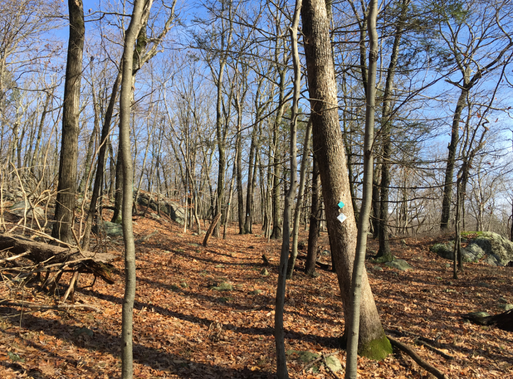
Follow the HT through the Hudson Farm lands, mostly on narrow trails, but sometimes on woods roads. Although the terrain undulates, once you’ve climbed up from Tomahawk Trail, the HT pretty much stays at a higher elevation.
5.1 Cross under the power lines at a tower and shortly turn right to join the original HT route. The white diamond blazed Lake Hopatcong Trail (LHT) joins the HT at this point. To the left, the LHT follows the former Highlands Trail route to Eve’s Mountain Inlet parking.
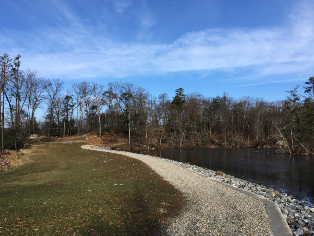
5.6 Reach an old woods road and an old water pump. Turn left on the HT/LHT and go down to Bear Pond, then follow the trail to the right as it follows the shoreline of Bear Pond, passing over a spillway, a dam, and along a dirt road.
6.6 Come out to a gate at the dead end of paved Aladdin Trail, a residential street. Please close the gate behind you. ***See notes on Aladdin Trail in the Trail Section Alerts section above *** Follow Aladdin Trail out to Route 607 Lackawanna Drive.
6.8 Turn left on Route 607 Lackawanna Drive.
7.1 Turn right off of Route 607 into the woods on the co-aligned HT/LHT, initially on an old road, then on a narrow trail up and over a few small hills.
7.6 Come out to a dirt road. Parking is available along Route 605, a short distance down the dirt road to the right. Cross the dirt road, leaving Hudson Farm property and entering the Hopatcong Natural Area Preserve on the HT/LHT. Follow the trail along the ridge above Route 605, eventually turning away from the road before passing under power lines. You are now entering a section of Hopatcong State Park that was saved from development and acquired for the HT. Follow mostly woods roads before coming to a junction where the Lake Hopatcong Trail turns left and the Highlands Trail turns right. Follow the HT out to Sparta-Stanhope Road Route 605. at 10 miles.
10.4 Turn left on Route 605.
10.5 Turn right onto the Byram Bike Trail / HT.
11.5 Come out to the gate at Byram Township Intermediate School on Mansfield Drive. Turn right and follow Mansfield Drive out to Route 607 Lackawanna Drive.
11.9 Turn left on Route 607, Mansfield Drive, and follow it out to Route 206.
12.8 Arrive at Rt 206. Restaurants, fast food, and groceries are available here.


Join

Become a member and protect wild places
Shop

Maps, gear & books, all proceeds support trails
Volunteer

Give back by helping maintain the trails
Donate

Keep trails open and safe with a one-time gift