Hike: Catfish Loop Trail
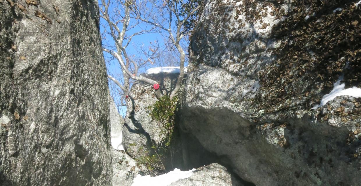
Narrow passage on the Catfish Loop Trail – Photo by Daniel Chazin
The 4.6-mile Catfish Loop Trail explores the rugged, lesser-traveled southwest corner of Clarence Fahnestock State Park, offering a peaceful circuit through forested ridges, historic stone walls, laurel tunnels, and scattered viewpoints. Starting from Dennytown Road, the loop briefly follows the Appalachian Trail before veering off onto red blazes for a quiet clockwise journey through rock-strewn woodlands once used for farming.
Along the way, hikers cross multiple streams, pass remnants of stone fencing, and gradually ascend to a high point framed by lichen-covered boulders, where a narrow pass leads to a stunning west-facing overlook toward Storm King and Crows Nest Mountains. The second half of the loop winds through more laurel thickets, ridge crests, and hidden outcrops with glimpses of Duck Pond and distant valleys—especially rewarding in the leaf-off seasons.
While this loop doesn’t reach dramatic elevations, its frequent climbs and descents, occasional scrambles, and natural solitude make it a rich experience for hikers seeking a quiet, half-day backcountry outing in the Hudson Highlands region.
How to Get There
Trails Related to this Hike
Don’t Leave Unprepared
The digital version of this map is available exclusively at:
Detailed Hike Description
Publication: Submitted by Daniel Chazin on 03/23/2007, updated/verified on 01/10/2021
This hike follows the 4.6-mile-long Catfish Loop Trail, which loops around the southwest corner of Fahnestock State Park.
On the west side of Dennytown Road, across from and just south of the parking area, you will see a sign for the Catfish Loop Trail. Head west into the woods on the white-blazed Appalachian Trail. In a short distance, you’ll reach an intersection with the red-blazed Catfish Loop Trail. Turn left to follow the Catfish Loop Trail in the clockwise direction.
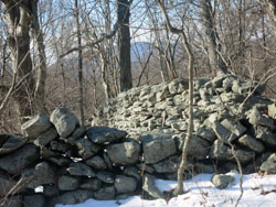
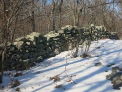
The Catfish Loop Trail immediately crosses a stone wall. You’ll observe many stone walls, which indicate that the area was once used for agricultural purposes, along the hike. In a quarter mile, the trail turns sharply right and crosses a stream. After crossing another stream, the trail begins a steady climb. At the crest of the rise, it passes through a mountain laurel thicket. The trail then descends to cross yet another stream, and it follows the park boundary for some distance. Soon, it reaches the highest point on this section of the ridge.
After a relatively level stretch, the Catfish Loop Trail crosses the white-blazed A.T. (this junction is marked by a cairn). The trail now proceeds through mountain laurel thickets and soon begins a steady descent to cross a woods road (blazed yellow as a horse trail). It continues to descend and, in a short distance, crosses a stream on rocks.
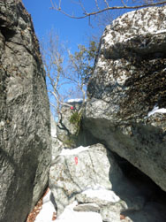
The trail now climbs gradually to the most interesting point on the hike, where it goes through a narrow passage between large lichen-covered boulders. From the top of the boulders, there is a panoramic west-facing view, with Crows Nest and Storm King Mountains visible on the west side of the Hudson River. You’ve now hiked for nearly two miles, and this attractive spot Is a good place to take a break.
Continue ahead on the Catfish Loop Trail, which descends through mountain laurel, climbs a rock outcrop, then descends steeply. The trail crosses several more rock outcrops and passes through dense mountain laurel thickets. After going by a cliff on the left, the trail bends sharply to the right and begins to head north on a relatively level footpath through mountain laurel.
After crossing a small stream, the trail climbs to a ridge overlooking a valley on the left. It descends a little to cross a wider stream, then goes through a gap in a stone wall and climbs again to a rock outcrop that overlooks the valley. You’ll notice an abundance of rock walls near the trail in this area, and it is hard to believe that this land, which appears so inhospitable to settlement, was once devoted to agricultural pursuits. In leaf-off season, there are several limited west-facing viewpoints along this section of the trail, with the West Hudson Highlands visible in the distance.
Soon, the trail begins to parallel a stone wall on the left, which marks the park boundary. After a while, the blazes bear right, away from the wall. A short distance beyond, the trail crosses a stream and continues through dense mountain laurel thickets. It climbs gradually to a rock outcrop from which Duck Pond is visible through the trees to the left. Just north of this outcrop, the trail makes a very sharp bend and nearly doubles back on itself, heading south and then east. Soon, it reaches a large rock outcrop with a view of the valley below to the left.
From the outcrop, the Catfish Loop Trail descends steeply to the valley below, where it crosses a wide stream on rocks. After going over a minor rise, the trail begins a steep, steady climb of about 150 vertical feet. Upon reaching the crest of the ridge, the trail goes down a little, regains the lost altitude, and levels off, heading north along the west side of the ridge.
After bending to the right, the Catfish Loop Trail crosses a yellow-blazed woods road – the same horse trail that you crossed earlier in the hike. The trail now climbs briefly to a rock outcrop, descends steadily through the woods, and climbs once more to reach a junction with the white-blazed Appalachian Trail, completing the loop. Follow the Appalachian Trail uphill to Dennytown Road and the parking area where the hike began.
Support the trails you love
Your gift helps build, maintain, and protect over 2,150 miles of trails across the region.
Join

Become a member and protect wild places
Shop

Maps, gear & books, all proceeds support trails
Volunteer

Give back by helping maintain the trails
Donate

Keep trails open and safe with a one-time gift