Hike: Doris Duke Trail
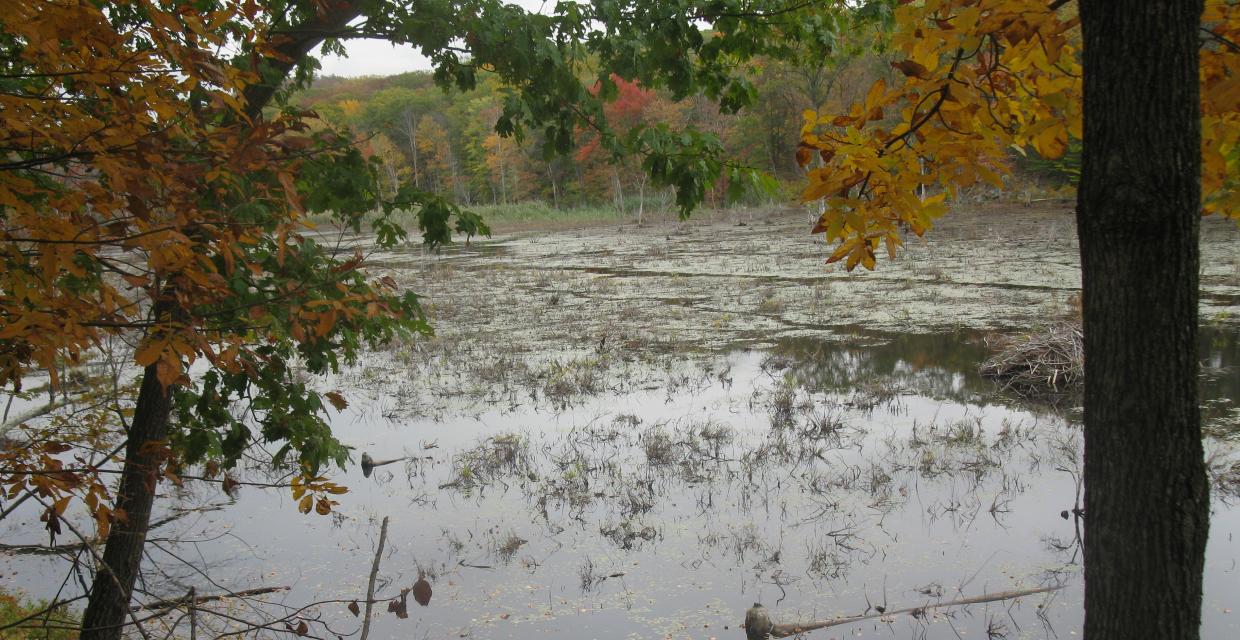
Wetland along the Doris Duke Trail – Photo by Daniel Chazin
This moderate 4-mile loop hike explores the scenic and tranquil Doris Duke Wildlife Sanctuary in Sterling Forest, where hunting is prohibited. Following the yellow-on-white Doris Duke Trail, the route winds through forests, skirts marshes with views of beaver lodges, and climbs to a rocky ridge with sweeping views of Mombasha Lake and the surrounding hills. After joining the Allis Trail (also part of the Highlands Trail), hikers pass through pitch pine stands and enjoy additional viewpoints before descending past quiet streams and lichen-covered rocks. Rock steps and boardwalks ease the way through rugged and wet terrain. Ideal for hikers seeking a peaceful experience and varied terrain without heavy elevation gain.
How to Get There
Trails Related to this Hike
Don’t Leave Unprepared
The digital version of this map is available exclusively at:
Detailed Hike Description
Publication: Submitted by Daniel Chazin on 10/16/2014, updated/verified on 11/15/2020
This hike traverses the Doris Duke Wildlife Sanctuary, a section of Sterling Forest State Park where hunting is not permitted. It follows the Doris Duke Trail, which was improved, under the auspices of the New York-New Jersey Trail Conference, by volunteers and AmeriCorps crews.
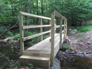
From a kiosk at the western end of the parking area, enter the woods at a triple blaze for the Doris Duke Trail (yellow “DD” logo on white). The trail follows a woods road and soon crosses a wooden footbridge over a stream (built as an Eagle Scout project). About 200 feet beyond the bridge, you’ll notice a sign on the right “DD Loop.” Turn right, leaving the woods road, and head into the woods on a footpath, now following the loop of the Doris Duke Trail in a counterclockwise direction.
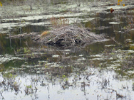
Soon, you’ll pass massive cliffs on the left. A short distance beyond, the trail begins to descend towards a wide marsh. It comes out on a rock outcrop overlooking the marsh (note the beaver lodge in the marsh), then bears left and continues along the base of the hill, parallel to the marsh.
After joining an old woods road, the trail bears left, leaving the road, and continues on a footpath. The trail curves to the left and begins to climb. It levels off, passes a balanced boulder on the left, then continues a gradual climb, soon joining a wide woods road.
The Doris Duke Trail follows the road uphill towards the crest of the ridge, with several detours to avoid eroded and overgrown sections. As it approaches the crest, the trail bears left and continues on a footpath. Rock steps have been placed in places along this section of the trail to improve the tread for the hiker.
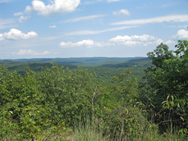
Upon reaching the crest of the ridge, the trail heads southwest along the ridge. Soon, it climbs to a panoramic viewpoint from a rock outcrop (marked by a large cairn). Mombasha Lake may be seen on the left, and the hills of Sterling Forest and Harriman State Park are visible in the distance. This is a good spot to take a break.
Just beyond, you’ll come to a junction with the blue-blazed Allis Trail (also the route of the Highlands Trail). Bear left and continue to head southwest along the ridge, now following both the dark blue blazes of the Allis Trail and the yellow-on-white logo blazes of the Doris Duke Trail.
After a relatively level section, you’ll begin a steady climb and reach the highest point on the ridge (1,386'), marked by several white pines. Unfortunately, there are no views from this high point. The trail now begins to descend, with several steep sections. In about half a mile, you’ll cross a woods road and follow stepping stones across a wet area.
A short distance beyond, the Doris Duke Trail turns left, leaving the Allis Trail. Follow the yellow-on-white Doris Duke blazes, which climb a little and then head downhill, soon reaching an east-facing viewpoint from a rock outcrop with cedar trees. Beyond the viewpoint, the trail descends rock steps and passes lichen-covered rocks on the right. After going by another viewpoint, it continues its steady descent. The trail approaches a stream on the left, with attractive cascades, then curves to the right and goes down to a woods road.
The Doris Duke Trail turns left on the road, but a short distance ahead, it bears left, leaving the road, and soon crosses the stream on stepping stones. It rejoins the road and follows it back to the start of the loop. Turn right and retrace your steps across the footbridge and back to the parking area where the hike began.
Support the trails you love
Your gift helps build, maintain, and protect over 2,150 miles of trails across the region.
Join

Become a member and protect wild places
Shop

Maps, gear & books, all proceeds support trails
Volunteer

Give back by helping maintain the trails
Donate

Keep trails open and safe with a one-time gift