Hike: West Kill Mountain from Spruceton Road
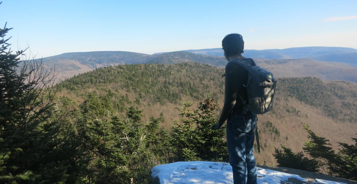
A hiker taking in the view from the Buck Ridge Lookout – Photo by Daniel Chazin
Hikers planning to climb West Kill Mountain from Spruceton Road are in for a challenging and rewarding day in the Catskills. The trek climbs 1,700 feet over 3.4 miles to summit West Kill Mountain (3,880′), the sixth-highest peak in the Catskills. The route begins on the blue-blazed Diamond Notch Trail, which follows the scenic West Kill stream, reaching Diamond Notch Falls at 0.7 miles. There, it joins the red-blazed Devil’s Path, beginning a steep and sustained climb through evergreen forests and past notable features like a rock overhang “cave” and the spectacular Buck Ridge Lookout, offering panoramic views of Hunter Mountain, Southwest Hunter, and the Blackhead Range. From the summit cairn (no views), retrace your steps via the Devil’s Path and Diamond Notch Trail for a 6.8-mile out-and-back experience.
How to Get There
Trails Related to this Hike
Don’t Leave Unprepared
The digital version of this map is available exclusively at:

Detailed Hike Description
Publication: Submitted by Daniel Chazin on 11/12/2017
West Kill Mountain is one of the 35 peaks in the Catskill Mountains that is over 3,500 feet in elevation. To ascend West Kill Mountain from Spruceton Road, hikers must ascend about 1,700 feet in elevation over 3.4 miles (most of the elevation gain is concentrated into a single mile). Trail conditions in the Catskills constantly change - especially in the winter - so make sure to check the weather report and the condition of the trails before you embark on the hike.
From the parking area, continue ahead on the road. In another 0.2 mile, a cable barrier marks the end of the drivable road. Proceed ahead on a woods road, following the blue markers of the Diamond Notch Trail. The trail parallels the West Kill stream, with many scenic cascades and pools.
In 0.7 mile, at the Diamond Notch Falls, you’ll reach a junction with the red-blazed Devil’s Path. Turn right, crossing a wooden bridge over the stream, then immediately turn right again. The Devil’s Path parallels the stream for a short distance (the best views of the falls are from this side of the stream), then bears left and begins a steady ascent of West Kill Mountain. The grade is quite steep in places and more gentle in others, but you’ll be gaining more than 1,000 feet in elevation in just over a mile.
At about 3,400 feet in elevation, the trail levels off. Soon, you’ll pass a brown DEC sign on a tree to the right of the trail marking the 3,500-foot elevation (camping and fires are not permitted above this elevation). The trail now proceeds through a beautiful evergreen forest.
A short distance beyond, you’ll notice a large overhanging rock, with a sheltered area (resembling a “cave”) underneath. This is a good place to take a break. The trail climbs steeply around the left side of the rock and continues along undulating terrain, with some minor ups and downs. For much of the way, you’ll traverse an evergreen forest.
In about a mile from the “cave”– after a steep descent and then a rather steep climb - you’ll reach the Buck Ridge Lookout, on the left side of the trail. This east-facing viewpoint overlooks a broad panorama, with many of the 3,500-foot peaks visible. The imposing peak in the foreground is Southwest Hunter, with Hunter Mountain (the next peak to the east on the Devil’s Path) behind it, and the Blackhead Range visible in the distance to its left.
After spending some time to take in the view, continue uphill on the trail for another 500 feet to the summit of West Kill Mountain (marked both by a sign and by a large cairn). There are no views from the summit, which is the sixth-highest peak in the Catskills.
Return to your car by retracing your steps down the Devil’s Path and then (after crossing the footbridge over the West Kill) the Diamond Notch Trail.
Support the trails you love
Your gift helps build, maintain, and protect over 2,150 miles of trails across the region.
Join

Become a member and protect wild places
Shop

Maps, gear & books, all proceeds support trails
Volunteer

Give back by helping maintain the trails
Donate

Keep trails open and safe with a one-time gift