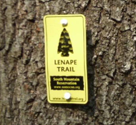
The Lenape Trail
The 36-mile Lenape Trail is a unique urban/suburban trail connecting 18 parks and 11 municipalities in Essex County. The trail follows an inverted horseshoe path between the famous Branch Brook Park in Newark and South Mountain Reservation in Millburn. — The Lenape Trail is built and maintained by partnerships between public land managers, the New York-New Jersey Trail Conference, and people like you.


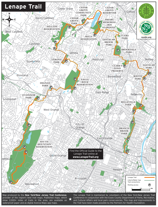
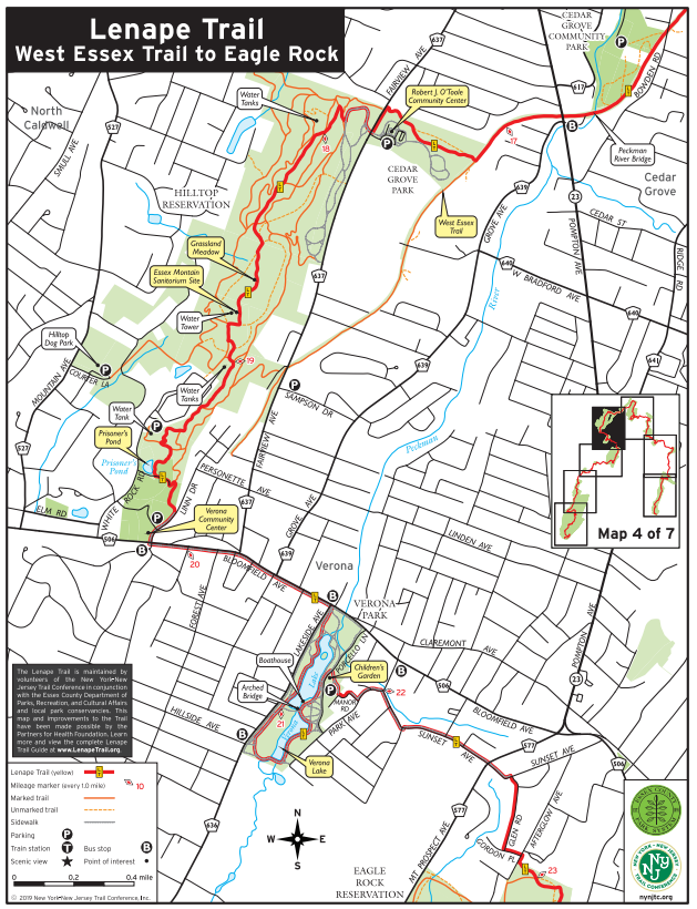
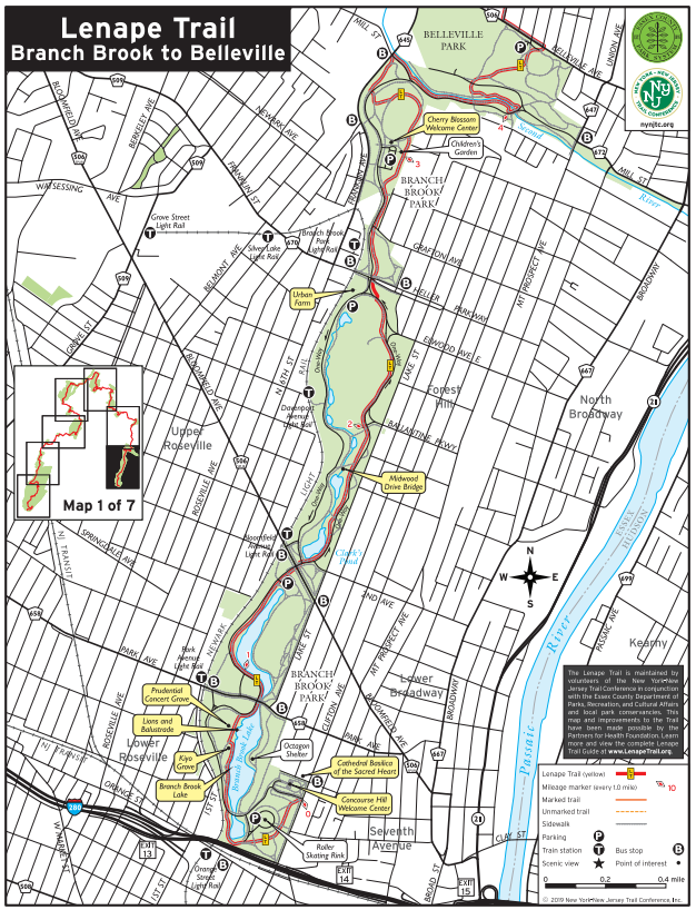
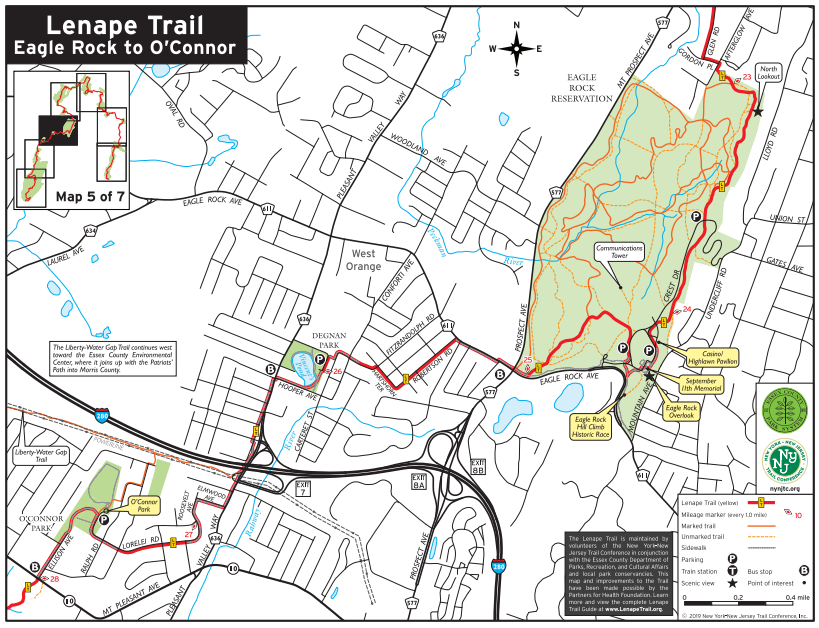
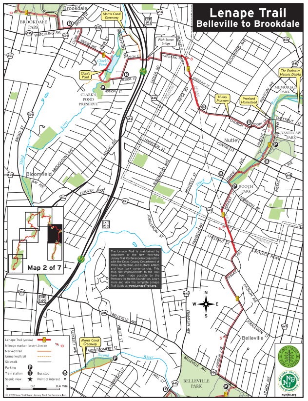
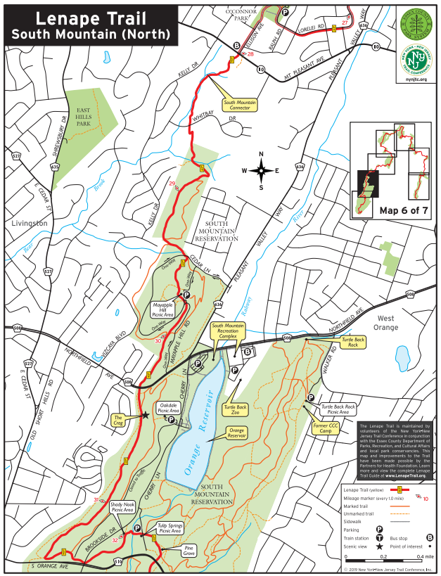
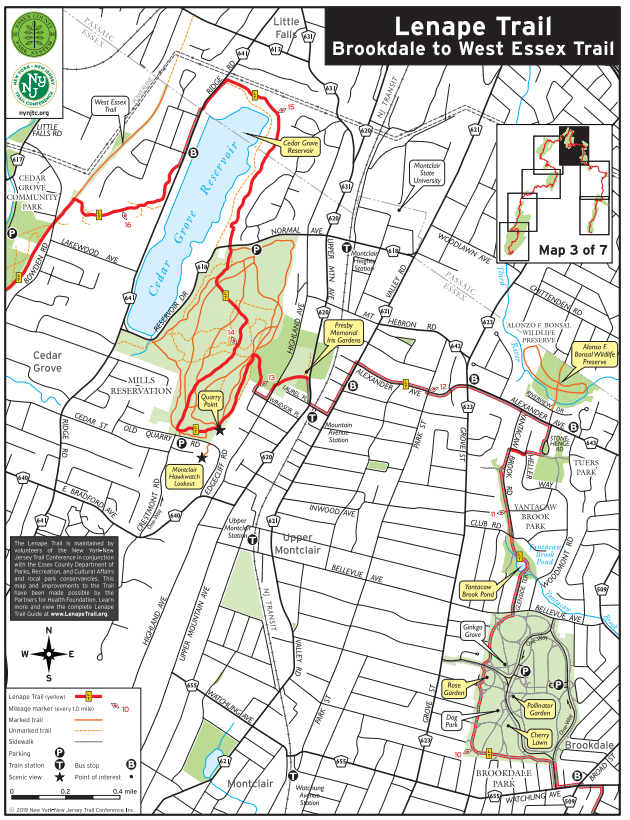
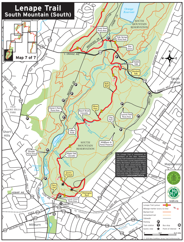
Each of the seven section maps in the Official Guide to the Lenape Trail can be downloaded individually. If you’d like only certain maps or just the maps without the full guide, use the links below to download each one. The overview map of the Lenape Trail is also available as a separate download. Please note the following updates not yet reflected in the guide or maps:
Section 1: Branch Brook Park
The Lenape Trail begins on Clifton Ave., near Highway 658, then continues past a playground toward the lake.
Section 2: Pilch St. Bridge to Clarks Pond
After exiting Pilch St., hikers should turn left (south) to follow the new section of the Greenway, which runs alongside the Garden State Parkway westward to Bessida St. The trail then turns right (west) and follows Bessida St. across Broughton St.
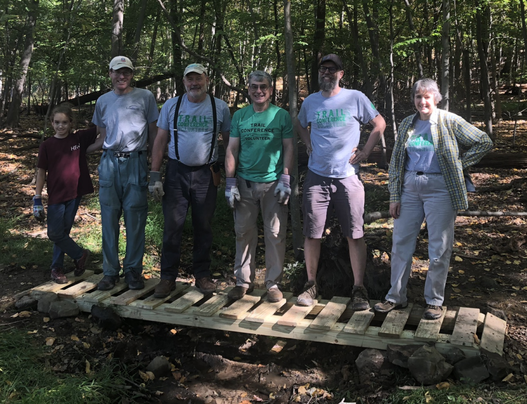
Join the Legacy: Volunteer as a Long Distance Trail Maintainer
Help keep the Lenape Trail beautiful! Our 2,000-plus volunteers build, maintain, and protect trails and care for natural areas all across the region. Your favorite parks and trails need you!