Our Publications Committee has continued to be quite busy recently, so here is an overview of recently published titles and upcoming updates as of mid-September.
Recent Maps and Books:

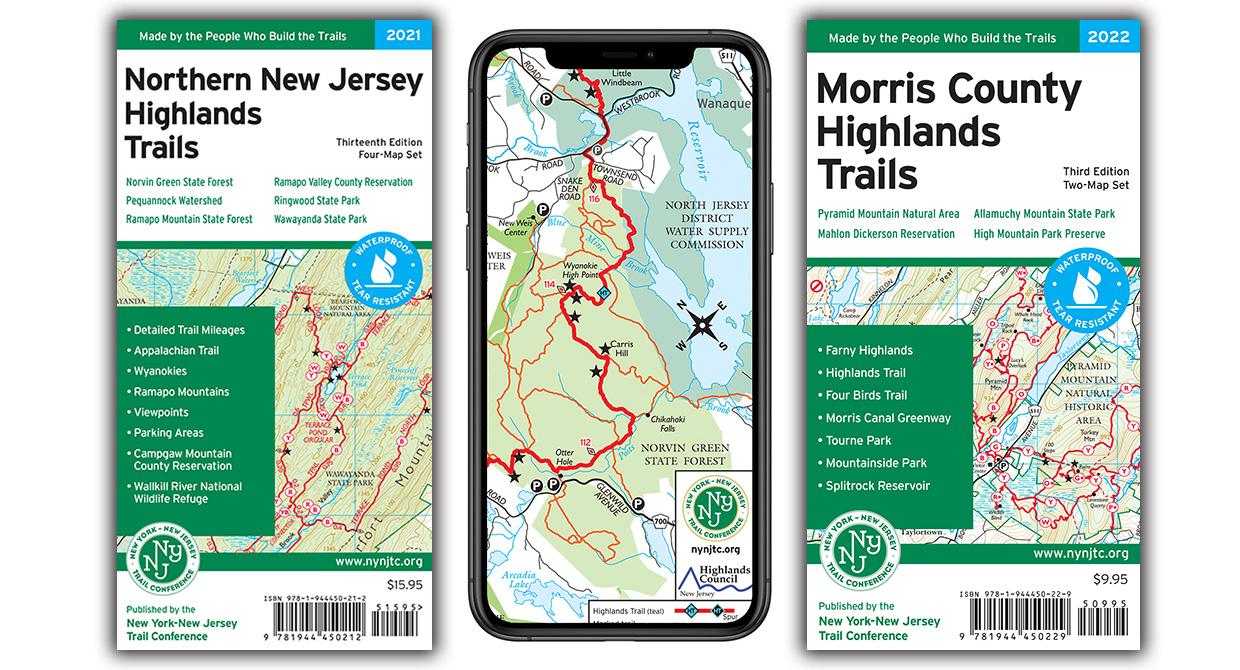
Northern New Jersey Highlands Trails map set
Check out the Northern New Jersey Highlands Trails map set, an updated version of our popular North Jersey Trails map, released at the end of 2021! This enhanced map features over 360 miles of trails, 40+ parks and preserves, new trail mileage numbers, an improved scale, and updates for 75+ miles of trails—all thanks to Trail Conference volunteers. Available in a durable Tyvek print or digitally on Avenza Maps as a combined app map. Click here to learn more and get your copy!
Reflections book
Released in late 2021 to celebrate our Centennial, the Reflections book offers a full-color journey through the history of the Trail Conference, featuring stunning photos and stories of the people behind a century of trail stewardship. Learn more and get your copy here!
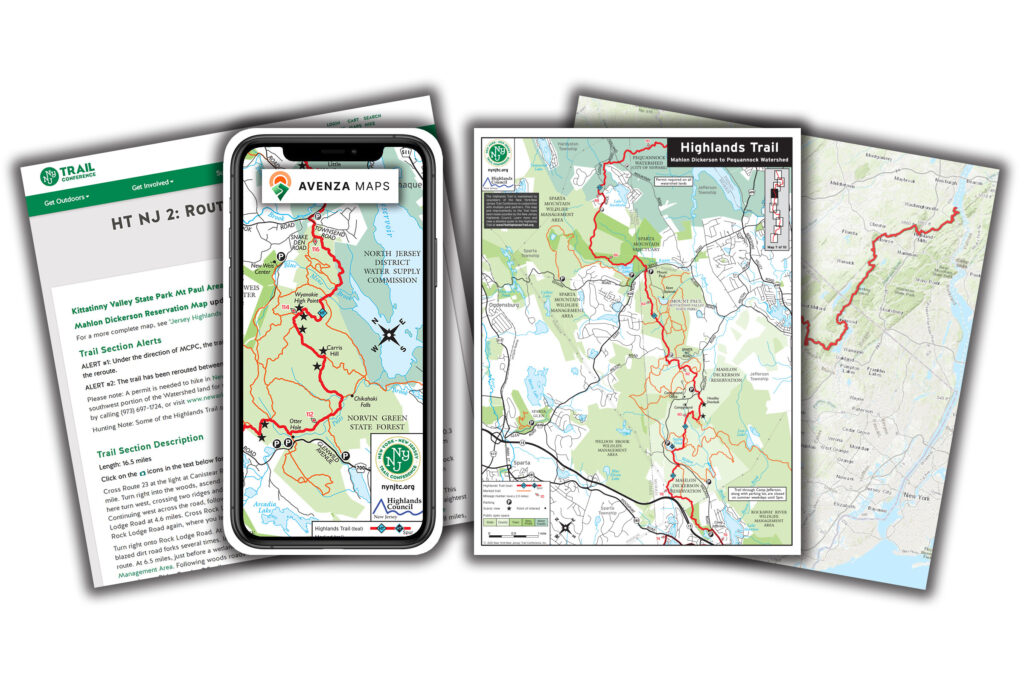
Highlands Trail in New Jersey maps
Released as a free app map on Avenza Maps in late 2021, this map details over 130 miles of the Highlands Trail through New Jersey into southern New York. It covers nearly 30 parks, including 150+ parking locations for trail access. Paired with a new signage project, these maps highlight this incredible long-distance trail. Learn more and get your free maps here!

Avenza Maps
This spring, Avenza launched a major app update with a new design, enhanced map store, and other useful improvements. Make sure to download the latest version! If you’re new to Avenza or want to learn more about the updates and tips, view our new Overview Presentation here. We offer over 85 trail maps, including free and paid options—available now on your Apple or Android device!
Upcoming Maps:
Map delays due to Tyvek supply issues
Did you know the Trail Conference has been printing our maps on waterproof and tear-resistant Tyvek for nearly 50 years? Currently, Tyvek for graphics/printing purposes is in extremely limited supply, and we have been working throughout the past year to find enough Tyvek for our map printings. We have unfortunately been unable to obtain enough Tyvek for significant 2022 revisions to our Catskill Trails maps and Morris County Highlands Trails maps, so the printing of both maps is delayed without a clear timeframe of expected availability, although we are hopeful that printed maps may be available before the end of the year..
Tyvek is a material produced by DuPont that has a wide variety of applications in various industries, including mailing envelopes, insulation wraps for homes, and medical gowns and coveralls. For the past 2 years, DuPont has shifted their production toward their healthcare and PPE products to meet the needs of the global pandemic, which has left the other products like we use in limited and dwindling supply, and global supply chain issues have only heightened the uncertainty of when supplies may increase again. We continue to be in contact with multiple suppliers to try to secure enough Tyvek to get these maps printed, and we understand this situation is not helpful for customers looking for a print map.
In the absence of print maps, digital versions of our maps are being published on the Avenza Maps app. The Morris County Highlands Trails app maps are currently available, and the new edition of the Catskill Trails app map is in progress and expected to be available in early fall.
Morris County Highlands Trails map set
Previously titled Jersey Highlands Trails: Central North Region, this 3rd edition map covers over 230 miles of trails in the New Jersey Highlands of northern Morris County and surrounding areas. The 2022 update includes new trails and blazing changes in parks like Pyramid Mountain, Mountainside Park, Wildcat Ridge, and more. Currently available only as a digital version on Avenza Maps due to Tyvek shortages. Click here to learn more and download the maps.
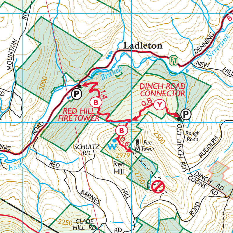
Catskill Trails map set
The revised 13th edition of this popular map is nearly complete, with digital versions expected this fall. Updates since the 2018 edition include new trails like the Red Hill Fire Tower Trail and Bluestone Wild Forest, updated trail lines with new GPS data, added and removed viewpoint stars, adjustments around Doubletop and Graham mountains for no public access, and newly protected lands. Click here for availability updates. Limited copies of the 2018 12th edition are still available for purchase.
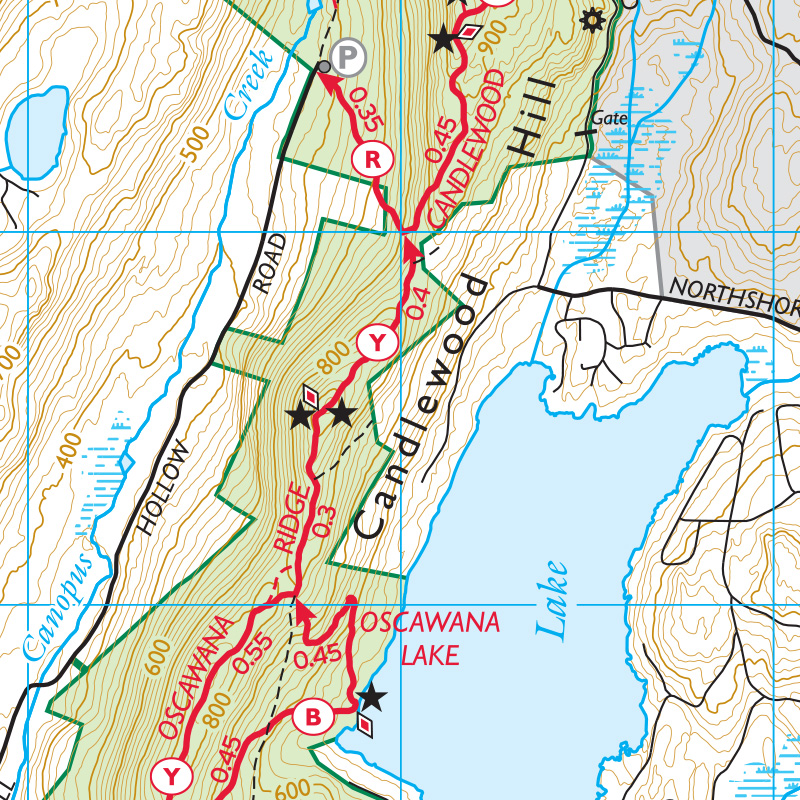
East Hudson Trails map set
We’re quickly working to complete the revised 13th edition of this map, with digital versions planned for release on Avenza Maps this fall. Updates include new trails in Hudson Highlands State Park Preserve and Fahnestock State Park, trail relocations, redrawn trail lines, new parking and access points, added viewpoint stars, trails at Granite Mountain Preserve, and newly protected lands. Click here for availability updates. The 2018 12th edition is still available for purchase.
Our Publications Committee volunteers are also continuing work on other upcoming projects, including a new book focused on trails in Morris County entitled Afoot in Morris, updates to the Hiking Long Island book, and revisions to other maps including Hudson Palisades and Shawangunk. We can always use help to reach our goals of providing authoritative trail content to users throughout the region, so if you might have the time and interest to assist with the efforts of this committee, please visit www.nynjtc.org/volunteer and click on Volunteer Openings to discover openings with our Publications work.