Ashokan Rail Trail Map
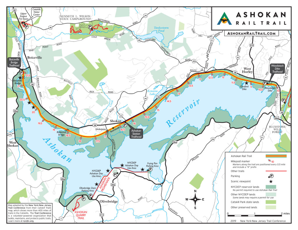
This free Ashokan Rail Trail map is provided by the New York-New Jersey Trail Conference in partnership with the County of Ulster and the New York City Department of Environmental Protection. The Ashokan Rail Trail (“ART”) was opened in 2019. The ART is 11.5 miles long between West Hurley and Boiceville along the Ashokan Reservoir, and it can be accessed from three public trailheads: Woodstock Dike Trailhead, Ashokan Station Trailhead, and Boiceville Bridge Trailhead. Learn more about the Ashokan Rail Trail at ashokanrailtrail.com.
While this map may be free, our organization needs your support to help protect, build, and maintain more than 2,150 miles of trails throughout the region. Support the trails you love:
Be sure to check out our selection of other free maps!
Be Prepared! Batteries can die, so don’t rely on your device and always have a backup plan. Even if you’ve downloaded a map on your phone, make sure to carry a printed copy if possible.