Hike: Buttermilk Falls in Rockland County
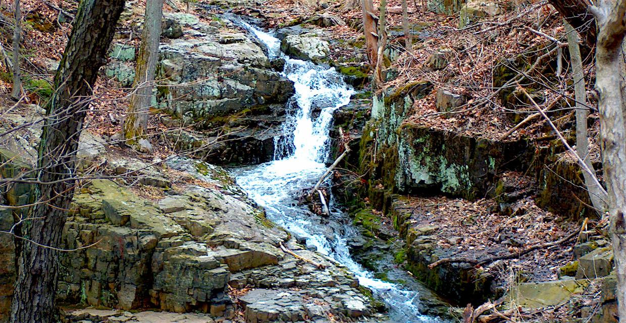
Buttermilk Falls in Rockland County – Buttermilk Falls County Park – Photo: Daniel Chazin
This 1.5-mile loop explores the scenic hillside above Buttermilk Falls in Rockland County, offering a short but rewarding climb to multiple panoramic viewpoints. The hike begins on the blue-blazed trail, ascending beside a wooded ravine to the base of the falls. As the trail climbs, hikers pass historic stone pillars, remnants of the area’s early history, before reaching a series of rocky outcrops with increasingly broad views—including long-distance sights of the Ramapo Mountains, Newark skyline, and the active West Shore Railroad corridor.
At just about a half-mile in, a broad west-facing overlook marks the high point of the loop—once a favorite spot of President Theodore Roosevelt. From there, the trail turns and descends along a woods road, meeting a white-blazed trail that leads back downhill via stone steps and a boardwalk, completing the loop near the parking area.
How to Get There
Don’t Leave Unprepared
The digital version of this map is available exclusively at:
Detailed Hike Description
Publication: Submitted by Daniel Chazin on 10/22/2004, updated/verified on 01/06/2021
From the northern end of the parking area, head into the woods on a blue-blazed trail, which climbs steadily to the right of a ravine. Soon, you’ll reach the remnants of two stone pillars to the left of the trail, with scenic Buttermilk Falls cascading down the mountain.
The trail now bears right and continues to climb. After a brief descent, you’ll reach a limited west-facing viewpoint, with a field visible below. Continue ahead uphill on the blue trail, and you’ll soon come to a broader viewpoint from a rock outcrop to the right of the trail. The tall building in the distance is part of the Blue Hill Plaza office complex in Pearl River. You may hear and see a train along the railroad tracks running parallel to the hills in the background. This rail line - commonly known as the West Shore Railroad - was built in 1883 as the New York, West Shore and Buffalo. Passenger service along the line, which extends from northern New Jersey to Albany, was discontinued in 1959, but the line remains an important route for freight trains traveling between the Midwest and the New York metropolitan area.
After a little more climbing, you'll reach a junction with a woods road. An orange-blazed trail heads left along the road, but you should turn right, continuing to follow the blue blazes. Just beyond - about half a mile from the start of the hike - you'll reach the third viewpoint, with the broadest view. You can see all the way west to Ramapo Mountains and, on a clear day, the skyscrapers of Newark are visible on the horizon to the south. In the early 1900s, when he rode horseback in the area, President Theodore Roosevelt would stop here to take in the view. This is a good spot to rest from the climb and enjoy the panoramic view.
In another 300 feet, follow the blue trail as it turns sharply right, leaving the woods road it has been following, and descends on switchbacks along another woods road. When the blue trail ends at a junction with a white-blazed gravel road, turn right and follow the white blazes along the road. As the road bears left near the base of the descent, watch carefully for a turn where the white blazes turn right, leaving the road. Continue to follow the white-blazed trail, which descends stone steps, crosses a boardwalk, and soon ends at the parking area where the hike began.
Support the trails you love
Your gift helps build, maintain, and protect over 2,150 miles of trails across the region.
Join

Become a member and protect wild places
Shop

Maps, gear & books, all proceeds support trails
Volunteer

Give back by helping maintain the trails
Donate

Keep trails open and safe with a one-time gift