Hike: Kennedy Dells County Park Loop Hike
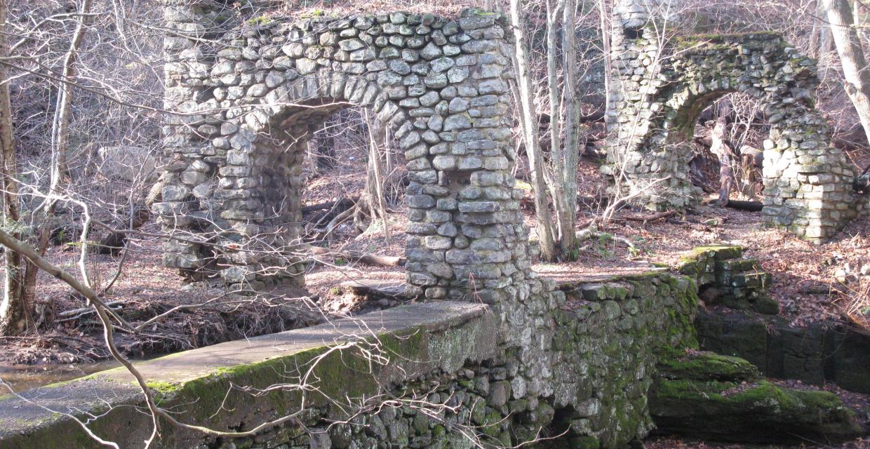
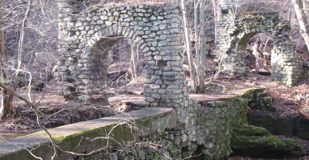
View of ruins on Kennedy Dells County Park Loop – Photo: Daniel Chazin
This 2.3-mile loop in a quiet corner of Westchester County explores the scenic ravines and historic infrastructure surrounding Crum Creek, blending wooded paths with parkland edges and suburban glimpses. Starting from the main parking area, the hike begins on the white-blazed Bridle Path, a wood-chipped trail that winds past fields, the Eleanor Burlingham Tree Nursery, and alongside a golf course.
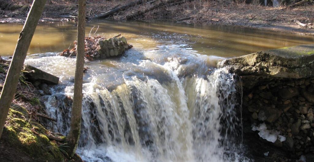
Midway through, the route visits a compelling historic site along Crum Creek, where a breached stone dam, arch bridge ruins, and a 19th-century pumping station mark the area’s industrial past. Returning to the Bridle Path, the trail parallels the creek before joining the stone-lined Fitness Trail, which weaves past fields and across a small wooden bridge before closing the loop.
This mellow loop is ideal for casual hikers, dog walkers, and anyone looking to explore natural and historic features in a suburban greenbelt setting.
How to Get There
Don’t Leave Unprepared
The digital version of this map is available exclusively at:
Detailed Hike Description
Publication: Submitted by Daniel Chazin on 12/31/2009, updated/verified on 07/01/2015
From the north end of the main parking area, proceed west and continue on a rough paved road, passing soccer fields on both sides. Go around a gate and continue on the road as it bears right and climbs a little.
As the road bends to the left, a white blaze on a tree to the right marks the start of the Bridle Path. Turn right and follow this white-blazed trail, covered with wood chips for part of the way, which heads through a wooded area. Although open to equestrian use, it is more heavily used by walkers with their dogs.
After passing a field to the left, the trail bends left and reaches the Eleanor Burlingham Tree Nursery. Here, it turns right, then heads left and begins to run along a golf course, which borders the park to the north. When a dirt road comes in from the left, bear right and continue to follow the park boundary, with an old stone wall to the left.
Soon, you'll reach a cul-de-sac at the end of a residential street. Here, the trail turns left and begins to run along an old paved road, with the back yards of homes to the right. After a short distance, the road turns left and proceeds through a hemlock forest, paralleling Crum Creek, in a ravine below to the right.
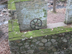
In a few minutes, you'll reach a fork. The white-blazed Bridle Path bears left, but you should continue to follow the paved road, which bears right and descends towards the creek, where it ends abruptly. Steps on the left lead down to a viewpoint over a stone dam, which has been breached. On the opposite side of the creek, stone arches are all that remain from a bridge that formerly carried the paved road over the creek. To the right, on the east side of the creek, a stone building contains the remnants of old pumping equipment.
After taking in this scenic and historic site, go back up to the fork and turn sharply right to continue on the white-blazed Bridle Path. The trail continues to parallel the stream, now visible to the right. Two hiking trails, blazed blue and orange, go off to the left, but you should continue ahead on the white-blazed trail.
Eventually, the trail reaches the level of the creek, with homes visible on the opposite side. A short distance beyond, you'll reach a T-intersection, where the Bridle Path ends. Turn left onto a gravel road, and in about 150 feet, turn left again onto a stone-lined dirt path. This is the Fitness Trail, and you'll pass several fitness stations along the way.
The Fitness Trail bends to the right and soon reaches a T-intersection with a dirt road. Turn right, passing a field to the right. At the next four-way intersection, turn left to continue on the stone-lined Fitness Trail, which passes a field to the left and homes to the right. After crossing a stream on a wooden bridge, it bends right, turns left, and passes another field. It then turns left and descends on a long switchback. After again running along the park boundary for a short distance, it turns left, goes by a soccer field, and ends at the parking area where the hike began.
Support the trails you love
Your gift helps build, maintain, and protect over 2,150 miles of trails across the region.
Join

Become a member and protect wild places
Shop

Maps, gear & books, all proceeds support trails
Volunteer

Give back by helping maintain the trails
Donate

Keep trails open and safe with a one-time gift