Hike: Duck Pond & Spring Lake Loop
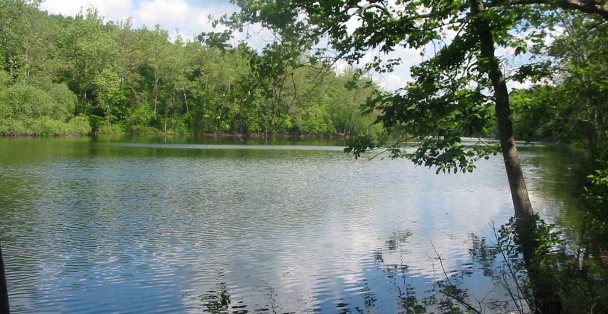
Duck Pond – Photo by Daniel Chazin
This gentle 3.5-mile loop explores the rare sinkhole pond landscape of northwest New Jersey. Beginning on the yellow-blazed Bear Claw Trail, you’ll pass through second-growth forest and remnants of old farmland before crossing to the Limestone Trail, which skirts the shore of Duck Pond. The route connects to the red-blazed Spring Lake Trail, passing Spring Lake and the smaller Little Frog Pond—both striking examples of sinkhole formations. A short, unmarked spur brings you lakeside at Spring Lake for a scenic break. The trail then winds through hemlock groves before closing the loop via the entrance road to the Duck Pond Group Camping Area.
How to Get There
Don’t Leave Unprepared
The digital version of this map is available exclusively at:
Detailed Hike Description
Publication: Submitted by Daniel Chazin on 06/16/2006, updated/verified on 03/23/2015
You will notice a brown sign marking the start of the Duck Pond Multi-Use Trail on the left side of the road (before the gate). On the right side of the road, opposite the sign, three yellow blazes on a tree mark the start of the yellow-blazed Bear Claw Trail. Follow this trail through a pleasant second-growth forest, crossing several stone walls – evidence that this area was once farmed. After climbing a low rise, the Bear Claw Trail descends to end at the paved Duck Pond Multi-Use Trail.
Cross the road and continue on the white-blazed Limestone Trail, which soon curves sharply left and begins to run parallel to the shore of Duck Pond. Like the other ponds that you’ll be passing on the hike, Duck Pond is known as a “sinkhole pond,” meaning that it was formed in a depression in the limestone that underlies the area. The water level in this and other sinkhole ponds varies significantly from season to season, and they are home to some rare and endangered species.
Soon after crossing a low stone wall (where a path leads, left, to the lakeshore), the Limestone Trail bears right, away from the water, and climbs a little. It continues to run parallel to the pond, but some distance from it, until it ends at a junction with the red-blazed Spring Lake Trail. Turn right onto the Spring Lake Trail, which follows the route of an old woods road.
When you reach a fork in the road, bear left to continue on the red-blazed Spring Lake Trail (the right fork leads to a parking area on Dove Island Road). About 0.2 mile beyond, an unmarked trail on the right leads to the southwestern shore of Spring Lake, but you should continue ahead on the Spring Lake Trail. Soon, you’ll be able to see Spring Lake through the trees on your right, and the green-blazed Sinkhole Trail begins on the left. Continue ahead on the red-blazed Spring Lake Trail, which makes a short ascent and then turns sharply right.
In another 0.2 mile, you’ll reach a four-way intersection. The blue-blazed Passage Trail begins on the left, but you should turn right and follow an unmarked trail that leads down to the shore of beautiful Spring Lake. This lake is technically a sinkhole pond, but it is deep enough that is filled with water year-round. You’ll want to take a break here to enjoy the scenic surroundings.
When you’re ready to continue, take the right fork of the trail (facing away from the lake) that leads back to the red-blazed Spring Lake Trail. Turn right on the Spring Lake Trail, which soon passes through a hemlock grove and reaches a third sinkhole pond. This one, known as Little Frog Pond, is usually little more than a shallow grassy depression partially covered with water, and it is an interesting contrast to the two larger ponds that you passed earlier in the hike.
The Spring Lake Trail continues through dense groves of hemlock. It climbs a little and eventually reaches an intersection where the red blazes lead both straight ahead and to the left. This is the beginning of the “tail” of the loop, and you should continue straight ahead to the trailhead on the entrance road to the Duck Pond Group Camping Area. Turn right, follow the entrance road back to Route 619, turn left onto Route 619, and follow it for 350 feet to the turn-off for the Duck Pond Multi-Use Trail Area, where the hike began.
Support the trails you love
Your gift helps build, maintain, and protect over 2,150 miles of trails across the region.
Join

Become a member and protect wild places
Shop

Maps, gear & books, all proceeds support trails
Volunteer

Give back by helping maintain the trails
Donate

Keep trails open and safe with a one-time gift