
The Long Path – Section 35
East Berne to Altamont
Distance: 12.2 miles
Parks: John Boyd Thacher State Park
Maps: LP Interactive Map
Alert: The description has been updated with a major relocation through the Village of Altamont that was completed spring 2025.
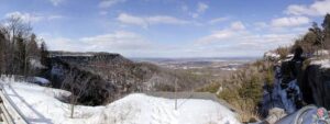
This section of the Long Path starts pleasantly as it passes through farm country. The section begins where the Long Path crosses NY Route 443 and follows a grassy road past a farm house to reach Stage Road. For the next mile the trail continues though fields and forests until it reaches Sawmill Road. The trail then continues along local roads to John Boyd Thacher State Park. The Long Path follows a series of trails through the park, emerging on the cliffs of the Helderberg Escarpment at the overlook on the north side of NY Route 157. Here, there are spectacular views northeast into Vermont. This ridge is made up of a core of limestone in which were found many fossils during the early days of geology in the 1800s. These fossils are known worldwide for their sequence from the Silurian to the Devonian eras. Early studies in this area helped lay the foundations for modern paleontology and geology. The Long Path then turns north and descends on the historic Indian Ladder Trail under the base of the cliffs, continues north through the park along the escarpment, and then heads downhill along a new footpath completed by volunteers in spring 2025, ending in the Village of Altamont after a short roadwalk. The section ends at the village’s Orsini Park, and this is now the official terminus of the Long Path for End-to-End Hikers.
Access
Take the New York State Thruway to Exit 22 (Selkirk). Turn right on NY Route 144 and continue south to NY Route 396. Turn right on Route 396 and follow it 6 miles to South Bethlehem, where Route 396 ends and the road becomes Albany County Route 301. Follow Route 301 west another 6 miles to its end at NY Route 443 in Clarksville. Turn left on Route 443 and follow it west about 5 miles to the second intersection with Stage Road, 1.5 miles from the intersection of NY 443/85.
Parking
0.00 Stage Road, near the intersection with NY Route 443, about 0.1 mile east of the trail. (42.60218°, -74.04600°)
3.50 John Boyd Thacher State Park parking area on Beaver Dam Road. (42.63870°, -74.01524°)
4.55 Lower Paint Mine Picnic Area (about 0.2 miles off the trail). (42.65111°, -74.01632°)
5.20 Helderberg Escarpment Overlook parking area. (42.65248°, -74.01204°)
6.20 North end of Indian Ladder Trail, John Boyd Thacher State Park Visitor Center. (42.65481°, -74.01787°)
7.20 Hailes Cave parking area. (42.663657°, -74.021116°)
9.75 (plus 0.8 mile) Old Stage Road (limited), approximately 0.8 mile from the Long Path. (42.68158°, -74.05442°)
12.20 Parking in the Village of Altamont, including along Main Street and in signed ‘Parking’ lots off Main Street and Maple Street. (42.701184°, -74.032932°)
Camping
None.
Detailed Trail Description
0.00 The Long Path crosses NY Route 443 just east of the driveway of a private residence and heads uphill in a northeasterly direction along the edge of a large field. The trail climbs gradually and passes a farm house on the left when it reaches Stage Road.
0.15 Reach Stage Road and continue straight to follow the road through farm fields.
0.40 Turn left at a hedgerow bordering a field, crossing a short bridge over the drainage ditch. The trail descends gradually north along the west side of the hedgerow. There is an expansive view west, across open fields, toward Cole Hill and the Schoharie Valley.
0.80 Bear right through a gap in the hedgerow, then enter a young hardwood forest.
0.95 Reach Sawmill Road opposite its intersection with Stempel Road, and turn left (north) to follow Sawmill Road.
1.30 Turn right (east) onto Long Road.
2.35 Turn left at Elm Drive.
2.50 Bear right onto Bush Drive.
3.25 Turn right onto Beaver Dam Road (Albany County Route 303).
3.50 Turn left off the road into the woods at a trailhead for John Boyd Thacher State Park. Parking is available for several cars along a wide gravel shoulder. In about 200 feet, turn left (west), now following a coaligned blue-blazed trail.
3.90 Bear left as the blue-blazed trail turns right. Soon cross a small stream and pass a white connector trail.
4.10 A Nature Trail joins from the right at the head of a ravine. The Long Path and coaligned Nature Trail continue ahead, gradually descending on the left side of the ravine.
4.40 Turn right at a junction with a white connector trail. The white connector trail continues straight to reach the Lower Paint Mine picnic area and pavilion in 0.15 mile. The Long Path crosses the ravine on a bridge and follows the lower part of the Nature Trail. In 0.1 mile, the Natural Trail forks to the right, but bear left to remain on the Long Path and pass through a dense hemlock forest.
4.85 Turn left to follow a woods road that leads into the Upper Knowles Flat Picnic Area. The trail follows the north edge of the picnic area, then descends right on a gravel path to the paved access road. The trail then turns right onto the access road toward NY Route 157.
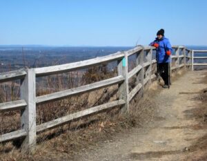
5.15 Cross NY Route 157 and reach the Overlook parking area. The trail turns left and follows the overlook along the edge of the escarpment, with spectacular views across the upper Hudson Valley to the Green Mountains of Vermont and the Adirondacks of New York.
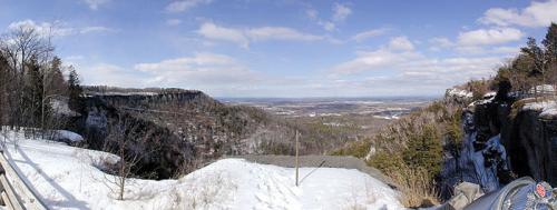
5.40 Reach the northern end of the parking area, and continue to follow the escarpment fence through the woods. About about 0.2 mile, emerge from the woods to reach a view over Mine Lot Falls, which plunges over the escarpment, near La Grange Bush parking lot.
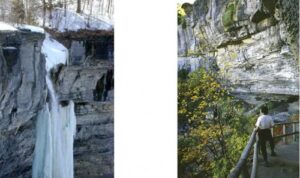
5.70 Reach the southern end of the Indian Ladder Trail, which descends stairs to the right. Note the Indian Ladder Trail is only open from mid-May to late fall, as it is dangerous when there is ice; the Long Path follows the Indian Ladder Trail when it is open, but follows the path along the top of the escarpment (which passes another overlook and the top of the falls) during the remainder of the year. When open, turn right onto the Indian Ladder Trail and descend a series of stairs. At the base of the stairs, follow the bottom of the escarpment northward under the cliffs, passing under Mine Lot Falls and another waterfall (the water flow for each is very variable, so they can be just a trickle during dry periods). The trail then reaches another set of stairs that climbs back up to the top of the escarpment.
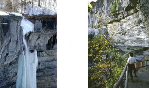
Base of the Indian Ladder Trail, 2001 [Warren]
6.20 Reach the northern end of the Indian Ladder Trail. To the left is the Visitor Center, which is worth a short detour. The Long Path turns right to follow the Escarpment Trail, which follows the escarpment fence and offers periodic views through the trees.
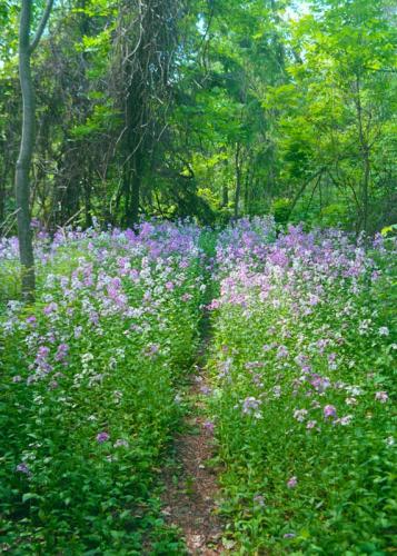
6.50 Reach a viewpoint along the escarpment and picnic area near the Horseshoe 1 parking area. The trail continues following the escarpment as it loops around this horseshoe-shaped section.
6.80 To the left through the trees is the Horseshoe 2 parking area.
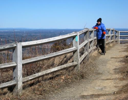
7.20 Reach another panoramic viewpoint over the escarpment near the northern end of the Hailes Cave parking lot. In a short distance, the trail passes a rock climbing area entrance called Squeeze Box and then turns left away from the escarpment, crosses Hailes Cave Road (where parking is available), and soon reaches a grassy road. Follow this road for a short distance as it traverses an open area with a mountain bike terrain park.
7.30 Turn right into the woods at two large limestone slabs. After crossing several limestone fissures, cross a gravel road (a private driveway) and then a stone wall.
7.50 Soon after crossing a stone wall, turn right onto a woods road, the old extension of Hailes Cave Road.
7.70 Bear right where a trail branches off to the left (the former route of the Long Path), following the base of the hill on a snowmobile trail. The trail bears right, paralleling the snowmobile trail for about 0.1 mile before reconnecting to it. The trail passes several stone walls over the next half mile.
8.35 Reach gravel Hang Glider Road and turn left. To the right, this road is used by hang-glider enthusiasts to access a take-off pad at the edge of the escarpment.
8.40 Reach a four-way junction and continue straight. The Hang Glider Trail is to the right, and the former route of the Long Path is to the left.
8.65 The Long Path turns right, leaving Hang Glider Road, and circles a depression in the escarpment.
9.05 Reach a junction with the Fred Schroeder Memorial Trail to the left and continue straight. The trail approaches the escarpment, with views to the right toward Hang Glider Cliff.
9.45 The trail rejoins the escarpment and proceeds to a junction with a red-blazed trail. The Long Path turns left, but to the right is High Point viewpoint, which is worth a very short detour. At this lookout, to the right, peeking over the shoulder of the hang-glider opening, one can potentially see Mt. Everett in southern Massachusetts. Panning north, one can possibly see Albany, Mt. Greylock, the Village of Altamont, and Vermont’s Green Mountains with Killington and Pico Peak prominent. Once you are finished at the viewpoint, retrace your steps back to the junction with the red-blazed trail, and turn right (west).
9.70 Turn right at a junction with White Trail #3. In approximately 50 feet, turn left onto the High Point Road Trail, and follow that approximately 100 feet to a new trail junction.
9.75 Turn right off the High Point Road Trail as the Long Path blazes now follow a new trail that was established by volunteers in 2024/2025 and officially opened in spring 2025. The trail first follows several S-turns in an attractive, mixed forest, and then follows the escarpment, where there are occasional views near the edge.
10.2 The trail turns right to begin the descent off the escarpment, dropping along steep cliffs and wonderful limestone blocks to soon reach the park boundary. Proceed through private land, where permission for the trail has been granted and hikers are asked to remain on the trail, and eventually cross three bridges and a utility line corridor before reaching and old woods road and descending to a gorge with small cascades. Be alert for a small fenced off mound that the trail goes around to avoid a nest of ground hornets.
10.95 Turn left onto the private driveway for the Joshua Foundation and continue downhill.
11.10 Turn left onto Leesome Lane.
11.45 Turn right onto the shoulder of NY State Route 156. This road is well-traveled, but is only followed for 0.25 mile, and remaining on the right shoulder is recommended to make the next turn without needing to cross this road; there is a grassy shoulder for most of this segment, and where a guard rail impinges on the shoulder, it may be best to remain on the grassy side of the rail.
11.70 Turn right onto Helderberg Avenue, a one-way road that descends along a gorge through a quiet neighborhood. As the road starts to level out, you can move off the road onto a sidewalk.
12.10 Reach a junction with NY State Route 156, Main Street, and Altamont Boulevard, with a Stewart’s gas station and convenience store on the right. Proceed straight onto Main Street (toward NY State Route 146), soon cross railroad tracks and pass the Altamont Free Library, and reach Orsini Park, turning right onto the sidewalk path through the park.
12.20 The sidewalk path reaches Park Street, and this marks the new and current end of this section. This represents the official terminus of the Long Path for End-to-End Hikers, although the official end will continue to move northward through the years as the trail is further developed. A new kiosk, expected to be completed in Fall 2025, will showcase the Long Path and the Village of Altamont and be a fitting start/end point for the Long Path!
This is currently the “End-to-End” end of the Long Path. Note that as of Spring 2025, the terminus is now in the Village of Altamont, instead of the previous terminus of the Old Stage Road parking lot. The trail has been blazed across the Mohawk River to the Saratoga County line, and from there a route has been described to the Adirondacks blue line, but until more of that route is off-road those sections are not a requirement for the “End-to-End” certificate.