The Long Path – Section 36
Altamont to Christman Sanctuary
Distance: 9.75 miles
Parks: Bozenkill Park, Wolf Creek Falls Preserve, Christman Sanctuary
Maps: LP Interactive Map, Wolf Creek Falls Preserve Map
Trail Alert: In Wolf Creek Falls Preserve, a bridge is out as of summer 2023. A high-water alternate route has been established, and it is described below.
Alert: The description has been updated with a major relocation through the Village of Altamont that was completed spring 2025.
After leaving Orsini Park in the Village of Altamont, the Long Path follows sidewalks and paved roads, with a short scenic detour through Bozenkill Park, to eventually reach Wolf Creek Falls Preserve, where it follows several trails past attractive waterfalls. The trail then follows local roads until it reaches Christman Sanctuary.
Access
From the NY Thruway North, merge onto I-87 N/I-90 E toward Albany/Montreal. Take Exit 1S toward US-20/Western Ave. Turn right onto US-20 W/Western Ave, and in about 4 miles turn left onto NY-146 W. Continue for 6 miles to reach the Village of Altamont, where parking is available in multiple locations.
Parking
0.00 Parking in the Village of Altamont, including along Main Street and in signed ‘Parking’ lots off Main Street and Maple Street. (42.701184°, -74.032932°)
1.00 Bozenkill Park parking lot. (42.709228°, -74.025447°)
5.30 Wolf Creek Falls Preserve parking area. (42.72155°, -74.08547°)
9.40 Christman Sanctuary parking area. (42.74317°, -74.12860°)
Camping
There is currently no camping available in this section.
Detailed Trail Description
0.00 From Orsini Park on Park Street, proceed to Main Street and turn right. Follow sidewalks and use a crosswalk to cross to the north side of the street.
0.70 Soon after the Altamont Fair entrance, turn left onto Gun Club Road.
1.00 Turn right off Gun Club Road into Bozenkill Park, following the park driveway past a guard booth and then bearing right. Begin following the woods line to a right turn at a trail map sign, then descend to Bozenkill Creek, where there are occasional spurs to view spots. Red trail markers are now present. There are three places where flooding has washed out the trail, so be alert during high water; if desired, a highwater route has been marked, first following the White Trail to the lower half of the Blue Trail before connecting back with the Long Path. The trail then heads uphill toward a DOT storage lot, follows a fence past a baseball field backstop, and returns to the woods, eventually reaching Gun Club Road again.
1.75 Turn right onto Gun Club Road, and soon turn right onto Western Avenue.
1.95 Turn left onto Bozenkill Road.
2.85 Continue straight past Westfall Road. To the right, in approximately 500 feet, the Bozen Kill Preserve is managed by the Mohawk Hudson Land Conservancy and offers a small network of scenic trails.
4.45 Continue straight past Bell Road.
5.30 Reach the boundary of Wolf Creek Falls Preserve, which is owned by the Mohawk Hudson Land Conservancy. The Long Path is coaligned with multiple trails through this preserve. As of summer 2023, there are low-water (standard) and high-water (alternate) route options for the Long Path through this preserve until a new bridge can be built. After significant rainfall, the first crossing of Wolf Creek on stepping stones may be difficult.
Low-Water (Standard) Route
5.30 Turn right off Bozenkill Road onto the Red trail. Proceed through the woods and reach Wolf Creek on stepping stones.
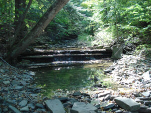
5.55 Soon after the creek crossing, turn left onto the White Trail and continue along the creek to progressively larger waterfalls. The largest waterfall is approximately 25 feet tall and 50 feet wide.
5.70 Reach an intersection with the Blue and White trails and turn left onto the Blue Trail. Proceed past a private bridge, then bear left at an intersection with the Green Trail to continue on the Blue Trail.
5.80 Reach an intersection with the Blue and Yellow trails and turn left onto the Yellow Trail. Descend to cross Wolf Creek on the Musical Bridge; if you strike the ends of the treads with the attached mallet, the treads play different tones of a musical scale. Continue uphill toward the road.
5.90 Reach Bozenkill Road and turn right (west) to follow the road.
*High-Water (Alternate) Route
*5.30 After significant rainfall, continue following Bozenkill Road west for about 100 feet and turn left to enter the woods on the south side of the road at a sign for Wolf Creek Mini Falls. Follow the Red Trail south along a tributary of Wolf Creek and pass several small waterfalls, then turn left onto the White Trail.
*5.65 Reach an intersection with the White and Yellow/Gold trails and turn right onto the Yellow/Gold trail. Follow this trail downhill toward the road.
*5.80 Reach Bozenkill Road and turn left (west) to follow the road. Continue with the description below, but subtract 0.1 mile from the mileage numbers.
7.50 Turn right onto Colliton Road (also known as Ostrander Road) and then right onto Bozie Hollow Road. Pass the old Ostrander Cemetery on the left. There is little blazing from here to the Schoharie Turnpike.
8.60 Cross railroad tracks and the Albany/Schenectady County line, where the name of the road changes to Bozen Kill Road. The Bozenkill Falls can be heard through the fencing on the right. A gristmill was once at its base. (DO NOT LEAVE THE ROADWAY – DO NOT TRESPASS OR YOU WILL BE ARRESTED) The rail line was built by the Delaware & Hudson Railroad in 1863 and is now operated by SMS Rail Lines.
9.30 Reach the Schoharie Turnpike (Schenectady County Route 74) and turn left.
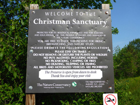
9.75 At the top of the hill, on the left, is the Christman Wildlife Sanctuary where a trail leads to the historic “Long Path Lean-to” at the base of a beautiful waterfall. It was built by the Mohawk Valley Hiking Club in the 1930s as a shelter for LP hikers. Mr. W.W. Christman, renowned as the “Poet of the Helderhills,” was highly enthusiastic about the Long Path and owned the land which now comprises the sanctuary. Continue on the Schoharie Turnpike.