These sections of the Long Path mark the beginning of the route through Catskill Park. The Catskill Park has spectacular scenery and considerable rugged terrain. It passes over Slide Mountain, the tallest in the Catskills. Nowhere does the Long Path go higher. Small villages nestled in the valleys provide a break from the traverses through dense forests carpeting most of the Catskill Mountains. Most of its route follows DEC trails maintained by the Trail Conference. The trails are generally marked with different colored plastic markers. These are usually the only trail identification except at major trail junctions. The LP aqua paint blaze is reserved for when the trail crosses private property and road sections. As the Long Path changes frequently from one DEC trail to another, hikers must watch carefully for turns and make sure that they are on the proper trail. Most trail DEC junctions have signs that give the trail names and the direction and distance to important points.* At many of these intersections, a plastic Long Path marker indicates the route of the Long Path. Camping is permitted on State land at elevations below 3,500 feet (this elevation is usually marked by signs along the trails), and at locations at least 150 feet away from trails and water. The Long Path also passes several DEC lean-tos and campgrounds.

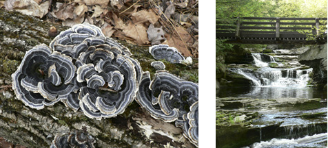
Mushrooms. 2005 and Vernooy Falls. 2006 [JAKOB FRANKE]
_________________________________________________________________________
* The distances given on these signs are not always accurate.
